TopoQuest Logo
Do you find TopoQuest useful?
Help keep TopoQuest running and adding new maps/features by donating!
Bitcoin:  19c7KJd3qBynnjoSw5npx9KScwjBe4ifkT
Litecoin:  LXs6TkuXGGXo1vDsWCkWVdjQX94eUKd6ui
Home View Maps Find Maps Find Places Resources & Links


Capetown, California Topographic Map

USGS Map Title: Capetown, CA
USGS Map MRC: 40124D3
DRG (GeoTIFF) Download: o40124d3.tif


Neighboring USGS Topographic Map Quads:


  Ferndale, CA  
40124E3
 

  Fortuna, CA  
40124E2
 

  Cape Mendocino, CA  
40124D4
 

  Capetown, CA  
40124D3
 

  Taylor Peak, CA  
40124D2


  Petrolia, CA  
40124C3
 

  Buckeye Mountain, CA  
40124C2


Map MRC Location:

N41°
W125°
N41°
W124°
H8 H7 H6 H5 H4 H3 H2 H1
G8 G7 G6 G5 G4 G3 G2 G1
F8 F7 F6 F5 F4 F3 F2 F1
E8 E7 E6 E5 E4 E3 E2 E1
D8 D7 D6 D5 D4 D3 D2 D1
C8 C7 C6 C5 C4 C3 C2 C1
B8 B7 B6 B5 B4 B3 B2 B1
A8 A7 A6 A5 A4 A3 A2 A1
N40°
W125°
N40°
W124°

Capetown, CA USGS 1:24K Topographic Map Preview:
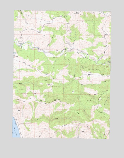
Capetown, CA USGS Topographic Map
Click on map above to begin viewing in our Map Viewer.

This topographic map contains these locations and features:
Feature Name Type Latitude Longitude GNIS ID View Map
Bonanza GulchValleyN40.4649°W124.2981°219623View Map
Bonanza RanchLocaleN40.4637°W124.2995°1665204View Map
Branstetter RidgeRidgeN40.4051°W124.3087°219788View Map
Bunker HillSummitN40.4976°W124.2942°254679View Map
Cape RidgeRidgeN40.4482°W124.3626°220580View Map
CapetownPopulated PlaceN40.4662°W124.3673°1658215View Map
Davis CreekStreamN40.3849°W124.3695°253662View Map
Ferndale DivisionCivilN40.3773°W124.2733°1935102View Map
Green Pond RanchLocaleN40.4771°W124.2553°224557View Map
Hollister CreekStreamN40.4271°W124.2873°225453View Map
Hollister RidgeRidgeN40.4237°W124.2528°225454View Map
Indian PrairieFlatN40.4201°W124.2984°225896View Map
Johnson GulchValleyN40.4612°W124.3351°226306View Map
Red RockPillarN40.4543°W124.3214°231372View Map
Red Rock GulchValleyN40.4543°W124.3198°231379View Map
Smith RockPillarN40.4618°W124.3209°234724View Map
South Fork Bear RiverStreamN40.4324°W124.2512°234970View Map
Southmayd RidgeRidgeN40.4376°W124.2573°235138View Map
Twin PeaksSummitN40.4126°W124.3181°254535View Map
Walker RidgeRidgeN40.3854°W124.3137°237184View Map
West Side CreekStreamN40.4507°W124.2542°237525View Map

Note: Coordinates in the location and feature list above are referenced to NAD83 datum.


Copyright (C) 2008-2024 Ryan Niemi / Sunset Dynamics ... All Rights Reserved