TopoQuest Logo
Do you find TopoQuest useful?
Help keep TopoQuest running and adding new maps/features by donating!
Bitcoin:  19c7KJd3qBynnjoSw5npx9KScwjBe4ifkT
Litecoin:  LXs6TkuXGGXo1vDsWCkWVdjQX94eUKd6ui
Home View Maps Find Maps Find Places Resources & Links


Buckeye Mountain, California Topographic Map

USGS Map Title: Buckeye Mountain, CA
USGS Map MRC: 40124C2
DRG (GeoTIFF) Download: o40124c2.tif


Neighboring USGS Topographic Map Quads:


  Capetown, CA  
40124D3
 

  Taylor Peak, CA  
40124D2
 

  Scotia, CA  
40124D1
 

  Petrolia, CA  
40124C3
 

  Buckeye Mountain, CA  
40124C2
 

  Bull Creek, CA  
40124C1
 

  Cooskie Creek, CA  
40124B3
 

  Shubrick Peak, CA  
40124B2
 

  Honeydew, CA  
40124B1


Map MRC Location:

N41°
W125°
N41°
W124°
H8 H7 H6 H5 H4 H3 H2 H1
G8 G7 G6 G5 G4 G3 G2 G1
F8 F7 F6 F5 F4 F3 F2 F1
E8 E7 E6 E5 E4 E3 E2 E1
D8 D7 D6 D5 D4 D3 D2 D1
C8 C7 C6 C5 C4 C3 C2 C1
B8 B7 B6 B5 B4 B3 B2 B1
A8 A7 A6 A5 A4 A3 A2 A1
N40°
W125°
N40°
W124°

Buckeye Mountain, CA USGS 1:24K Topographic Map Preview:
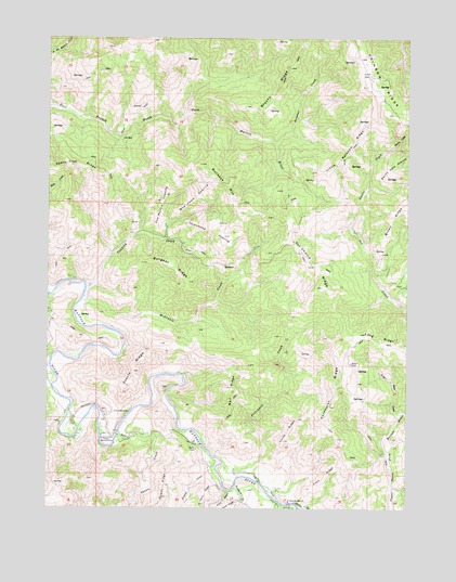
Buckeye Mountain, CA USGS Topographic Map
Click on map above to begin viewing in our Map Viewer.

This topographic map contains these locations and features:
Feature Name Type Latitude Longitude GNIS ID View Map
Arthur W Way County Memorial ParkParkN40.2671°W124.2300°218413View Map
Brushy RidgeRidgeN40.3690°W124.1659°233559View Map
Buckeye MountainSummitN40.3412°W124.1984°220039View Map
Burgess RidgeRidgeN40.3143°W124.2078°220187View Map
Camp MattoleLocaleN40.2751°W124.2228°220470View Map
Conklin CreekStreamN40.3085°W124.2378°221457View Map
Cook GulchValleyN40.2540°W124.1884°221481View Map
Coon RidgeRidgeN40.2579°W124.1539°221515View Map
Cow Pasture OpeningFlatN40.3307°W124.2112°221709View Map
Damon RidgeRidgeN40.2521°W124.2098°221991View Map
Devils CreekStreamN40.3246°W124.1462°222293View Map
Devils HoleValleyN40.3457°W124.1320°222315View Map
Devils Hole PrairieFlatN40.3421°W124.1275°222316View Map
Everts RidgeRidgeN40.2862°W124.2206°223302View Map
Granny CreekStreamN40.2612°W124.1917°224421View Map
Green RidgeRidgeN40.3301°W124.1264°224559View Map
Homestead OpeningFlatN40.3232°W124.1945°225504View Map
Horse RidgeRidgeN40.2699°W124.1659°225626View Map
Indian CreekStreamN40.2854°W124.2489°225870View Map
Little Rainbow RidgeRidgeN40.3437°W124.1464°227338View Map
Long RidgeRidgeN40.2929°W124.1287°234194View Map
Long Ridge CreekStreamN40.2743°W124.1289°227605View Map
Mail RidgeRidgeN40.2818°W124.1864°227957View Map
McGinnis CreekStreamN40.3060°W124.2378°228369View Map
Parkhurst RidgeRidgeN40.2829°W124.1495°230358View Map
Pritchard CreekStreamN40.2618°W124.1900°231066View Map
Rainbow RidgeRidgeN40.3626°W124.1334°234533View Map
Saunders CreekStreamN40.2562°W124.1853°232598View Map
Squaw CreekStreamN40.2687°W124.2264°235307View Map
Sulphur CreekStreamN40.3468°W124.1723°235706View Map
Upper Mattole SchoolSchoolN40.2518°W124.1664°236901View Map
Van Choick RidgeRidgeN40.3151°W124.1595°237000View Map
Wire Fence OpeningFlatN40.3321°W124.1998°238061View Map

Note: Coordinates in the location and feature list above are referenced to NAD83 datum.


Copyright (C) 2008-2025 Ryan Niemi / Sunset Dynamics ... All Rights Reserved