TopoQuest Logo
Do you find TopoQuest useful?
Help keep TopoQuest running and adding new maps/features by donating!
Bitcoin:  19c7KJd3qBynnjoSw5npx9KScwjBe4ifkT
Litecoin:  LXs6TkuXGGXo1vDsWCkWVdjQX94eUKd6ui
Home View Maps Find Maps Find Places Resources & Links


Capon Bridge, West Virginia Topographic Map

USGS Map Title: Capon Bridge, WV
USGS Map MRC: 39078C4
DRG (GeoTIFF) Download: o39078c4.tif


Neighboring USGS Topographic Map Quads:


  Levels, WV  
39078D5
 

  Largent, WV  
39078D4
 

  Ridge, WV  
39078D3
 

  Hanging Rock, WV  
39078C5
 

  Capon Bridge, WV  
39078C4
 

  Gore, VA  
39078C3
 

  Yellow Spring, WV  
39078B5
 

  Capon Springs, WV  
39078B4
 

  Hayfield, VA  
39078B3


Map MRC Location:

N40°
W79°
N40°
W78°
H8 H7 H6 H5 H4 H3 H2 H1
G8 G7 G6 G5 G4 G3 G2 G1
F8 F7 F6 F5 F4 F3 F2 F1
E8 E7 E6 E5 E4 E3 E2 E1
D8 D7 D6 D5 D4 D3 D2 D1
C8 C7 C6 C5 C4 C3 C2 C1
B8 B7 B6 B5 B4 B3 B2 B1
A8 A7 A6 A5 A4 A3 A2 A1
N39°
W79°
N39°
W78°

Capon Bridge, WV USGS 1:24K Topographic Map Preview:
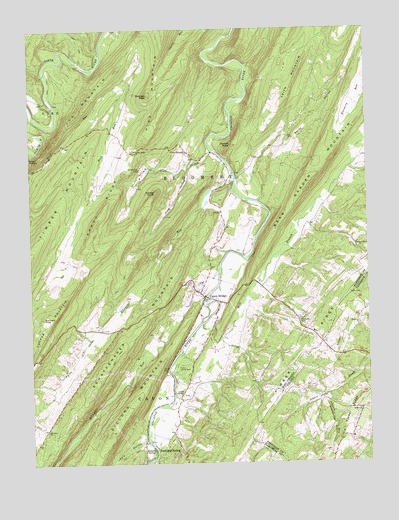
Capon Bridge, WV USGS Topographic Map
Click on map above to begin viewing in our Map Viewer.

This topographic map contains these locations and features:
Feature Name Type Latitude Longitude GNIS ID View Map
Bear Garden MountainSummitN39.3315°W78.3950°1535367View Map
Bethel CemeteryCemeteryN39.2645°W78.3778°1986567View Map
Bethel ChurchChurchN39.2645°W78.3778°1463207View Map
Bethel School (historical)SchoolN39.2645°W78.3781°1986538View Map
Bore SpringSpringN39.3351°W78.4242°1677904View Map
Bubbling SpringSpringN39.2543°W78.4575°1536540View Map
Bubbling SpringPopulated PlaceN39.2543°W78.4581°1554012View Map
Buffalo Gap CampLocaleN39.3351°W78.4586°1536642View Map
Buffalo Gap SpringSpringN39.3334°W78.4567°1677905View Map
Butchers KnobSummitN39.2920°W78.4950°1536798View Map
Camp White RockLocaleN39.2779°W78.4464°1536967View Map
Capon BridgePopulated PlaceN39.2982°W78.4361°1537027View Map
Capon Bridge Elementary SchoolSchoolN39.3029°W78.4371°1718608View Map
Capon Bridge Middle SchoolSchoolN39.3044°W78.4389°1718609View Map
Capon Bridge Police DepartmentBuildingN39.3011°W78.4352°2727930View Map
Capon Bridge Post OfficePost OfficeN39.2988°W78.4359°1718611View Map
Capon Bridge Rescue SquadBuildingN39.2962°W78.4295°2581078View Map
Capon Bridge Volunteer Fire DepartmentBuildingN39.2967°W78.4292°2577611View Map
Capon ChapelChurchN39.2698°W78.4445°1537028View Map
Capon Chapel CemeteryCemeteryN39.2698°W78.4439°1718613View Map
Cold StreamPopulated PlaceN39.3395°W78.4420°1554174View Map
Cold StreamStreamN39.3398°W78.4328°1537507View Map
Cold Stream Run SpringSpringN39.3351°W78.4492°1677903View Map
Cold Stream School (historical)SchoolN39.3284°W78.4317°1556753View Map
Crossroads School (historical)SchoolN39.2809°W78.3847°1986545View Map
Daisy Baker SpringSpringN39.2540°W78.4589°1677900View Map
Darbys NoseSummitN39.3415°W78.4250°1538001View Map
Dillons RunStreamN39.2979°W78.4356°1550926View Map
Edwards RunStreamN39.3326°W78.4245°1538564View Map
Edwards Run Wildlife Management AreaParkN39.3226°W78.4378°1718627View Map
Fairview CemeteryCemeteryN39.2904°W78.3781°1986569View Map
Fairview ChurchChurchN39.2901°W78.3781°1466419View Map
Frog HollowValleyN39.3348°W78.4417°1539274View Map
Georges PeakSummitN39.3559°W78.4558°1554545View Map
Glenwood School (historical)SchoolN39.2737°W78.4306°1556767View Map
Hiett SpringSpringN39.3107°W78.4495°1677901View Map
Ice MountainSummitN39.3634°W78.4670°1540653View Map
Ice Mountain SpringSpringN39.3415°W78.4947°1677902View Map
Johnson RunStreamN39.2693°W78.3925°1468802View Map
Kale HollowValleyN39.2562°W78.4592°1551619View Map
Leith MountainSummitN39.3548°W78.4042°1554939View Map
Mill BranchStreamN39.2901°W78.4367°1543300View Map
Mount Olive ChurchChurchN39.2598°W78.4947°1543724View Map
Nixon RunStreamN39.2748°W78.3803°1471552View Map
Old Man RunStreamN39.2512°W78.4550°1552381View Map
Parks ValleyValleyN39.2929°W78.4686°1544589View Map
Pike School (historical)SchoolN39.2912°W78.4000°1556789View Map
Pine MountainSummitN39.3559°W78.4558°1555358View Map
Pleasant Grove ChurchChurchN39.3118°W78.3781°1544988View Map
Pleasant Grove School (historical)SchoolN39.3120°W78.3783°1556791View Map
Raven RocksSummitN39.3376°W78.4967°1545430View Map
Riggs HollowValleyN39.3340°W78.4986°1545600View Map
River's Edge Farm AirportAirportN39.3266°W78.4245°2443453View Map
Sandy HollowValleyN39.3268°W78.4133°1546408View Map
Sandy RidgeRidgeN39.3226°W78.4728°1546411View Map
Sandy Ridge CemeteryCemeteryN39.3397°W78.4605°2726694View Map
Sandy Ridge ChurchChurchN39.3398°W78.4606°1546413View Map
Sandy Ridge School (historical)SchoolN39.3409°W78.4589°1556799View Map
Schaffenaker MountainSummitN39.2770°W78.4725°1546489View Map
Slanes KnobSummitN39.3279°W78.4536°1546903View Map
Stonebridge HollowValleyN39.2688°W78.3919°1475187View Map
Town of Capon BridgeCivilN39.2998°W78.4337°2390769View Map
Walnut Grove School (historical)SchoolN39.3379°W78.4158°1556813View Map

Note: Coordinates in the location and feature list above are referenced to NAD83 datum.


Copyright (C) 2008-2025 Ryan Niemi / Sunset Dynamics ... All Rights Reserved