TopoQuest Logo
Do you find TopoQuest useful?
Help keep TopoQuest running and adding new maps/features by donating!
Bitcoin:  19c7KJd3qBynnjoSw5npx9KScwjBe4ifkT
Litecoin:  LXs6TkuXGGXo1vDsWCkWVdjQX94eUKd6ui
Home View Maps Find Maps Find Places Resources & Links


Hayfield, Virginia Topographic Map

USGS Map Title: Hayfield, VA
USGS Map MRC: 39078B3
DRG (GeoTIFF) Download: o39078b3.tif


Neighboring USGS Topographic Map Quads:


  Capon Bridge, WV  
39078C4
 

  Gore, VA  
39078C3
 

  White Hall, VA  
39078C2
 

  Capon Springs, WV  
39078B4
 

  Hayfield, VA  
39078B3
 

  Winchester, VA  
39078B2
 

  Mountain Falls, VA  
39078A4
 

  Middletown, VA  
39078A3
 

  Stephens City, VA  
39078A2


Map MRC Location:

N40°
W79°
N40°
W78°
H8 H7 H6 H5 H4 H3 H2 H1
G8 G7 G6 G5 G4 G3 G2 G1
F8 F7 F6 F5 F4 F3 F2 F1
E8 E7 E6 E5 E4 E3 E2 E1
D8 D7 D6 D5 D4 D3 D2 D1
C8 C7 C6 C5 C4 C3 C2 C1
B8 B7 B6 B5 B4 B3 B2 B1
A8 A7 A6 A5 A4 A3 A2 A1
N39°
W79°
N39°
W78°

Hayfield, VA USGS 1:24K Topographic Map Preview:
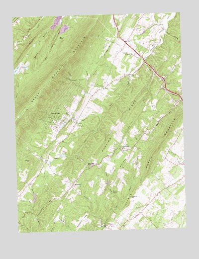
Hayfield, VA USGS Topographic Map
Click on map above to begin viewing in our Map Viewer.

This topographic map contains these locations and features:
Feature Name Type Latitude Longitude GNIS ID View Map
Back Creek DistrictCivilN39.1328°W78.3372°1927082View Map
Beans HillSummitN39.1665°W78.3650°1462868View Map
Bear RunStreamN39.2157°W78.2706°1462902View Map
Beaver LakeReservoirN39.2043°W78.3278°1987044View Map
Bloom (historical)Populated PlaceN39.1470°W78.3733°1779203View Map
Bucher RunStreamN39.2140°W78.2883°1463972View Map
Buck Lick SpringSpringN39.1471°W78.3037°1463987View Map
CabanissPopulated PlaceN39.1779°W78.2825°1987011View Map
Cherokee LakeReservoirN39.1867°W78.3401°1987045View Map
Cherry Grove School (historical)SchoolN39.1790°W78.3447°1987112View Map
Clearboard HollowValleyN39.1522°W78.3071°1779207View Map
Clowser GapGapN39.1904°W78.3317°1465006View Map
Cove DamDamN39.2184°W78.3747°1489825View Map
Cove LakeReservoirN39.2199°W78.3723°1502259View Map
Cove Lake CampLocaleN39.2209°W78.3686°1987042View Map
Cove Number Two DamDamN39.2218°W78.3664°1489836View Map
Cove RidgeRidgeN39.2301°W78.3661°1482744View Map
Cove School (historical)SchoolN39.2187°W78.3692°1987113View Map
Cross Roads School (historical)SchoolN39.2409°W78.2847°1987114View Map
Crystal DamDamN39.1868°W78.3381°1489823View Map
Crystal LakeReservoirN39.1867°W78.3401°1489824View Map
Devland EstatesPopulated PlaceN39.2270°W78.2789°1987015View Map
Dick HollowValleyN39.2014°W78.2512°1465762View Map
Emerald LakeReservoirN39.1959°W78.3328°1987046View Map
Fawcett GapGapN39.1273°W78.3111°1466510View Map
Fawcetts School (historical)SchoolN39.1348°W78.2836°1987116View Map
Flint RidgeRidgeN39.2232°W78.3092°1466720View Map
Fox RidgeRidgeN39.1401°W78.3533°1466836View Map
Frederick CountyCivilN39.2046°W78.2625°1480124View Map
Frederick County Fire and Rescue Department Station 19 - North Mountain Volunteer Fire and RescueBuildingN39.1905°W78.3310°2075420View Map
Fremont ChurchChurchN39.2084°W78.3081°1466884View Map
Fremont School (historical)SchoolN39.2090°W78.3081°1987117View Map
Fresh Water PondReservoirN39.2464°W78.3389°1489848View Map
Full Gospel Church (historical)ChurchN39.2126°W78.2636°1987253View Map
Gap RunStreamN39.2240°W78.2794°1466976View Map
Gap School (historical)SchoolN39.2157°W78.2686°1987118View Map
Gough RunStreamN39.1415°W78.2983°1467290View Map
HayfieldPopulated PlaceN39.2343°W78.2897°1495669View Map
Hayfield Assembly of God ChurchChurchN39.2354°W78.2922°1987129View Map
Hayfield Post OfficePost OfficeN39.2332°W78.2908°1779223View Map
Hayfield School (historical)SchoolN39.2329°W78.2906°1987258View Map
High Hill FarmLocaleN39.1256°W78.2647°2518908View Map
High View ManorPopulated PlaceN39.1620°W78.3211°1495688View Map
High View Manor DamDamN39.1634°W78.3164°1489834View Map
High View Manor LakeReservoirN39.1633°W78.3183°1489835View Map
Hogue Creek EstatesPopulated PlaceN39.1990°W78.3125°1987020View Map
Hunting RidgeRidgeN39.2284°W78.2533°1468403View Map
Indian HollowValleyN39.2384°W78.2607°1468475View Map
Indian HollowPopulated PlaceN39.2412°W78.2631°1779225View Map
Indian Hollow Elementary SchoolSchoolN39.2407°W78.2876°2499252View Map
Indian LakePopulated PlaceN39.2393°W78.2817°1987022View Map
Keckley RunStreamN39.1901°W78.3328°1468921View Map
Kelchners DamDamN39.1434°W78.3614°1489830View Map
Lake LeckszasReservoirN39.2209°W78.3660°1489837View Map
Lamps Memorial ChurchChurchN39.1723°W78.2964°1469115View Map
Lamps Memorial Church CemeteryCemeteryN39.1726°W78.2956°1987124View Map
Lamps School (historical)SchoolN39.1726°W78.2956°1987259View Map
Laurel Grove School (historical)SchoolN39.1345°W78.3414°1987119View Map
Layside EstatesPopulated PlaceN39.1940°W78.2522°1987024View Map
Lehmans DamDamN39.1518°W78.3064°1489826View Map
Lehmans PondReservoirN39.1525°W78.3066°1489827View Map
Lick RunStreamN39.1262°W78.3650°1484834View Map
Lincoln EstatesPopulated PlaceN39.1973°W78.2864°1987025View Map
Marker-Miller OrchardsLocaleN39.1458°W78.2644°2677581View Map
McQuirePopulated PlaceN39.2218°W78.2769°1779241View Map
Meadow LakeReservoirN39.1716°W78.3387°1489833View Map
Meadowlake DamDamN39.1718°W78.3381°1489832View Map
Mine SpringSpringN39.2369°W78.3403°1470598View Map
Mount Airy School (historical)SchoolN39.1279°W78.2969°1987260View Map
Mount Olive CemeteryCemeteryN39.2262°W78.2869°1987266View Map
Mount Olive ChurchChurchN39.2265°W78.2864°1470991View Map
Mount Olive School (historical)SchoolN39.2265°W78.2867°1987120View Map
Mount PleasantPopulated PlaceN39.1720°W78.2950°1495973View Map
Mount Pleasant United Methodist ChurchChurchN39.1726°W78.2964°1987131View Map
Mount WilliamsPopulated PlaceN39.1520°W78.3328°1495978View Map
Mount Williams School (historical)SchoolN39.1479°W78.3364°1987261View Map
Mountain View School (historical)SchoolN39.1890°W78.3292°1987262View Map
Paxton Chapel (historical)ChurchN39.1490°W78.2642°1987255View Map
Paxton HillsPopulated PlaceN39.1634°W78.2928°1987029View Map
Paxton School (historical)SchoolN39.1490°W78.2642°1987122View Map
Peaceful Valley Lake CampLocaleN39.1462°W78.3608°1987043View Map
Peacefull Valley LakeReservoirN39.1454°W78.3621°1489831View Map
Pifer RunStreamN39.1418°W78.3631°1486195View Map
Poplar RunStreamN39.2004°W78.2514°1472661View Map
Preffitt RunStreamN39.1276°W78.3122°1472767View Map
Rainbow LakeReservoirN39.1934°W78.3350°1987047View Map
Roanoke School (historical)SchoolN39.1445°W78.3086°1987123View Map
RosenbergerPopulated PlaceN39.2023°W78.3183°1987288View Map
Saint Johns ChurchChurchN39.1532°W78.3653°1473786View Map
Saint Pauls CemeteryCemeteryN39.1279°W78.2964°1987286View Map
Saint Pauls ChurchChurchN39.1273°W78.2969°1473893View Map
Sand RidgeRidgeN39.2351°W78.3531°1473994View Map
Shawnee LandPopulated PlaceN39.1915°W78.3456°1496210View Map
Shawneeland Census Designated PlaceCensusN39.1975°W78.3463°2630782View Map
Swan LakeReservoirN39.2040°W78.3192°1987048View Map
Tailings PondReservoirN39.2368°W78.3364°1489850View Map
Unimin Fresh Water DamDamN39.2451°W78.3381°1489847View Map
Unimin Tailings DamDamN39.2368°W78.3364°1489849View Map
Whisson RidgeRidgeN39.1715°W78.2875°1476572View Map
White RunStreamN39.1415°W78.2983°1476639View Map
Wisecarver CemeteryCemeteryN39.1376°W78.2869°1476884View Map
Wisecarver GapGapN39.1437°W78.2900°1476885View Map
Wolf Spring RunStreamN39.1923°W78.3128°1476898View Map
WUSQ-FM (Winchester)TowerN39.1773°W78.2644°1499012View Map
Yellow Spring HollowValleyN39.2125°W78.3201°1474340View Map
ZeigerPopulated PlaceN39.1990°W78.2569°1987040View Map

Note: Coordinates in the location and feature list above are referenced to NAD83 datum.


Copyright (C) 2008-2025 Ryan Niemi / Sunset Dynamics ... All Rights Reserved