TopoQuest Logo
Do you find TopoQuest useful?
Help keep TopoQuest running and adding new maps/features by donating!
Bitcoin:  19c7KJd3qBynnjoSw5npx9KScwjBe4ifkT
Litecoin:  LXs6TkuXGGXo1vDsWCkWVdjQX94eUKd6ui
Home View Maps Find Maps Find Places Resources & Links


Capon Springs, West Virginia Topographic Map

USGS Map Title: Capon Springs, WV
USGS Map MRC: 39078B4
DRG (GeoTIFF) Download: o39078b4.tif


Neighboring USGS Topographic Map Quads:


  Hanging Rock, WV  
39078C5
 

  Capon Bridge, WV  
39078C4
 

  Gore, VA  
39078C3
 

  Yellow Spring, WV  
39078B5
 

  Capon Springs, WV  
39078B4
 

  Hayfield, VA  
39078B3
 

  Wardensville, WV  
39078A5
 

  Mountain Falls, VA  
39078A4
 

  Middletown, VA  
39078A3


Map MRC Location:

N40°
W79°
N40°
W78°
H8 H7 H6 H5 H4 H3 H2 H1
G8 G7 G6 G5 G4 G3 G2 G1
F8 F7 F6 F5 F4 F3 F2 F1
E8 E7 E6 E5 E4 E3 E2 E1
D8 D7 D6 D5 D4 D3 D2 D1
C8 C7 C6 C5 C4 C3 C2 C1
B8 B7 B6 B5 B4 B3 B2 B1
A8 A7 A6 A5 A4 A3 A2 A1
N39°
W79°
N39°
W78°

Capon Springs, WV USGS 1:24K Topographic Map Preview:
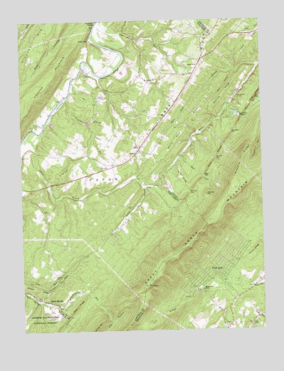
Capon Springs, WV USGS Topographic Map
Click on map above to begin viewing in our Map Viewer.

This topographic map contains these locations and features:
Feature Name Type Latitude Longitude GNIS ID View Map
Arnold FordCrossingN39.2282°W78.4578°1553749View Map
Bear RidgeRidgeN39.1993°W78.3942°1481525View Map
Bear RidgeRidgeN39.1348°W78.4714°1550187View Map
Big HollowValleyN39.1359°W78.4420°1550295View Map
Burnt RidgeRidgeN39.1868°W78.4158°1482182View Map
Camp BuckhornLocaleN39.1265°W78.3811°1482249View Map
Camp Green BriarLocaleN39.2198°W78.4567°1550601View Map
Camp Rim RockLocaleN39.2079°W78.4931°1550611View Map
Camp Rock EnonLocaleN39.2101°W78.3895°1482272View Map
Camp Tall TimbersLocaleN39.2101°W78.4622°1550617View Map
Camp White MountainLocaleN39.2293°W78.4664°1550618View Map
Capon School (historical)SchoolN39.1909°W78.4553°1550633View Map
Capon SpringsPopulated PlaceN39.1362°W78.4845°1560645View Map
Capon SpringsSpringN39.1293°W78.4725°1677907View Map
Capon Springs Post OfficePost OfficeN39.1395°W78.4880°1718615View Map
Capon Springs Resort Golf CourseLocaleN39.1325°W78.4840°2634010View Map
Capon Springs Volunteer Fire and Rescue CompanyBuildingN39.1373°W78.4896°2577657View Map
Christian ChurchChurchN39.2262°W78.4345°1550708View Map
Cold SpringSpringN39.1743°W78.4995°1677906View Map
Crag RocksAreaN39.2087°W78.3870°1779210View Map
Crooked RunStreamN39.2195°W78.4758°1550843View Map
Crooked Run Lake DamDamN39.2084°W78.4664°1558871View Map
Deep HollowValleyN39.2289°W78.3884°1482969View Map
Double RidgeRidgeN39.1504°W78.4167°1779213View Map
Dunlap FordCrossingN39.2162°W78.3917°1779215View Map
Fall RidgeRidgeN39.1307°W78.4283°1483348View Map
Farmers GapGapN39.1804°W78.4122°1483378View Map
Finger Lake EstatesPopulated PlaceN39.2348°W78.3925°1987017View Map
Friendly Grove School (historical)SchoolN39.1390°W78.3878°1987256View Map
Gallows RidgeRidgeN39.2201°W78.3939°1483581View Map
High ViewPopulated PlaceN39.2307°W78.4083°1554710View Map
High View Post OfficePost OfficeN39.2212°W78.4160°1718653View Map
Himmelwright RunStreamN39.1357°W78.4817°1551452View Map
Hooks MillsPopulated PlaceN39.2420°W78.4636°1551487View Map
Hunters ValleyPopulated PlaceN39.1826°W78.4228°1987021View Map
Jericho (historical)Populated PlaceN39.2118°W78.4247°1718658View Map
L RidgeRidgeN39.1895°W78.4767°1551678View Map
L Ridge School (historical)SchoolN39.1951°W78.4645°1718663View Map
Laurel RunStreamN39.2159°W78.3917°1484727View Map
LehewPopulated PlaceN39.1993°W78.4381°1551778View Map
Loman BranchStreamN39.2040°W78.4964°1551915View Map
Mount Salem ChurchChurchN39.2187°W78.3861°1485639View Map
Mountain FallsFallsN39.1412°W78.4061°1485676View Map
Mountain Falls ParkPopulated PlaceN39.1579°W78.3908°1987027View Map
Mountain SpringSpringN39.1308°W78.4768°1677908View Map
Mountain View School (historical)SchoolN39.2409°W78.4206°1718677View Map
Nero (historical)Populated PlaceN39.1757°W78.4386°1718680View Map
North Mountain EstatesPopulated PlaceN39.1918°W78.3961°1987028View Map
North Mountain Neighborhood ParkParkN39.1273°W78.3983°1987051View Map
PinnacleSummitN39.1432°W78.4347°1552490View Map
Pinnacle RidgeRidgeN39.1940°W78.3847°1486276View Map
Pooles FordCrossingN39.2312°W78.3750°1779245View Map
Racey CemeteryCemeteryN39.1748°W78.4453°1552576View Map
Red Bud School (historical)SchoolN39.1784°W78.4361°1718697View Map
Reed CreekStreamN39.1965°W78.4164°1486553View Map
Reed GapGapN39.1873°W78.4050°1486558View Map
Riverdale School (historical)SchoolN39.2340°W78.4642°1718700View Map
Rock EnonPopulated PlaceN39.2043°W78.4083°1779248View Map
Rock Enon School (historical)SchoolN39.2043°W78.4072°1987264View Map
Rock Enon SpringsPopulated PlaceN39.2120°W78.3864°1493499View Map
Sawlog GapGapN39.1940°W78.3983°1486952View Map
Shiloh (historical)Populated PlaceN39.1826°W78.4317°1718715View Map
Shiloh ChurchChurchN39.1965°W78.4400°1552864View Map
Shiloh United Methodist Church CemeteryCemeteryN39.1964°W78.4404°2726695View Map
Sunset HillSummitN39.2157°W78.3867°1779257View Map
Thomas MountainSummitN39.1801°W78.4036°1487869View Map
Timber Ridge Christian Church CemeteryCemeteryN39.2262°W78.4339°2726700View Map
Tunnel RidgeRidgeN39.1559°W78.3789°1488014View Map
White Pine BranchStreamN39.2309°W78.3758°1488301View Map
White Pine RidgeRidgeN39.2059°W78.4145°1488302View Map
Wilde AcresPopulated PlaceN39.1470°W78.3997°1493802View Map
Wingfield GapGapN39.2045°W78.3897°1488427View Map
WTRM-FM (Winchester)TowerN39.1832°W78.3895°1502730View Map
WVEP-FM (Martinsburg)TowerN39.1440°W78.4356°1559806View Map

Note: Coordinates in the location and feature list above are referenced to NAD83 datum.


Copyright (C) 2008-2024 Ryan Niemi / Sunset Dynamics ... All Rights Reserved