TopoQuest Logo
Do you find TopoQuest useful?
Help keep TopoQuest running and adding new maps/features by donating!
Bitcoin:  19c7KJd3qBynnjoSw5npx9KScwjBe4ifkT
Litecoin:  LXs6TkuXGGXo1vDsWCkWVdjQX94eUKd6ui
Home View Maps Find Maps Find Places Resources & Links


Galice, Oregon Topographic Map

USGS Map Title: Galice, OR
USGS Map MRC: 42123E5
DRG (GeoTIFF) Download: o42123e5.tif


Neighboring USGS Topographic Map Quads:


  Bunker Creek, OR  
42123F6
 

  Mount Reuben, OR  
42123F5
 

  Glendale, OR  
42123F4
 

  Mount Peavine, OR  
42123E6
 

  Galice, OR  
42123E5
 

  Merlin, OR  
42123E4
 

  Chrome Ridge, OR  
42123D6
 

  Onion Mountain, OR  
42123D5
 

  Wilderville, OR  
42123D4


Map MRC Location:

N43°
W124°
N43°
W123°
H8 H7 H6 H5 H4 H3 H2 H1
G8 G7 G6 G5 G4 G3 G2 G1
F8 F7 F6 F5 F4 F3 F2 F1
E8 E7 E6 E5 E4 E3 E2 E1
D8 D7 D6 D5 D4 D3 D2 D1
C8 C7 C6 C5 C4 C3 C2 C1
B8 B7 B6 B5 B4 B3 B2 B1
A8 A7 A6 A5 A4 A3 A2 A1
N42°
W124°
N42°
W123°

Galice, OR USGS 1:24K Topographic Map Preview:
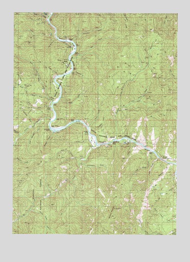
Galice, OR USGS Topographic Map
Click on map above to begin viewing in our Map Viewer.

This topographic map contains these locations and features:
Feature Name Type Latitude Longitude GNIS ID View Map
Almeada Bar Boat RampLocaleN42.6062°W123.5796°2668165View Map
Almeda (historical)LocaleN42.6082°W123.5845°1154563View Map
Almeda BarBarN42.6054°W123.5831°1155715View Map
Almeda County ParkParkN42.6054°W123.5831°1639421View Map
Almeda MineMineN42.6104°W123.5845°1137161View Map
Almeda Post Office (historical)Post OfficeN42.6082°W123.5845°1164825View Map
Applegate GulchValleyN42.5609°W123.6109°1132272View Map
Argo County ParkParkN42.6221°W123.5998°1132279View Map
Argo CreekStreamN42.6207°W123.6009°1137289View Map
Argo RiffleRapidsN42.6246°W123.5970°1158907View Map
Armedio RiffleRapidsN42.6082°W123.5828°1155720View Map
Ash GulchValleyN42.5996°W123.5840°1137313View Map
Bailey CreekStreamN42.6126°W123.5951°1137413View Map
Bear GulchValleyN42.5821°W123.6192°1155713View Map
Belknap GulchValleyN42.5929°W123.5817°1154551View Map
Black Bear MineMineN42.5837°W123.6187°1138171View Map
Blanchard GulchValleyN42.5568°W123.6217°1138249View Map
Blue CanyonValleyN42.5512°W123.5345°1154566View Map
Buck GulchValleyN42.5415°W123.5762°1154539View Map
Buckhorn MountainSummitN42.5103°W123.5490°1138859View Map
Burned Timber CreekStreamN42.5137°W123.6140°1138975View Map
Carpenters IslandIslandN42.5584°W123.5956°1639412View Map
Carpenters Island ParkParkN42.5582°W123.5956°1154565View Map
Centennial CreekValleyN42.6093°W123.5817°1140049View Map
Chair RiffleRapidsN42.5926°W123.5817°1154287View Map
Coffee Pot TrailTrailN42.6226°W123.5320°1139891View Map
Cold Springs CreekStreamN42.5637°W123.6067°1154546View Map
Cooksie GulchValleyN42.5540°W123.5637°1154541View Map
Delta CreekStreamN42.5596°W123.5692°1154542View Map
Dunn RiffleRapidsN42.5493°W123.5262°1154295View Map
Ennis RiffleRapidsN42.5623°W123.5734°1154247View Map
Ennis Riffle Boat RampLocaleN42.5634°W123.5776°2668239View Map
Ennis Riffle County ParkParkN42.5632°W123.5776°1987695View Map
Fraser SpringSpringN42.5943°W123.5887°1154554View Map
Friday SpringSpringN42.5707°W123.6012°1154548View Map
GalicePopulated PlaceN42.5696°W123.5973°1142560View Map
Galice Boat LandingLocaleN42.5680°W123.5946°2668583View Map
Galice CreekStreamN42.5637°W123.5984°1142561View Map
Galice Post Office (historical)Post OfficeN42.5696°W123.5973°1165289View Map
Galice RiffleRapidsN42.5615°W123.5984°1158876View Map
Golden Wedge MineMineN42.6081°W123.6124°1142839View Map
Hellgate BridgeBridgeN42.5501°W123.5276°1638051View Map
Hellgate CanyonValleyN42.5462°W123.5176°1143460View Map
Hog CreekStreamN42.5398°W123.5001°1143635View Map
Hog Creek Boat RampLocaleN42.5400°W123.5010°2668105View Map
Hog Creek County ParkParkN42.5401°W123.5006°1987694View Map
Hooks GulchValleyN42.5901°W123.5934°1143716View Map
Indian Mary County ParkParkN42.5528°W123.5405°1159167View Map
Indian Mary Park Boat RampLocaleN42.5541°W123.5394°2668240View Map
Keyte CreekStreamN42.5415°W123.5734°1154540View Map
Little Stratton CreekStreamN42.5721°W123.5448°1159166View Map
Little Zigzag CreekStreamN42.5462°W123.5195°1145295View Map
Lower Galice RiffleRapidsN42.5654°W123.5940°1155718View Map
Maple GulchValleyN42.5762°W123.5901°1154549View Map
Marks IslandIslandN42.6018°W123.5831°1155716View Map
Mouse CreekStreamN42.6234°W123.5998°1146550View Map
North Fork Rocky GulchValleyN42.5768°W123.5998°1155714View Map
North Star GulchValleyN42.5943°W123.5817°1154552View Map
Old ChannelSummitN42.5643°W123.6181°1158404View Map
Old Channel MineMineN42.5754°W123.6145°1147187View Map
Old Man RiffleRapidsN42.5559°W123.5665°1155712View Map
Oriole MineMineN42.5912°W123.6095°1147271View Map
Paint CreekStreamN42.5609°W123.5692°1154543View Map
Patrick GulchValleyN42.6096°W123.6095°1154561View Map
Phipps CreekStreamN42.5415°W123.5220°1163638View Map
RandPopulated PlaceN42.5962°W123.5862°1148203View Map
Rand Access Boat LaunchLocaleN42.5933°W123.5818°2668524View Map
Rand Ranger Station (historical)LocaleN42.5932°W123.5845°1154318View Map
Rand Recreation AreaParkN42.5971°W123.5831°1154564View Map
Red GulchValleyN42.5734°W123.5981°1148259View Map
Rich GulchValleyN42.5721°W123.6140°1148419View Map
Rocky GulchValleyN42.5748°W123.5962°1148664View Map
Rocky RiffleRapidsN42.5743°W123.5928°1154301View Map
Sanders GulchValleyN42.5332°W123.5026°1154550View Map
Schoolmarm CreekStreamN42.5396°W123.5776°1155719View Map
Serpentine GulchValleyN42.5401°W123.5067°1116466View Map
Seven-Thirty MineMineN42.6223°W123.6198°1149255View Map
Smith CreekStreamN42.6221°W123.5998°1154562View Map
South Fork Argo CreekStreamN42.6201°W123.6028°1149923View Map
South Fork Galice CreekStreamN42.5509°W123.6248°1155708View Map
South Fork Rocky GulchValleyN42.5768°W123.5998°1154553View Map
Spangler GulchValleyN42.5582°W123.5956°1154545View Map
Spring GulchValleyN42.5012°W123.5253°1116467View Map
Stratton CreekStreamN42.5543°W123.5481°1150473View Map
Taylor CreekStreamN42.5498°W123.5634°1150917View Map
Taylor Creek BarBarN42.5529°W123.5665°1155711View Map
Taylor Creek GorgeValleyN42.5512°W123.5595°1154337View Map
Taylor Gorge OverlookLocaleN42.5259°W123.5920°1926260View Map
Tin Can Recreation SiteLocaleN42.5109°W123.6178°1159346View Map
Toss GulchValleyN42.5693°W123.5956°1154547View Map
Upper Galice RiffleRapidsN42.5609°W123.5987°1155717View Map
Waterspout CreekStreamN42.5582°W123.5942°1154544View Map
Yew Wood CreekStreamN42.6101°W123.5942°1152733View Map
Zigzag CreekStreamN42.5432°W123.5153°1152773View Map

Note: Coordinates in the location and feature list above are referenced to NAD83 datum.


Copyright (C) 2008-2024 Ryan Niemi / Sunset Dynamics ... All Rights Reserved