TopoQuest Logo
Do you find TopoQuest useful?
Help keep TopoQuest running and adding new maps/features by donating!
Bitcoin:  19c7KJd3qBynnjoSw5npx9KScwjBe4ifkT
Litecoin:  LXs6TkuXGGXo1vDsWCkWVdjQX94eUKd6ui
Home View Maps Find Maps Find Places Resources & Links


Mount Peavine, Oregon Topographic Map

USGS Map Title: Mount Peavine, OR
USGS Map MRC: 42123E6
DRG (GeoTIFF) Download: o42123e6.tif


Neighboring USGS Topographic Map Quads:


  Kelsey Peak, OR  
42123F7
 

  Bunker Creek, OR  
42123F6
 

  Mount Reuben, OR  
42123F5
 

  Hobson Horn, OR  
42123E7
 

  Mount Peavine, OR  
42123E6
 

  Galice, OR  
42123E5
 

  York Butte, OR  
42123D7
 

  Chrome Ridge, OR  
42123D6
 

  Onion Mountain, OR  
42123D5


Map MRC Location:

N43°
W124°
N43°
W123°
H8 H7 H6 H5 H4 H3 H2 H1
G8 G7 G6 G5 G4 G3 G2 G1
F8 F7 F6 F5 F4 F3 F2 F1
E8 E7 E6 E5 E4 E3 E2 E1
D8 D7 D6 D5 D4 D3 D2 D1
C8 C7 C6 C5 C4 C3 C2 C1
B8 B7 B6 B5 B4 B3 B2 B1
A8 A7 A6 A5 A4 A3 A2 A1
N42°
W124°
N42°
W123°

Mount Peavine, OR USGS 1:24K Topographic Map Preview:
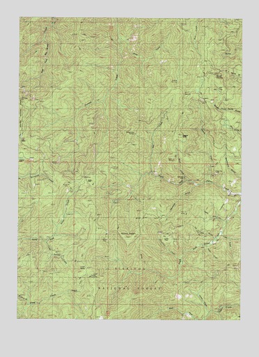
Mount Peavine, OR USGS Topographic Map
Click on map above to begin viewing in our Map Viewer.

This topographic map contains these locations and features:
Feature Name Type Latitude Longitude GNIS ID View Map
Anna CreekStreamN42.6176°W123.6954°1137224View Map
Antler CreekStreamN42.5312°W123.6456°1155707View Map
Baldy CreekStreamN42.5207°W123.6790°1154557View Map
Bartley GulchValleyN42.5401°W123.6359°1154556View Map
Birch CreekStreamN42.5582°W123.6567°1154558View Map
Browns GulchValleyN42.5073°W123.7459°1138689View Map
Bunker Hill MineMineN42.5546°W123.7234°1138960View Map
Canfield GulchValleyN42.5548°W123.6526°1139302View Map
Cedar MountainSummitN42.5189°W123.7086°1139525View Map
Cedar SpringSpringN42.5205°W123.7148°1139528View Map
Cedar Swamp CreekStreamN42.5318°W123.7356°1139537View Map
Chieftain CreekStreamN42.5262°W123.6595°1139640View Map
China CreekStreamN42.5029°W123.6437°1139664View Map
East Fork Howard CreekStreamN42.5943°W123.7012°1154559View Map
Gold Plate MineMineN42.5582°W123.6584°1142827View Map
Hansen MineMineN42.5343°W123.7015°1143270View Map
Hansen SaddleGapN42.5368°W123.6965°1143271View Map
Howland MineMineN42.5098°W123.7162°1143858View Map
Julie CreekStreamN42.5915°W123.7040°1154560View Map
Lake CreekStreamN42.5365°W123.6370°1163824View Map
Lost FlatFlatN42.5334°W123.6687°1145534View Map
Mill CreekStreamN42.5612°W123.6770°1146221View Map
Mount PeavineSummitN42.6017°W123.6426°1147547View Map
North Fork Galice CreekStreamN42.5515°W123.6251°1146956View Map
Northwest Josephine DivisionCivilN42.6153°W123.6253°1938083View Map
Peavine LookoutLocaleN42.5946°W123.6573°1147542View Map
Peggler ButteSummitN42.5760°W123.6607°1147566View Map
Quartz CreekStreamN42.5571°W123.6448°1148082View Map
Reservoir CreekStreamN42.5443°W123.6295°1159165View Map
Sailor GulchValleyN42.5429°W123.6317°1154555View Map
Sailor Jack CreekStreamN42.5404°W123.6345°1155709View Map
Serpentine SpringSpringN42.5771°W123.6864°1149245View Map
Soldier CampLocaleN42.5565°W123.7167°1149862View Map
Sugar Pine MineMineN42.5598°W123.6412°1150540View Map
Tin Canyon GulchValleyN42.5340°W123.6417°1151260View Map
Victor MineMineN42.5651°W123.6651°1151759View Map
West Fork Taylor CreekStreamN42.5059°W123.6267°1152118View Map

Note: Coordinates in the location and feature list above are referenced to NAD83 datum.


Copyright (C) 2008-2025 Ryan Niemi / Sunset Dynamics ... All Rights Reserved