TopoQuest Logo
Do you find TopoQuest useful?
Help keep TopoQuest running and adding new maps/features by donating!
Bitcoin:  19c7KJd3qBynnjoSw5npx9KScwjBe4ifkT
Litecoin:  LXs6TkuXGGXo1vDsWCkWVdjQX94eUKd6ui
Home View Maps Find Maps Find Places Resources & Links


Onion Mountain, Oregon Topographic Map

USGS Map Title: Onion Mountain, OR
USGS Map MRC: 42123D5
DRG (GeoTIFF) Download: o42123d5.tif


Neighboring USGS Topographic Map Quads:


  Mount Peavine, OR  
42123E6
 

  Galice, OR  
42123E5
 

  Merlin, OR  
42123E4
 

  Chrome Ridge, OR  
42123D6
 

  Onion Mountain, OR  
42123D5
 

  Wilderville, OR  
42123D4
 

  Eight Dollar Mountain, OR  
42123C6
 

  Selma, OR  
42123C5
 

  Murphy Mountain, OR  
42123C4


Map MRC Location:

N43°
W124°
N43°
W123°
H8 H7 H6 H5 H4 H3 H2 H1
G8 G7 G6 G5 G4 G3 G2 G1
F8 F7 F6 F5 F4 F3 F2 F1
E8 E7 E6 E5 E4 E3 E2 E1
D8 D7 D6 D5 D4 D3 D2 D1
C8 C7 C6 C5 C4 C3 C2 C1
B8 B7 B6 B5 B4 B3 B2 B1
A8 A7 A6 A5 A4 A3 A2 A1
N42°
W124°
N42°
W123°

Onion Mountain, OR USGS 1:24K Topographic Map Preview:
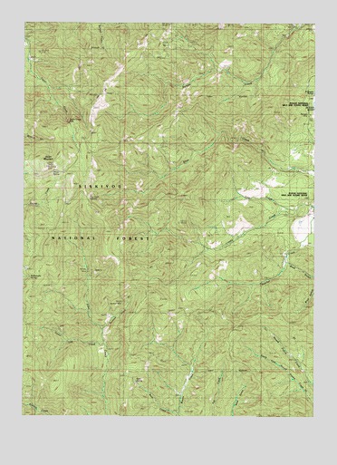
Onion Mountain, OR USGS Topographic Map
Click on map above to begin viewing in our Map Viewer.

This topographic map contains these locations and features:
Feature Name Type Latitude Longitude GNIS ID View Map
Annie SpringSpringN42.4531°W123.6132°1159175View Map
Bear CreekStreamN42.3757°W123.5609°1137649View Map
Blue GulchValleyN42.4193°W123.5012°1138305View Map
Buckeye CreekStreamN42.4018°W123.5942°1138844View Map
Buckeye MineMineN42.4115°W123.5845°1138848View Map
Cedar Log CreekStreamN42.3968°W123.5928°1139524View Map
China CreekStreamN42.4984°W123.5081°1154347View Map
Dutcher CreekStreamN42.4398°W123.5012°1141435View Map
Flanagan MineMineN42.4726°W123.5012°1154248View Map
Flanagan SloughLakeN42.4776°W123.5020°1159177View Map
Limpy CreekStreamN42.4415°W123.5006°1145028View Map
Midnight GulchValleyN42.4818°W123.5317°1154346View Map
Murry MineMineN42.4632°W123.6076°1146686View Map
Onion MountainSummitN42.4544°W123.6160°1147238View Map
Panther GulchValleyN42.4993°W123.5103°1147397View Map
Ramsey MineMineN42.4196°W123.6001°1148195View Map
Rattlesnake SpringSpringN42.4190°W123.6231°1148244View Map
Root SpringSpringN42.3865°W123.5779°1148725View Map
Shan Creek Recreation SiteLocaleN42.4437°W123.5992°1159178View Map
Slate CreekStreamN42.4407°W123.5156°1149659View Map
Taylor Creek FallsFallsN42.4679°W123.6067°1159176View Map
Trask Post Office (historical)Post OfficeN42.4401°W123.6095°1166062View Map

Note: Coordinates in the location and feature list above are referenced to NAD83 datum.


Copyright (C) 2008-2025 Ryan Niemi / Sunset Dynamics ... All Rights Reserved