TopoQuest Logo
Do you find TopoQuest useful?
Help keep TopoQuest running and adding new maps/features by donating!
Bitcoin:  19c7KJd3qBynnjoSw5npx9KScwjBe4ifkT
Litecoin:  LXs6TkuXGGXo1vDsWCkWVdjQX94eUKd6ui
Home View Maps Find Maps Find Places Resources & Links


Luke Mountain, Montana Topographic Map

USGS Map Title: Luke Mountain, MT
USGS Map MRC: 46112E6
DRG (GeoTIFF) Download: o46112e6.tif


Neighboring USGS Topographic Map Quads:


  Windy Rock, MT  
46112F7
 

  Gravely Mountain, MT  
46112F6
 

  Ophir Creek, MT  
46112F5
 

  Garrison, MT  
46112E7
 

  Luke Mountain, MT  
46112E6
 

  Avon, MT  
46112E5
 

  Conleys Lake, MT  
46112D7
 

  Deer Lodge, MT  
46112D6
 

  Baggs Creek, MT  
46112D5


Map MRC Location:

N47°
W113°
N47°
W112°
H8 H7 H6 H5 H4 H3 H2 H1
G8 G7 G6 G5 G4 G3 G2 G1
F8 F7 F6 F5 F4 F3 F2 F1
E8 E7 E6 E5 E4 E3 E2 E1
D8 D7 D6 D5 D4 D3 D2 D1
C8 C7 C6 C5 C4 C3 C2 C1
B8 B7 B6 B5 B4 B3 B2 B1
A8 A7 A6 A5 A4 A3 A2 A1
N46°
W113°
N46°
W112°

Luke Mountain, MT USGS 1:24K Topographic Map Preview:
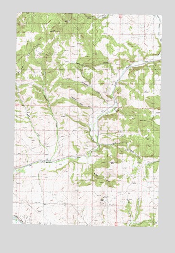
Luke Mountain, MT USGS Topographic Map
Click on map above to begin viewing in our Map Viewer.

This topographic map contains these locations and features:
Feature Name Type Latitude Longitude GNIS ID View Map
09N09W01AABA01 WellWellN46.5691°W112.6648°816864View Map
09N09W28CABD01 WellWellN46.5041°W112.7384°816560View Map
09N09W28DCBB01 WellWellN46.5010°W112.7348°816544View Map
09N09W29AADD01 WellWellN46.5099°W112.7464°816583View Map
10N09W13BBCC01 WellWellN46.6247°W112.6839°817219View Map
Avon Rest AreaLocaleN46.5694°W112.6650°1803452View Map
Avon-Elliston DivisionCivilN46.5872°W112.6710°1940563View Map
Bradley (historical)Populated PlaceN46.5702°W112.6698°1803422View Map
Bradley (historical)LocaleN46.5702°W112.6698°1803423View Map
Bradley School (historical)SchoolN46.5702°W112.6698°1803424View Map
Castle RockPillarN46.5363°W112.6636°769655View Map
Clear CreekStreamN46.5494°W112.6798°769918View Map
Dave GulchValleyN46.5480°W112.6767°770459View Map
Deep GulchValleyN46.5902°W112.6648°770559View Map
George GulchValleyN46.5360°W112.6867°771738View Map
Gimlet CreekStreamN46.6208°W112.6267°771782View Map
Homestead GulchValleyN46.5733°W112.6736°772501View Map
Little Blackfoot River BridgeBridgeN46.5733°W112.6642°1803445View Map
Luke MineMineN46.6199°W112.7073°773759View Map
Luke MountainSummitN46.6144°W112.7167°773760View Map
McDonald CreekStreamN46.5374°W112.7192°773996View Map
Meade CreekStreamN46.5372°W112.7228°774056View Map
Northern Pacific Railroad OverpassBridgeN46.5485°W112.6781°1803444View Map
Orwell (historical)LocaleN46.5360°W112.7331°1803430View Map
Rocky RidgeRidgeN46.5169°W112.6728°775902View Map
Shearing Plant GulchValleyN46.5666°W112.6828°776418View Map
Sixmile CreekStreamN46.6094°W112.6264°790564View Map
Tavenner DamDamN46.6183°W112.6892°796511View Map
Threemile CreekStreamN46.6010°W112.6284°801604View Map
Valley of a Thousand Haystacks Historical MarkerParkN46.5694°W112.6650°1803453View Map

Note: Coordinates in the location and feature list above are referenced to NAD83 datum.


Copyright (C) 2008-2025 Ryan Niemi / Sunset Dynamics ... All Rights Reserved