TopoQuest Logo
Do you find TopoQuest useful?
Help keep TopoQuest running and adding new maps/features by donating!
Bitcoin:  19c7KJd3qBynnjoSw5npx9KScwjBe4ifkT
Litecoin:  LXs6TkuXGGXo1vDsWCkWVdjQX94eUKd6ui
Home View Maps Find Maps Find Places Resources & Links


Garrison, Montana Topographic Map

USGS Map Title: Garrison, MT
USGS Map MRC: 46112E7
DRG (GeoTIFF) Download: o46112e7.tif


Neighboring USGS Topographic Map Quads:


  Bailey Mountain, MT  
46112F8
 

  Windy Rock, MT  
46112F7
 

  Gravely Mountain, MT  
46112F6
 

  Griffin Creek, MT  
46112E8
 

  Garrison, MT  
46112E7
 

  Luke Mountain, MT  
46112E6
 

  Rock Creek Lake, MT  
46112D8
 

  Conleys Lake, MT  
46112D7
 

  Deer Lodge, MT  
46112D6


Map MRC Location:

N47°
W113°
N47°
W112°
H8 H7 H6 H5 H4 H3 H2 H1
G8 G7 G6 G5 G4 G3 G2 G1
F8 F7 F6 F5 F4 F3 F2 F1
E8 E7 E6 E5 E4 E3 E2 E1
D8 D7 D6 D5 D4 D3 D2 D1
C8 C7 C6 C5 C4 C3 C2 C1
B8 B7 B6 B5 B4 B3 B2 B1
A8 A7 A6 A5 A4 A3 A2 A1
N46°
W113°
N46°
W112°

Garrison, MT USGS 1:24K Topographic Map Preview:
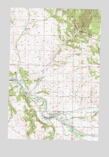
Garrison, MT USGS Topographic Map
Click on map above to begin viewing in our Map Viewer.

This topographic map contains these locations and features:
Feature Name Type Latitude Longitude GNIS ID View Map
09N10W04BDBC01 WellWellN46.5655°W112.8645°816848View Map
09N10W04BDBC02 WellWellN46.5652°W112.8648°816847View Map
09N10W04CACC01 WellWellN46.5599°W112.8659°816822View Map
09N10W04CDBB01 WellWellN46.5594°W112.8659°816820View Map
09N10W04CDBB02 WellWellN46.5591°W112.8653°816817View Map
09N10W05DDDA01 WellWellN46.5572°W112.8717°816810View Map
09N10W05DDDA02 WellWellN46.5574°W112.8714°816813View Map
09N10W08AADA01 WellWellN46.5544°W112.8714°816792View Map
09N10W10CCAD01 WellWellN46.5438°W112.8450°816744View Map
09N10W10CDBD01 WellWellN46.5438°W112.8425°816743View Map
09N10W10CDCC01 WellWellN46.5427°W112.8428°816738View Map
09N10W14DDCD01 WellWellN46.5277°W112.8117°816676View Map
09N10W15AABB01 WellWellN46.5280°W112.8137°816677View Map
09N10W15BABC01 WellWellN46.5405°W112.8439°816725View Map
09N10W15BABD01 WellWellN46.5402°W112.8434°816722View Map
09N10W15BACA01 WellWellN46.5399°W112.8425°816720View Map
09N10W15BBAB01 WellWellN46.5413°W112.8464°816728View Map
09N10W22ABAB01 WellWellN46.5263°W112.8370°816673View Map
09N10W22DAAD01 WellWellN46.5180°W112.8295°816620View Map
09N10W23AADD01 WellWellN46.5244°W112.8087°816656View Map
09N10W23ACBD01 WellWellN46.5219°W112.8164°816644View Map
09N10W23ACDD01 WellWellN46.5202°W112.8131°816632View Map
09N10W23ADCC01 WellWellN46.5202°W112.8120°816631View Map
09N10W23BDAD01 WellWellN46.5222°W112.8195°816645View Map
09N10W23CAAD01 WellWellN46.5185°W112.8189°816621View Map
09N10W23CCAA01 WellWellN46.5160°W112.8248°816613View Map
09N10W24ABCA01 WellWellN46.5255°W112.7962°816666View Map
09N10W24ABCD01 WellWellN46.5244°W112.7956°816654View Map
09N10W24BABC01 WellWellN46.5255°W112.8031°816667View Map
09N10W24BBBD01 WellWellN46.5260°W112.8059°816670View Map
09N10W24BBCA01 WellWellN46.5252°W112.8064°816664View Map
09N10W24BBCA02 WellWellN46.5255°W112.8059°816669View Map
09N10W24BBCC01 WellWellN46.5247°W112.8087°816660View Map
09N10W24BBDA01 WellWellN46.5249°W112.8037°816661View Map
09N10W24BBDB01 WellWellN46.5255°W112.8048°816668View Map
09N10W24BBDC01 WellWellN46.5244°W112.8048°816655View Map
Bear GulchValleyN46.5927°W112.8009°768592View Map
Brock CreekPopulated PlaceN46.6035°W112.8556°769239View Map
Brock CreekStreamN46.5560°W112.8675°769241View Map
Clark Fork River BridgeBridgeN46.5199°W112.8087°1803446View Map
GarrisonPopulated PlaceN46.5233°W112.8117°771720View Map
GarrisonLocaleN46.5233°W112.8117°1803402View Map
Garrison Census Designated PlaceCensusN46.5260°W112.8205°2408285View Map
Garrison Elementary SchoolSchoolN46.5249°W112.8073°1803321View Map
Garrison Post Office (historical)Post OfficeN46.5233°W112.8117°1803403View Map
Garrison Volunteer Fire DepartmentBuildingN46.5219°W112.8161°2546538View Map
Independence CreekStreamN46.5513°W112.8606°785233View Map
Interchange 170CrossingN46.5566°W112.8703°1803442View Map
Interchange 174CrossingN46.5235°W112.8167°1803441View Map
Interchange 175CrossingN46.5130°W112.7875°1803440View Map
Little Blackfoot RiverStreamN46.5149°W112.7978°786244View Map
PhosphateLocaleN46.5583°W112.8703°1803378View Map
Riverfront RV ParkLocaleN46.5233°W112.8117°1803352View Map
Rock CreekStreamN46.5197°W112.8198°789672View Map
Warm Springs CreekStreamN46.5402°W112.8462°778115View Map
Willow CreekStreamN46.5330°W112.8250°793352View Map

Note: Coordinates in the location and feature list above are referenced to NAD83 datum.


Copyright (C) 2008-2024 Ryan Niemi / Sunset Dynamics ... All Rights Reserved