TopoQuest Logo
Do you find TopoQuest useful?
Help keep TopoQuest running and adding new maps/features by donating!
Bitcoin:  19c7KJd3qBynnjoSw5npx9KScwjBe4ifkT
Litecoin:  LXs6TkuXGGXo1vDsWCkWVdjQX94eUKd6ui
Home View Maps Find Maps Find Places Resources & Links


Conleys Lake, Montana Topographic Map

USGS Map Title: Conleys Lake, MT
USGS Map MRC: 46112D7
DRG (GeoTIFF) Download: o46112d7.tif


Neighboring USGS Topographic Map Quads:


  Griffin Creek, MT  
46112E8
 

  Garrison, MT  
46112E7
 

  Luke Mountain, MT  
46112E6
 

  Rock Creek Lake, MT  
46112D8
 

  Conleys Lake, MT  
46112D7
 

  Deer Lodge, MT  
46112D6
 

  Mount Powell, MT  
46112C8
 

  Racetrack, MT  
46112C7
 

  Orofino Creek, MT  
46112C6


Map MRC Location:

N47°
W113°
N47°
W112°
H8 H7 H6 H5 H4 H3 H2 H1
G8 G7 G6 G5 G4 G3 G2 G1
F8 F7 F6 F5 F4 F3 F2 F1
E8 E7 E6 E5 E4 E3 E2 E1
D8 D7 D6 D5 D4 D3 D2 D1
C8 C7 C6 C5 C4 C3 C2 C1
B8 B7 B6 B5 B4 B3 B2 B1
A8 A7 A6 A5 A4 A3 A2 A1
N46°
W113°
N46°
W112°

Conleys Lake, MT USGS 1:24K Topographic Map Preview:
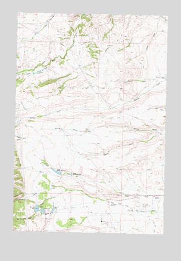
Conleys Lake, MT USGS Topographic Map
Click on map above to begin viewing in our Map Viewer.

This topographic map contains these locations and features:
Feature Name Type Latitude Longitude GNIS ID View Map
07N09W06DBBC01 WellWellN46.3883°W112.7762°815962View Map
07N09W06DBCB01 WellWellN46.3880°W112.7762°815960View Map
07N10W02CADD01 WellWellN46.3860°W112.8181°815939View Map
07N10W03ABBD01 WellWellN46.3958°W112.8373°816012View Map
07N10W03DD__01 WellWellN46.3844°W112.8303°815928View Map
08N09W20CAAB01 WellWellN46.4330°W112.7567°816247View Map
08N09W32DCDA01 WellWellN46.3977°W112.7506°816034View Map
08N10W23DBAD01 WellWellN46.4321°W112.8134°816245View Map
09N09W32BACA01 WellWellN46.4960°W112.7581°816523View Map
Brand DitchCanalN46.4749°W112.8492°780364View Map
Conleys LakeReservoirN46.3867°W112.8513°781574View Map
Conleys Lake DamDamN46.3866°W112.8509°796514View Map
Cottonwood DrawValleyN46.4622°W112.7570°781735View Map
Deer Lodge Golf ClubLocaleN46.3880°W112.7756°799305View Map
Deer Lodge-City-County AirportAirportN46.3897°W112.7659°798814View Map
Deer ParkParkN46.3880°W112.7737°782269View Map
Dry GulchValleyN46.4855°W112.8256°782618View Map
Hansen DrawValleyN46.4966°W112.7581°784524View Map
Hillcrest CemeteryCemeteryN46.3958°W112.7564°784894View Map
Kerns LakeReservoirN46.4007°W112.8451°785694View Map
Kerns Lake DamDamN46.3999°W112.8442°796527View Map
La Marche CreekStreamN46.4144°W112.8478°785871View Map
Lower Taylor ReservoirReservoirN46.4079°W112.8281°786681View Map
Montana State PrisonBuildingN46.3853°W112.7981°2548901View Map
Montana State PrisonBuildingN46.3830°W112.8025°2735593View Map
Montana State Prison Fire DepartmentBuildingN46.3853°W112.7979°2739786View Map
Morrison GulchValleyN46.3830°W112.8156°787713View Map
Mud LakeReservoirN46.3881°W112.8428°787806View Map
Mud Lake DamDamN46.3883°W112.8425°798710View Map
Pauly DitchCanalN46.4472°W112.8689°788710View Map
Robinson GulchValleyN46.3994°W112.8314°789651View Map
Rock Creek DitchCanalN46.4574°W112.8298°789691View Map
Rock Creek Lake DamDamN46.4666°W112.8575°798358View Map
Roth HallLocaleN46.3816°W112.8017°789800View Map
Skaggs HollowValleyN46.4316°W112.7539°790573View Map
Spring RanchLocaleN46.4333°W112.8139°791320View Map
State Prison Ranch Number 1LocaleN46.3910°W112.7964°791463View Map
Tin Cup LakeReservoirN46.3880°W112.8563°792210View Map
Tin Cup Lake DamDamN46.3883°W112.8559°796519View Map
Upper Taylor DamDamN46.4083°W112.8375°796246View Map
Upper Taylor ReservoirReservoirN46.4089°W112.8395°792656View Map
Williams and Tavenner RanchLocaleN46.4644°W112.7523°793314View Map

Note: Coordinates in the location and feature list above are referenced to NAD83 datum.


Copyright (C) 2008-2025 Ryan Niemi / Sunset Dynamics ... All Rights Reserved