TopoQuest Logo
Do you find TopoQuest useful?
Help keep TopoQuest running and adding new maps/features by donating!
Bitcoin:  19c7KJd3qBynnjoSw5npx9KScwjBe4ifkT
Litecoin:  LXs6TkuXGGXo1vDsWCkWVdjQX94eUKd6ui
Home View Maps Find Maps Find Places Resources & Links


Port Mansfield, Texas Topographic Map

USGS Map Title: Port Mansfield, TX
USGS Map MRC: 26097E4
DRG (GeoTIFF) Download: o26097e4.tif


Neighboring USGS Topographic Map Quads:


  Rosita Lake NE, TX  
26097F5
 

  South of Potrero Lopeno NW, TX  
26097F4
 

  South of Potrero Lopeno NE, TX  
26097F3
 

  El Jardin, TX  
26097E5
 

  Port Mansfield, TX  
26097E4
 

  South of Potrero Lopeno SE, TX  
26097E3
 

  Willamar, TX  
26097D5
 

  Hawk Island, TX  
26097D4
 

  Green Island, TX  
26097D3


Map MRC Location:

N27°
W98°
N27°
W97°
H8 H7 H6 H5 H4 H3 H2 H1
G8 G7 G6 G5 G4 G3 G2 G1
F8 F7 F6 F5 F4 F3 F2 F1
E8 E7 E6 E5 E4 E3 E2 E1
D8 D7 D6 D5 D4 D3 D2 D1
C8 C7 C6 C5 C4 C3 C2 C1
B8 B7 B6 B5 B4 B3 B2 B1
A8 A7 A6 A5 A4 A3 A2 A1
N26°
W98°
N26°
W97°

Port Mansfield, TX USGS 1:24K Topographic Map Preview:
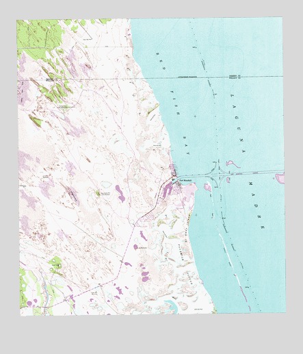
Port Mansfield, TX USGS Topographic Map
Click on map above to begin viewing in our Map Viewer.

This topographic map contains these locations and features:
Feature Name Type Latitude Longitude GNIS ID View Map
Agua Gorda Well South WindmillLocaleN26.5512°W97.4622°1329263View Map
Cabasenios WellWellN26.5548°W97.4966°1331805View Map
Casa de Pescadore MarinaLocaleN26.5556°W97.4269°2030503View Map
Charles R Johnson AirportAirportN26.5577°W97.4373°1387351View Map
Dave Dear WellWellN26.6167°W97.4650°1334064View Map
El Sauz IslandIslandN26.5367°W97.4216°1335270View Map
Fourmile SloughGutN26.5198°W97.4228°1336123View Map
Julian WellLocaleN26.5101°W97.4641°1338922View Map
Lava Manos WellWellN26.5284°W97.4444°1339721View Map
Palmital Well North WindmillLocaleN26.5881°W97.4772°1343474View Map
Palmital Well South WindmillLocaleN26.5881°W97.4772°1343475View Map
Port MansfieldPopulated PlaceN26.5548°W97.4250°1344369View Map
Port Mansfield Boat Basin MarinaLocaleN26.5520°W97.4286°2030481View Map
Port Mansfield Census Designated PlaceCensusN26.5620°W97.4362°2409094View Map
Port Mansfield Volunteer Fire DepartmentBuildingN26.5503°W97.4350°2552592View Map
Red Fish BayBayN26.6003°W97.4294°1344912View Map
Sausel WellWellN26.5217°W97.4816°1346725View Map
Willacy County Navigation District MarinaLocaleN26.5537°W97.4280°2030390View Map

Note: Coordinates in the location and feature list above are referenced to NAD83 datum.


Copyright (C) 2008-2024 Ryan Niemi / Sunset Dynamics ... All Rights Reserved