TopoQuest Logo
Do you find TopoQuest useful?
Help keep TopoQuest running and adding new maps/features by donating!
Bitcoin:  19c7KJd3qBynnjoSw5npx9KScwjBe4ifkT
Litecoin:  LXs6TkuXGGXo1vDsWCkWVdjQX94eUKd6ui
Home View Maps Find Maps Find Places Resources & Links


Rosita Lake NE, Texas Topographic Map

USGS Map Title: Rosita Lake NE, TX
USGS Map MRC: 26097F5
DRG (GeoTIFF) Download: o26097f5.tif


Neighboring USGS Topographic Map Quads:


  Saltillo Well, TX  
26097G6
 

  Los Amigos Windmill, TX  
26097G5
 

  Potrero Lopeno SW, TX  
26097G4
 

  Rosita Lake, TX  
26097F6
 

  Rosita Lake NE, TX  
26097F5
 

  South of Potrero Lopeno NW, TX  
26097F4
 

  San Perlita North, TX  
26097E6
 

  El Jardin, TX  
26097E5
 

  Port Mansfield, TX  
26097E4


Map MRC Location:

N27°
W98°
N27°
W97°
H8 H7 H6 H5 H4 H3 H2 H1
G8 G7 G6 G5 G4 G3 G2 G1
F8 F7 F6 F5 F4 F3 F2 F1
E8 E7 E6 E5 E4 E3 E2 E1
D8 D7 D6 D5 D4 D3 D2 D1
C8 C7 C6 C5 C4 C3 C2 C1
B8 B7 B6 B5 B4 B3 B2 B1
A8 A7 A6 A5 A4 A3 A2 A1
N26°
W98°
N26°
W97°

Rosita Lake NE, TX USGS 1:24K Topographic Map Preview:
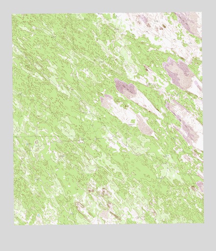
Rosita Lake NE, TX USGS Topographic Map
Click on map above to begin viewing in our Map Viewer.

This topographic map contains these locations and features:
Feature Name Type Latitude Longitude GNIS ID View Map
Alto Blanco WindmillLocaleN26.6520°W97.5283°1329451View Map
Campo Verde WindmillLocaleN26.6656°W97.5922°1332048View Map
Cerritos WindmillLocaleN26.6320°W97.5869°1332598View Map
Charco Blanco WindmillLocaleN26.6840°W97.5480°1332679View Map
Charco Nine WindmillLocaleN26.6523°W97.6105°1332682View Map
Colorado WindmillLocaleN26.7364°W97.5967°1333151View Map
El Burro WindmillLocaleN26.7409°W97.5547°1335166View Map
El Cortado WindmillLocaleN26.7078°W97.5342°1335180View Map
El Nido WindmillLocaleN26.7323°W97.5086°1335226View Map
El Rayo WindmillLocaleN26.7031°W97.6194°1335256View Map
Frijon WindmillLocaleN26.7481°W97.5553°1336258View Map
Gavilan WindmillLocaleN26.6756°W97.5200°1336450View Map
Horaito WindmillLocaleN26.6753°W97.5789°1338080View Map
Huidos WindmillLocaleN26.7451°W97.5305°1338250View Map
Huisatcho WindmillsLocaleN26.6653°W97.5242°1338269View Map
Mesquite WindmillLocaleN26.7214°W97.5650°1341420View Map
Mova WindmillLocaleN26.6290°W97.5428°1342177View Map
San Luis WindmillLocaleN26.6909°W97.5769°1346424View Map
Tecolote Artesian WellWellN26.6734°W97.6158°1348316View Map
Teodoro WindmillLocaleN26.7198°W97.6147°1348372View Map
Totache WindmillLocaleN26.6381°W97.5686°1348661View Map

Note: Coordinates in the location and feature list above are referenced to NAD83 datum.


Copyright (C) 2008-2024 Ryan Niemi / Sunset Dynamics ... All Rights Reserved