TopoQuest Logo
Do you find TopoQuest useful?
Help keep TopoQuest running and adding new maps/features by donating!
Bitcoin:  19c7KJd3qBynnjoSw5npx9KScwjBe4ifkT
Litecoin:  LXs6TkuXGGXo1vDsWCkWVdjQX94eUKd6ui
Home View Maps Find Maps Find Places Resources & Links


Weston, Louisiana Topographic Map

USGS Map Title: Weston, LA
USGS Map MRC: 32092B5
DRG (GeoTIFF) Download: o32092b5.tif


Neighboring USGS Topographic Map Quads:


  Jonesboro North, LA  
32092C6
 

  Curr Creek, LA  
32092C5
 

  Chatham, LA  
32092C4
 

  Jonesboro South, LA  
32092B6
 

  Weston, LA  
32092B5
 

  Womack, LA  
32092B4
 

  Dodson, LA  
32092A6
 

  Hudson, LA  
32092A5
 

  Sikes, LA  
32092A4


Map MRC Location:

N33°
W93°
N33°
W92°
H8 H7 H6 H5 H4 H3 H2 H1
G8 G7 G6 G5 G4 G3 G2 G1
F8 F7 F6 F5 F4 F3 F2 F1
E8 E7 E6 E5 E4 E3 E2 E1
D8 D7 D6 D5 D4 D3 D2 D1
C8 C7 C6 C5 C4 C3 C2 C1
B8 B7 B6 B5 B4 B3 B2 B1
A8 A7 A6 A5 A4 A3 A2 A1
N32°
W93°
N32°
W92°

Weston, LA USGS 1:24K Topographic Map Preview:
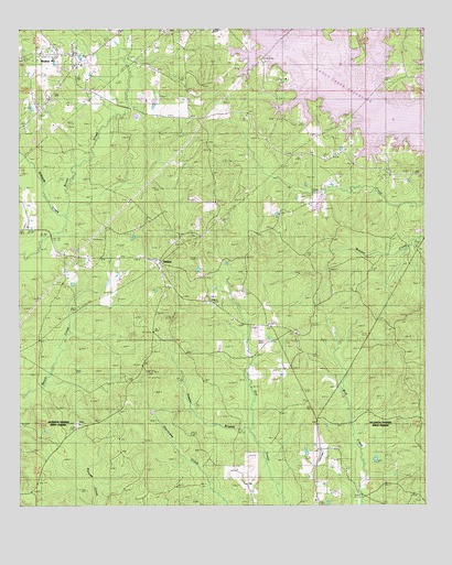
Weston, LA USGS Topographic Map
Click on map above to begin viewing in our Map Viewer.

This topographic map contains these locations and features:
Feature Name Type Latitude Longitude GNIS ID View Map
Boatner (historical)Populated PlaceN32.1977°W92.5474°542271View Map
Caney CreekStreamN32.2393°W92.5335°533744View Map
Caney Creek ReservoirReservoirN32.2427°W92.5259°556606View Map
Clear BranchStreamN32.2321°W92.5207°533981View Map
Halfway CreekStreamN32.1974°W92.6129°535489View Map
Hancock CreekStreamN32.2446°W92.5371°535514View Map
Jimmie Davis State ParkParkN32.2468°W92.5204°2044604View Map
Midway Baptist ChurchChurchN32.1702°W92.5393°555312View Map
Mount HebronPopulated PlaceN32.2118°W92.5107°542325View Map
Mount Hebron CemeteryCemeteryN32.2127°W92.5113°542326View Map
Mount Hebron SchoolSchoolN32.2127°W92.5099°537323View Map
Pepper BranchStreamN32.1457°W92.5529°538066View Map
Transport CemeteryCemeteryN32.1471°W92.6071°542356View Map
Transport ChurchChurchN32.1465°W92.6079°539975View Map
WalkerPopulated PlaceN32.1902°W92.5838°543766View Map
Walker High School (historical)SchoolN32.1899°W92.5824°542368View Map
Ward FourCivilN32.2449°W92.6163°545060View Map
Ward Four Fire Protection DistrictBuildingN32.2391°W92.6085°2672955View Map
WestonPopulated PlaceN32.2440°W92.6135°540342View Map
WESTON HIGH SCHOOLSchoolN32.2405°W92.6072°542370View Map
Weston PlaygroundParkN32.2402°W92.6079°542371View Map

Note: Coordinates in the location and feature list above are referenced to NAD83 datum.


Copyright (C) 2008-2025 Ryan Niemi / Sunset Dynamics ... All Rights Reserved