TopoQuest Logo
Do you find TopoQuest useful?
Help keep TopoQuest running and adding new maps/features by donating!
Bitcoin:  19c7KJd3qBynnjoSw5npx9KScwjBe4ifkT
Litecoin:  LXs6TkuXGGXo1vDsWCkWVdjQX94eUKd6ui
Home View Maps Find Maps Find Places Resources & Links


Bentley, Illinois Topographic Map

USGS Map Title: Bentley, IL
USGS Map MRC: 40091C1
DRG (GeoTIFF) Download: o40091c1.tif


Neighboring USGS Topographic Map Quads:


  Carthage West, IL  
40091D2
 

  Carthage East, IL  
40091D1
 

  Fountain Green, IL  
40090D8
 

  West Point, IL  
40091C2
 

  Bentley, IL  
40091C1
 

  Plymouth, IL  
40090C8
 

  Loraine, IL  
40091B2
 

  Bowen, IL  
40091B1
 

  Augusta, IL  
40090B8


Map MRC Location:

N41°
W92°
N41°
W91°
H8 H7 H6 H5 H4 H3 H2 H1
G8 G7 G6 G5 G4 G3 G2 G1
F8 F7 F6 F5 F4 F3 F2 F1
E8 E7 E6 E5 E4 E3 E2 E1
D8 D7 D6 D5 D4 D3 D2 D1
C8 C7 C6 C5 C4 C3 C2 C1
B8 B7 B6 B5 B4 B3 B2 B1
A8 A7 A6 A5 A4 A3 A2 A1
N40°
W92°
N40°
W91°

Bentley, IL USGS 1:24K Topographic Map Preview:
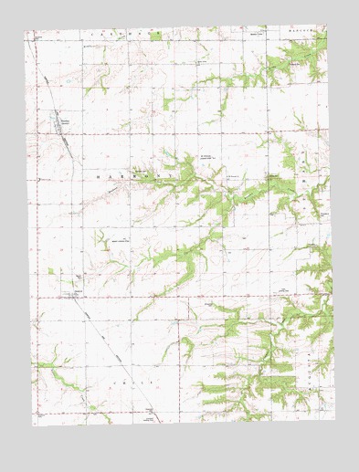
Bentley, IL USGS Topographic Map
Click on map above to begin viewing in our Map Viewer.

This topographic map contains these locations and features:
Feature Name Type Latitude Longitude GNIS ID View Map
BentleyPopulated PlaceN40.3445°W91.1118°404186View Map
Browning CemeteryCemeteryN40.2870°W91.0499°404972View Map
Clark Landing Strip (historical)AirportN40.2903°W91.0210°1720593View Map
Crossland Landing Strip (historical)AirportN40.2503°W91.0735°1720595View Map
DenverPopulated PlaceN40.2906°W91.1071°407135View Map
Denver CemeteryCemeteryN40.2975°W91.1037°407136View Map
Denver Post Office (historical)Post OfficeN40.2906°W91.1076°1812479View Map
Douglas School (historical)SchoolN40.3203°W91.1207°423980View Map
Groves CemeteryCemeteryN40.3273°W91.0254°409550View Map
Harmony CemeteryCemeteryN40.3300°W91.0812°409800View Map
Harmony School (historical)SchoolN40.2928°W91.0549°423990View Map
Holland CemeteryCemeteryN40.3625°W91.0160°410391View Map
Independence School (historical)SchoolN40.3562°W91.0443°423994View Map
Lauderdale School (historical)SchoolN40.2689°W91.0837°423998View Map
Liberty School (historical)SchoolN40.3248°W91.0829°423999View Map
Mabry Landing Strip (historical)AirportN40.3084°W91.0876°1720616View Map
Mc Pherson AirportAirportN40.3341°W91.0459°427117View Map
Middle CreekPopulated PlaceN40.3728°W91.0274°413482View Map
Middle Creek ChurchChurchN40.3634°W91.0543°413492View Map
Mount Pleasant CemeteryCemeteryN40.3267°W91.0437°1984109View Map
Mount Pleasant ChurchChurchN40.3275°W91.0426°414060View Map
Mount Pleasant School (historical)SchoolN40.3242°W91.0424°424001View Map
Old Sixteen CemeteryCemeteryN40.2536°W91.1001°1984118View Map
Pleasant Valley School (historical)SchoolN40.3564°W91.0818°424004View Map
Providence CemeteryCemeteryN40.3145°W91.0049°416248View Map
Providence ChurchChurchN40.3053°W91.0065°416257View Map
Providence School (historical)SchoolN40.3050°W91.0057°424006View Map
Ramsey CemeteryCemeteryN40.3034°W91.0429°1984120View Map
Rose Hill School (historical)SchoolN40.2681°W91.0468°424007View Map
School Number 338SchoolN40.3275°W91.1196°425462View Map
Scott CemeteryCemeteryN40.3078°W91.0368°1984125View Map
Shiloh School (historical)SchoolN40.3414°W91.0007°424008View Map
Town of BentleyCivilN40.3438°W91.1117°2396588View Map
Township of HarmonyCivilN40.3270°W91.0843°429111View Map
West Union School (historical)SchoolN40.2603°W91.0043°424013View Map

Note: Coordinates in the location and feature list above are referenced to NAD83 datum.


Copyright (C) 2008-2024 Ryan Niemi / Sunset Dynamics ... All Rights Reserved