TopoQuest Logo
Do you find TopoQuest useful?
Help keep TopoQuest running and adding new maps/features by donating!
Bitcoin:  19c7KJd3qBynnjoSw5npx9KScwjBe4ifkT
Litecoin:  LXs6TkuXGGXo1vDsWCkWVdjQX94eUKd6ui
Home View Maps Find Maps Find Places Resources & Links


Carthage East, Illinois Topographic Map

USGS Map Title: Carthage East, IL
USGS Map MRC: 40091D1
DRG (GeoTIFF) Download: o40091d1.tif


Neighboring USGS Topographic Map Quads:


  Colusa, IL  
40091E2
 

  Burnside, IL  
40091E1
 

  La Harpe, IL  
40090E8
 

  Carthage West, IL  
40091D2
 

  Carthage East, IL  
40091D1
 

  Fountain Green, IL  
40090D8
 

  West Point, IL  
40091C2
 

  Bentley, IL  
40091C1
 

  Plymouth, IL  
40090C8


Map MRC Location:

N41°
W92°
N41°
W91°
H8 H7 H6 H5 H4 H3 H2 H1
G8 G7 G6 G5 G4 G3 G2 G1
F8 F7 F6 F5 F4 F3 F2 F1
E8 E7 E6 E5 E4 E3 E2 E1
D8 D7 D6 D5 D4 D3 D2 D1
C8 C7 C6 C5 C4 C3 C2 C1
B8 B7 B6 B5 B4 B3 B2 B1
A8 A7 A6 A5 A4 A3 A2 A1
N40°
W92°
N40°
W91°

Carthage East, IL USGS 1:24K Topographic Map Preview:
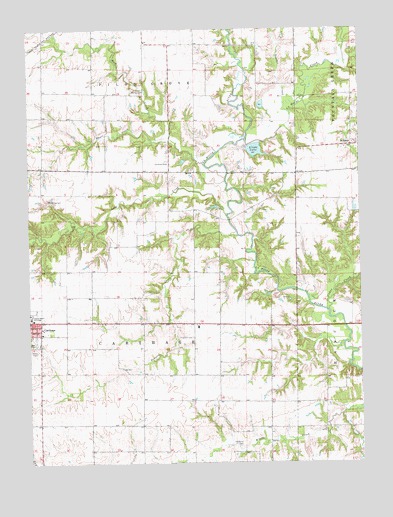
Carthage East, IL USGS Topographic Map
Click on map above to begin viewing in our Map Viewer.

This topographic map contains these locations and features:
Feature Name Type Latitude Longitude GNIS ID View Map
Brooks Ranch AirportAirportN40.4595°W91.0410°427091View Map
Cedar CreekStreamN40.4187°W91.0121°405739View Map
Cottage School (historical)SchoolN40.4923°W91.0710°423979View Map
Deer CreekStreamN40.4995°W91.0490°407065View Map
Dunbar CreekStreamN40.4767°W91.0285°407479View Map
East Union School (historical)SchoolN40.3862°W91.0829°423982View Map
Fairplay School (historical)SchoolN40.3862°W91.1210°423983View Map
Fairview School (historical)SchoolN40.4231°W91.1018°423984View Map
Franklin CemeteryCemeteryN40.4114°W91.0632°408662View Map
Franklin School (historical)SchoolN40.4150°W91.0532°423985View Map
Grant School (historical)SchoolN40.4592°W91.0813°423987View Map
Hobart School (historical)SchoolN40.4514°W91.0238°423993View Map
Jubilee School (historical)SchoolN40.4820°W91.1176°423995View Map
La Harpe CreekStreamN40.4678°W91.0426°411647View Map
Lake Linda DamDamN40.4653°W91.0399°1691247View Map
Linda LakeReservoirN40.4652°W91.0394°412222View Map
Little CreekStreamN40.3889°W91.0076°412321View Map
Long CreekStreamN40.4467°W91.0501°412563View Map
Lung RLA Airport (historical)AirportN40.4598°W91.0723°427118View Map
McKay CemeteryCemeteryN40.4825°W91.0857°413283View Map
Memorial HospitalHospitalN40.4080°W91.1133°1720617View Map
Mount Zion School (historical)SchoolN40.4531°W91.1204°424002View Map
Old Brick CemeteryCemeteryN40.3798°W91.0457°414992View Map
Pleasant Valley School (historical)SchoolN40.4442°W91.0532°424005View Map
Prairie CreekStreamN40.4406°W91.0463°416126View Map
Rock CreekStreamN40.4609°W91.0585°416802View Map
Short CreekStreamN40.4681°W91.0718°418466View Map
Thomas LakeReservoirN40.4817°W91.0751°1692537View Map
Thomas Lake DamDamN40.4817°W91.0751°1692536View Map
Township of CarthageCivilN40.4153°W91.0877°428770View Map
Valleydale School (historical)SchoolN40.3856°W91.0499°424012View Map
WebsterPopulated PlaceN40.4664°W91.0007°420692View Map
Woodring CemeteryCemeteryN40.4509°W91.1176°421463View Map

Note: Coordinates in the location and feature list above are referenced to NAD83 datum.


Copyright (C) 2008-2024 Ryan Niemi / Sunset Dynamics ... All Rights Reserved