TopoQuest Logo
Do you find TopoQuest useful?
Help keep TopoQuest running and adding new maps/features by donating!
Bitcoin:  19c7KJd3qBynnjoSw5npx9KScwjBe4ifkT
Litecoin:  LXs6TkuXGGXo1vDsWCkWVdjQX94eUKd6ui
Home View Maps Find Maps Find Places Resources & Links


Fountain Green, Illinois Topographic Map

USGS Map Title: Fountain Green, IL
USGS Map MRC: 40090D8
DRG (GeoTIFF) Download: o40090d8.tif


Neighboring USGS Topographic Map Quads:


  Burnside, IL  
40091E1
 

  La Harpe, IL  
40090E8
 

  Blandinsville, IL  
40090E7
 

  Carthage East, IL  
40091D1
 

  Fountain Green, IL  
40090D8
 

  Colchester, IL  
40090D7
 

  Bentley, IL  
40091C1
 

  Plymouth, IL  
40090C8
 

  Fandon, IL  
40090C7


Map MRC Location:

N41°
W91°
N41°
W90°
H8 H7 H6 H5 H4 H3 H2 H1
G8 G7 G6 G5 G4 G3 G2 G1
F8 F7 F6 F5 F4 F3 F2 F1
E8 E7 E6 E5 E4 E3 E2 E1
D8 D7 D6 D5 D4 D3 D2 D1
C8 C7 C6 C5 C4 C3 C2 C1
B8 B7 B6 B5 B4 B3 B2 B1
A8 A7 A6 A5 A4 A3 A2 A1
N40°
W91°
N40°
W90°

Fountain Green, IL USGS 1:24K Topographic Map Preview:
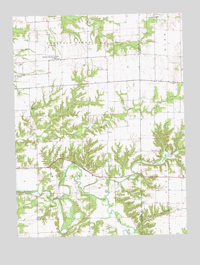
Fountain Green, IL USGS Topographic Map
Click on map above to begin viewing in our Map Viewer.

This topographic map contains these locations and features:
Feature Name Type Latitude Longitude GNIS ID View Map
Centennial School (historical)SchoolN40.4225°W90.9026°1721193View Map
Central CemeteryCemeteryN40.4975°W90.8951°405854View Map
East Fork La Moine RiverStreamN40.3962°W90.9335°407640View Map
Fisher CreekStreamN40.4317°W90.9815°408399View Map
Fountain GreenPopulated PlaceN40.4759°W90.9693°408584View Map
Fountain Green CemeteryCemeteryN40.4828°W90.9687°408585View Map
Fountain Green Post Office (historical)Post OfficeN40.4756°W90.9687°1812485View Map
Friendship CemeteryCemeteryN40.4603°W90.8815°1824373View Map
Friendship United Methodist ChurchChurchN40.4603°W90.8821°408765View Map
Hills Grove CemeteryCemeteryN40.3867°W90.8904°410285View Map
Hills Grove School (historical)SchoolN40.3923°W90.8824°1721222View Map
Hills Grove United Methodist ChurchChurchN40.3892°W90.8818°410286View Map
Joe Duncan School (historical)SchoolN40.4689°W90.9307°1720610View Map
JoettaPopulated PlaceN40.4337°W90.9315°422849View Map
La Harpe Fire Protection District Station 3BuildingN40.4777°W90.9688°2640762View Map
La Moine CampLocaleN40.4303°W90.9729°411648View Map
Liberty CemeteryCemeteryN40.4289°W90.9749°1983969View Map
Liberty Church (historical)ChurchN40.4292°W90.9754°1720613View Map
Liberty School (historical)SchoolN40.4148°W90.9793°1720614View Map
Lincoln Catholic CemeteryCemeteryN40.4717°W90.9493°412112View Map
Majorville CemeteryCemeteryN40.4598°W90.9446°1983970View Map
Majorville ChurchChurchN40.4598°W90.9454°412868View Map
Martin School (historical)SchoolN40.4475°W90.8829°1721238View Map
McConnell CemeteryCemeteryN40.4861°W90.9882°413219View Map
Middle CreekStreamN40.3956°W90.9740°413488View Map
Mourning CemeteryCemeteryN40.4609°W90.8824°1954816View Map
Oak Grove CemeteryCemeteryN40.3853°W90.9851°1984187View Map
Oak Grove ChurchChurchN40.3853°W90.9843°414791View Map
Oak Grove School (historical)SchoolN40.3853°W90.9951°1720621View Map
Pennsylvania School (historical)SchoolN40.4467°W90.9929°1720624View Map
Rattlesnake Den HollowValleyN40.3782°W90.9119°416407View Map
Spangler CemeteryCemeteryN40.4478°W90.9879°418873View Map
Sunnyside School (historical)SchoolN40.4762°W90.8865°1721258View Map
Township of HancockCivilN40.4154°W90.9658°429103View Map
Vishnu SpringsSpringN40.4320°W90.8937°1721263View Map
Walnut School (historical)SchoolN40.4562°W90.9315°1720634View Map
Woodville School (historical)SchoolN40.4212°W90.9315°1720642View Map
Wright CemeteryCemeteryN40.4728°W90.9960°421525View Map
Yetter CemeteryCemeteryN40.4575°W90.9974°421575View Map

Note: Coordinates in the location and feature list above are referenced to NAD83 datum.


Copyright (C) 2008-2025 Ryan Niemi / Sunset Dynamics ... All Rights Reserved