TopoQuest Logo
Do you find TopoQuest useful?
Help keep TopoQuest running and adding new maps/features by donating!
Bitcoin:  19c7KJd3qBynnjoSw5npx9KScwjBe4ifkT
Litecoin:  LXs6TkuXGGXo1vDsWCkWVdjQX94eUKd6ui
Home View Maps Find Maps Find Places Resources & Links


Jackson, California Topographic Map

USGS Map Title: Jackson, CA
USGS Map MRC: 38120C7
DRG (GeoTIFF) Download: o38120c7.tif


Neighboring USGS Topographic Map Quads:


  Irish Hill, CA  
38120D8
 

  Amador City, CA  
38120D7
 

  Pine Grove, CA  
38120D6
 

  Ione, CA  
38120C8
 

  Jackson, CA  
38120C7
 

  Mokelumne Hill, CA  
38120C6
 

  Wallace, CA  
38120B8
 

  Valley Springs, CA  
38120B7
 

  San Andreas, CA  
38120B6


Map MRC Location:

N39°
W121°
N39°
W120°
H8 H7 H6 H5 H4 H3 H2 H1
G8 G7 G6 G5 G4 G3 G2 G1
F8 F7 F6 F5 F4 F3 F2 F1
E8 E7 E6 E5 E4 E3 E2 E1
D8 D7 D6 D5 D4 D3 D2 D1
C8 C7 C6 C5 C4 C3 C2 C1
B8 B7 B6 B5 B4 B3 B2 B1
A8 A7 A6 A5 A4 A3 A2 A1
N38°
W121°
N38°
W120°

Jackson, CA USGS 1:24K Topographic Map Preview:
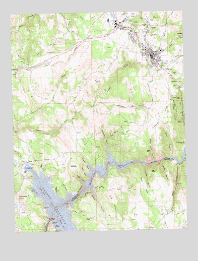
Jackson, CA USGS Topographic Map
Click on map above to begin viewing in our Map Viewer.

This topographic map contains these locations and features:
Feature Name Type Latitude Longitude GNIS ID View Map
Aetna SchoolSchoolN38.3307°W120.7538°218004View Map
Amador County CourthouseBuildingN38.3494°W120.7733°1733377View Map
Amador County JailBuildingN38.3494°W120.7733°1733379View Map
Amador County LibraryBuildingN38.3538°W120.7772°1733380View Map
Amador County MuseumBuildingN38.3507°W120.7738°1733381View Map
Amador County Sheriff's OfficeBuildingN38.3516°W120.7692°2755798View Map
Amador MineMineN38.3321°W120.7544°218213View Map
Amador Plaza Shopping CenterLocaleN38.3657°W120.7955°1733382View Map
Amador Queen MineMineN38.3246°W120.7541°218214View Map
American Legion AmbulanceBuildingN38.3748°W120.8004°2662190View Map
Argonaut High SchoolSchoolN38.3561°W120.7926°1733383View Map
Argonaut MineMineN38.3630°W120.7863°218359View Map
Bell Weather MineMineN38.3610°W120.7741°218996View Map
Bethel Assembly of God ChurchChurchN38.3560°W120.7802°1733385View Map
Big DomeSummitN38.2832°W120.7766°219180View Map
Black GulchValleyN38.2905°W120.7622°219362View Map
BonnefoyPopulated PlaceN38.3605°W120.7510°1658108View Map
Box CanyonValleyN38.2705°W120.8299°219731View Map
California Highway Patrol Valley Division - AmadorBuildingN38.3431°W120.7633°2770086View Map
Cave GulchValleyN38.2819°W120.8216°220743View Map
Channel ArmBayN38.2816°W120.8197°220909View Map
Chrome MountainSummitN38.2874°W120.8349°221095View Map
City of JacksonCivilN38.3485°W120.7724°2410128View Map
City of Sutter CreekCivilN38.3681°W120.8271°2412019View Map
Congregation B'nai Israel (historical)ChurchN38.3507°W120.7733°1733390View Map
Copper Mine GulchValleyN38.2721°W120.8458°221542View Map
Cypress PointCapeN38.2652°W120.8366°221958View Map
Detert ParkParkN38.3549°W120.7780°1733391View Map
Devils GateGapN38.3069°W120.8744°222304View Map
Dufresne GulchValleyN38.2846°W120.8197°222703View Map
First Baptist ChurchChurchN38.3655°W120.7888°1733393View Map
Fletcher GulchValleyN38.2869°W120.7819°223608View Map
French BarBarN38.2877°W120.7988°253640View Map
Gales RidgeRidgeN38.2752°W120.7822°224009View Map
Goat HillSummitN38.2952°W120.7794°224241View Map
Grapevine GulchValleyN38.2999°W120.8088°224454View Map
Gwin MineMineN38.2757°W120.7580°224751View Map
Hardenbergh MineMineN38.2994°W120.7535°224917View Map
Ione CanalCanalN38.3541°W120.8508°225961View Map
Jackass GulchValleyN38.3219°W120.8166°226056View Map
JacksonPopulated PlaceN38.3488°W120.7741°1658849View Map
Jackson City CemeteryCemeteryN38.3527°W120.7731°226079View Map
Jackson City Fire Department Station 131BuildingN38.3502°W120.7750°2623847View Map
Jackson City Fire Department Station 132BuildingN38.3629°W120.7890°2624644View Map
Jackson Creek SpillwayDamN38.2899°W120.8663°226082View Map
Jackson DivisionCivilN38.3363°W120.7815°1935148View Map
Jackson Elementary SchoolSchoolN38.3507°W120.7729°1733396View Map
Jackson GateLocaleN38.3657°W120.7744°226084View Map
Jackson Junior High SchoolSchoolN38.3530°W120.8285°1733397View Map
Jackson Police DepartmentBuildingN38.3476°W120.7730°2755742View Map
Jackson Post OfficePost OfficeN38.3526°W120.7759°1733398View Map
Jackson United Methodist ChurchChurchN38.3502°W120.7730°1733399View Map
John Bull PeakSummitN38.2571°W120.8244°226261View Map
Kennedy MineMineN38.3669°W120.7802°226502View Map
Kennedy ReservoirReservoirN38.3686°W120.7871°226508View Map
Kennedy Tailing Wheels ParkParkN38.3657°W120.7747°1733400View Map
Kirkwood RidgeRidgeN38.3130°W120.7683°226635View Map
Kreth DitchCanalN38.3060°W120.8569°226685View Map
Long GulchValleyN38.2735°W120.8097°227564View Map
Louisiana House (historical)BuildingN38.3480°W120.7738°1733401View Map
MartellPopulated PlaceN38.3669°W120.7960°228158View Map
Martell Census Designated PlaceCensusN38.3620°W120.8041°2583072View Map
Massa TunnelTunnelN38.3641°W120.7766°228206View Map
McAfee GulchValleyN38.2744°W120.8205°228270View Map
Minister GulchValleyN38.3202°W120.7524°228801View Map
Moore DitchCanalN38.3482°W120.7797°229021View Map
Moore MineMineN38.3369°W120.7602°229026View Map
Murphy GulchValleyN38.3132°W120.7519°229352View Map
North ArmBayN38.2732°W120.8535°229594View Map
North Fork Jackson CreekStreamN38.3477°W120.7752°229686View Map
Ohio HillSummitN38.3713°W120.7699°1659284View Map
Oneida CreekStreamN38.3671°W120.7752°230045View Map
Oneida MineMineN38.3732°W120.7880°230047View Map
PalomaPopulated PlaceN38.2594°W120.7633°1659338View Map
Paloma Community Open Bible ChurchChurchN38.2605°W120.7619°1804808View Map
Pardee DamDamN38.2574°W120.8502°230338View Map
Pardee ReservoirReservoirN38.2633°W120.8452°230339View Map
Pardee Reservoir Recreation AreaParkN38.2869°W120.8680°230340View Map
Pathfinder MineMineN38.3360°W120.8152°230396View Map
Peon GulchValleyN38.2735°W120.8097°230503View Map
Plaza ParkParkN38.3482°W120.7727°1733411View Map
Poorman GulchValleyN38.2902°W120.7524°230938View Map
Rabbit FlatFlatN38.3121°W120.7924°231153View Map
Red Hawk MineMineN38.2724°W120.8233°231328View Map
Rich GulchValleyN38.2877°W120.7574°231535View Map
Rock CreekStreamN38.3071°W120.8722°234578View Map
Saint Patricks Catholic ChurchChurchN38.3496°W120.7733°1733415View Map
Saint Sava Serbian Orthodox ChurchChurchN38.3560°W120.7763°1733416View Map
Santa Maria GulchValleyN38.3030°W120.8094°232553View Map
School Land GulchValleyN38.2902°W120.7738°232670View Map
ScottsvillePopulated PlaceN38.3346°W120.7558°1659616View Map
Shad Spring GulchValleyN38.2757°W120.8191°232834View Map
South ArmBayN38.2521°W120.8380°234919View Map
South Fork Jackson CreekStreamN38.3474°W120.7733°235018View Map
South Jackson MineMineN38.3413°W120.7644°235079View Map
South SpillwayDamN38.2527°W120.8473°235117View Map
Spanish GulchValleyN38.2894°W120.7677°235154View Map
Sutter Amador HospitalHospitalN38.3502°W120.7643°1733378View Map
Thatchers GulchValleyN38.2610°W120.8344°236140View Map
The GulchValleyN38.2730°W120.8380°236175View Map
Tule GulchValleyN38.2727°W120.8380°236596View Map
Tunnel HillSummitN38.3391°W120.7585°236631View Map
Valparaiso MineMineN38.3113°W120.7563°236988View Map
Waters PeakSummitN38.2699°W120.8705°237340View Map
Westover Field Amador County AirportAirportN38.3748°W120.7961°1653559View Map
Woodpile GulchValleyN38.2727°W120.8577°238145View Map
Yagers GulchValleyN38.2852°W120.8552°238222View Map

Note: Coordinates in the location and feature list above are referenced to NAD83 datum.


Copyright (C) 2008-2024 Ryan Niemi / Sunset Dynamics ... All Rights Reserved