TopoQuest Logo
Do you find TopoQuest useful?
Help keep TopoQuest running and adding new maps/features by donating!
Bitcoin:  19c7KJd3qBynnjoSw5npx9KScwjBe4ifkT
Litecoin:  LXs6TkuXGGXo1vDsWCkWVdjQX94eUKd6ui
Home View Maps Find Maps Find Places Resources & Links


Altamaha SW, Georgia Topographic Map

USGS Map Title: Altamaha SW, GA
USGS Map MRC: 31082G2
DRG (GeoTIFF) Download: o31082g2.tif


Neighboring USGS Topographic Map Quads:


  Baxley NE, GA  
31082H3
 

  Altamaha, GA  
31082H2
 

  Tison, GA  
31082H1
 

  Baxley, GA  
31082G3
 

  Altamaha SW, GA  
31082G2
 

  Altamaha SE, GA  
31082G1
 

  Alma NE, GA  
31082F3
 

  Surrency, GA  
31082F2
 

  Odum, GA  
31082F1


Map MRC Location:

N32°
W83°
N32°
W82°
H8 H7 H6 H5 H4 H3 H2 H1
G8 G7 G6 G5 G4 G3 G2 G1
F8 F7 F6 F5 F4 F3 F2 F1
E8 E7 E6 E5 E4 E3 E2 E1
D8 D7 D6 D5 D4 D3 D2 D1
C8 C7 C6 C5 C4 C3 C2 C1
B8 B7 B6 B5 B4 B3 B2 B1
A8 A7 A6 A5 A4 A3 A2 A1
N31°
W83°
N31°
W82°

Altamaha SW, GA USGS 1:24K Topographic Map Preview:
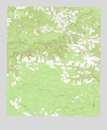
Altamaha SW, GA USGS Topographic Map
Click on map above to begin viewing in our Map Viewer.

This topographic map contains these locations and features:
Feature Name Type Latitude Longitude GNIS ID View Map
Alisons CreekStreamN31.7644°W82.1421°310440View Map
Appling County Fire Department Highway 144 StationBuildingN31.8277°W82.1567°2604242View Map
BethelPopulated PlaceN31.8233°W82.1482°331143View Map
Bethel United Methodist ChurchChurchN31.8227°W82.1493°349136View Map
Davis CemeteryCemeteryN31.7880°W82.1565°313336View Map
Eason LakeReservoirN31.8397°W82.1636°341675View Map
Eason Lake DamDamN31.8419°W82.1648°341674View Map
Easons CemeteryCemeteryN31.8463°W82.1437°355592View Map
Harmony Missionary Baptist ChurchChurchN31.8105°W82.2198°356178View Map
Joyner CemeteryCemeteryN31.8141°W82.2187°316292View Map
Little Tenmile CreekStreamN31.8388°W82.2412°317221View Map
McTierPopulated PlaceN31.8060°W82.2460°332360View Map
McTier ChurchChurchN31.8063°W82.2465°349174View Map
Oak Grove Church of GodChurchN31.8649°W82.1550°2502268View Map
Oak Grove Freewill Baptist ChurchChurchN31.8649°W82.1548°319782View Map
Rachel Baptist ChurchChurchN31.8064°W82.2463°2502703View Map
Tenmile Lookout TowerTowerN31.8621°W82.2490°344360View Map
ZionPopulated PlaceN31.8638°W82.1798°333496View Map
Zion Missionary Baptist ChurchChurchN31.8641°W82.1807°349221View Map

Note: Coordinates in the location and feature list above are referenced to NAD83 datum.


Copyright (C) 2008-2024 Ryan Niemi / Sunset Dynamics ... All Rights Reserved