TopoQuest Logo
Do you find TopoQuest useful?
Help keep TopoQuest running and adding new maps/features by donating!
Bitcoin:  19c7KJd3qBynnjoSw5npx9KScwjBe4ifkT
Litecoin:  LXs6TkuXGGXo1vDsWCkWVdjQX94eUKd6ui
Home View Maps Find Maps Find Places Resources & Links


Altamaha, Georgia Topographic Map

USGS Map Title: Altamaha, GA
USGS Map MRC: 31082H2
DRG (GeoTIFF) Download: o31082h2.tif


Neighboring USGS Topographic Map Quads:


  Johnson Corner, GA  
32082A3
 

  Reidsville West, GA  
32082A2
 

  Reidsville East, GA  
32082A1
 

  Baxley NE, GA  
31082H3
 

  Altamaha, GA  
31082H2
 

  Tison, GA  
31082H1
 

  Baxley, GA  
31082G3
 

  Altamaha SW, GA  
31082G2
 

  Altamaha SE, GA  
31082G1


Map MRC Location:

N32°
W83°
N32°
W82°
H8 H7 H6 H5 H4 H3 H2 H1
G8 G7 G6 G5 G4 G3 G2 G1
F8 F7 F6 F5 F4 F3 F2 F1
E8 E7 E6 E5 E4 E3 E2 E1
D8 D7 D6 D5 D4 D3 D2 D1
C8 C7 C6 C5 C4 C3 C2 C1
B8 B7 B6 B5 B4 B3 B2 B1
A8 A7 A6 A5 A4 A3 A2 A1
N31°
W83°
N31°
W82°

Altamaha, GA USGS 1:24K Topographic Map Preview:
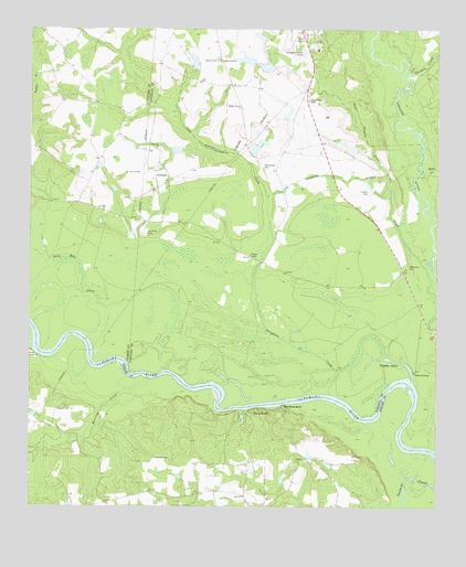
Altamaha, GA USGS Topographic Map
Click on map above to begin viewing in our Map Viewer.

This topographic map contains these locations and features:
Feature Name Type Latitude Longitude GNIS ID View Map
AltamahaPopulated PlaceN31.9616°W82.2073°331033View Map
Battle CreekStreamN31.9635°W82.1287°310864View Map
Bells Mill CreekStreamN31.9166°W82.2301°311060View Map
Big Club House PondReservoirN31.9691°W82.1801°341348View Map
Big Club House Pond DamDamN31.9669°W82.1815°341347View Map
Cedar Grove ChurchChurchN31.9916°W82.1921°312473View Map
Cotton Patch PondReservoirN31.9885°W82.1998°341340View Map
Cotton Patch Pond DamDamN31.9885°W82.1998°341339View Map
Davis LandingLocaleN31.9155°W82.2485°331523View Map
Downstream Twin PondReservoirN31.9902°W82.1774°341346View Map
Downstream Twin Pond DamDamN31.9902°W82.1748°341345View Map
Eason BluffPopulated PlaceN31.8999°W82.1818°331612View Map
Ebenezer ChurchChurchN31.9688°W82.2110°313825View Map
Harden CemeteryCemeteryN31.9569°W82.1462°315115View Map
Harris CemeteryCemeteryN31.9627°W82.2201°315179View Map
Highway 144 Fire SubstationBuildingN31.8791°W82.1874°2604840View Map
Iron Mine BluffCliffN31.9013°W82.1721°315941View Map
McArthur CemeteryCemeteryN31.9380°W82.1335°317835View Map
Moon BluffCliffN31.9569°W82.1357°347428View Map
Pearson ChapelChurchN31.9410°W82.1826°320325View Map
Roaring CreekStreamN31.9063°W82.2210°321664View Map
Slaughter CreekStreamN31.9144°W82.1410°323076View Map
Stripling CemeteryCemeteryN31.9466°W82.2140°323690View Map
Thomas CreekStreamN31.9877°W82.1340°324081View Map
Tillman CemeteryCemeteryN31.8877°W82.2110°324177View Map
Upstream Twin PondReservoirN31.9919°W82.1842°341344View Map
Upstream Twin Pond DamDamN31.9919°W82.1815°341343View Map
Wallace PondReservoirN31.9980°W82.1792°341342View Map
Wallace Pond DamDamN31.9969°W82.1782°341341View Map
Widincamp CemeteryCemeteryN31.9644°W82.1785°325250View Map
Woods CemeteryCemeteryN31.8877°W82.1660°349220View Map
Yeoman CemeteryCemeteryN31.9010°W82.2373°325626View Map

Note: Coordinates in the location and feature list above are referenced to NAD83 datum.


Copyright (C) 2008-2025 Ryan Niemi / Sunset Dynamics ... All Rights Reserved