TopoQuest Logo
Do you find TopoQuest useful?
Help keep TopoQuest running and adding new maps/features by donating!
Bitcoin:  19c7KJd3qBynnjoSw5npx9KScwjBe4ifkT
Litecoin:  LXs6TkuXGGXo1vDsWCkWVdjQX94eUKd6ui
Home View Maps Find Maps Find Places Resources & Links


Carsonville, Michigan Topographic Map

USGS Map Title: Carsonville, MI
USGS Map MRC: 43082D6
DRG (GeoTIFF) Download: o43082d6.tif


Neighboring USGS Topographic Map Quads:


  Palms, MI  
43082E7
 

  Deckerville, MI  
43082E6
 

  Richmondville, MI  
43082E5
 

  Sandusky, MI  
43082D7
 

  Carsonville, MI  
43082D6
 

  Port Sanilac, MI  
43082D5
 

  Peck, MI  
43082C7
 

  Applegate, MI  
43082C6
 

  Croswell, MI  
43082C5


Map MRC Location:

N44°
W83°
N44°
W82°
H8 H7 H6 H5 H4 H3 H2 H1
G8 G7 G6 G5 G4 G3 G2 G1
F8 F7 F6 F5 F4 F3 F2 F1
E8 E7 E6 E5 E4 E3 E2 E1
D8 D7 D6 D5 D4 D3 D2 D1
C8 C7 C6 C5 C4 C3 C2 C1
B8 B7 B6 B5 B4 B3 B2 B1
A8 A7 A6 A5 A4 A3 A2 A1
N43°
W83°
N43°
W82°

Carsonville, MI USGS 1:24K Topographic Map Preview:
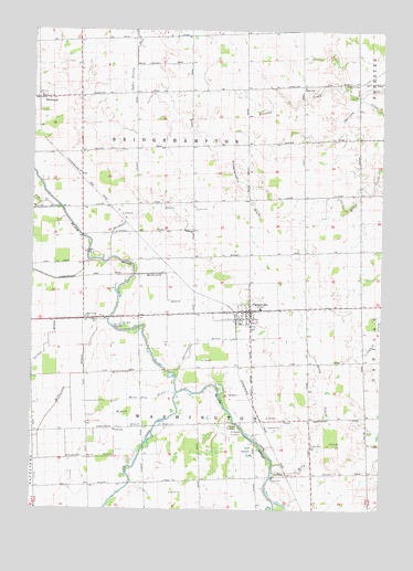
Carsonville, MI USGS Topographic Map
Click on map above to begin viewing in our Map Viewer.

This topographic map contains these locations and features:
Feature Name Type Latitude Longitude GNIS ID View Map
Alexander DrainCanalN43.3886°W82.7280°619933View Map
Baker SchoolSchoolN43.4853°W82.6530°620488View Map
Black River SchoolSchoolN43.4250°W82.7308°621531View Map
Bridge Hampton Township HallBuildingN43.4364°W82.7314°2554437View Map
Bridgehampton DrainCanalN43.4595°W82.6730°621966View Map
Bridgehampton Post Office (historical)Post OfficeN43.4681°W82.7403°2554387View Map
Butler SchoolSchoolN43.3956°W82.7199°622371View Map
CarsonvillePopulated PlaceN43.4270°W82.6713°622798View Map
Carsonville Assembly of God ChurchChurchN43.4250°W82.6719°2554436View Map
Carsonville DrainCanalN43.4184°W82.6883°622799View Map
Carsonville Fire DepartmentBuildingN43.4267°W82.6677°2554435View Map
Carsonville Police DepartmentBuildingN43.4272°W82.6667°2554433View Map
Carsonville Post OfficePost OfficeN43.4297°W82.6719°2554432View Map
Carsonville StationLocaleN43.4244°W82.6764°2554430View Map
Carsonville-Port Sanilac Elementary SchoolSchoolN43.4275°W82.6681°2554427View Map
Carsonville-Port Sanilac High SchoolSchoolN43.4286°W82.6319°2554428View Map
Elk CreekStreamN43.4056°W82.6972°1624509View Map
Gordon DrainCanalN43.4189°W82.7435°626991View Map
Hi-Way Drive-In TheaterLocaleN43.4242°W82.7203°2554007View Map
Kelly CreekStreamN43.3839°W82.6635°629541View Map
Kelly DrainCanalN43.4061°W82.6469°629543View Map
Lee CemeteryCemeteryN43.3920°W82.6491°630250View Map
McDonald DrainCanalN43.4328°W82.7016°631873View Map
McGregorPopulated PlaceN43.4825°W82.7474°631908View Map
McGregor Post Office (historical)Post OfficeN43.4819°W82.7478°2554250View Map
McGregor StationLocaleN43.4819°W82.7483°2554178View Map
McPherson DrainCanalN43.4064°W82.7355°632019View Map
Meyers DrainCanalN43.3984°W82.7149°632181View Map
Mount Zion CemeteryCemeteryN43.4861°W82.6385°632816View Map
Ogden Norton DrainCanalN43.4989°W82.7133°633951View Map
Pack's Mills Post Office (historical)Post OfficeN43.3889°W82.6611°2554207View Map
Pack's Mills StationLocaleN43.3889°W82.6614°2554206View Map
Recor DrainCanalN43.4039°W82.7077°635700View Map
Saint Marys CemeteryCemeteryN43.3950°W82.6763°636889View Map
Sanilac CountyCivilN43.4433°W82.6458°1623016View Map
Shrapnell DrainCanalN43.4531°W82.7116°637853View Map
Township of BridgehamptonCivilN43.4698°W82.6930°1625976View Map
Township of WashingtonCivilN43.3825°W82.6886°1627217View Map
Tucker CemeteryCemeteryN43.4678°W82.7319°2554452View Map
United Methodist ChurchChurchN43.4250°W82.6728°2554429View Map
Village of CarsonvilleCivilN43.4258°W82.6730°2397565View Map
Washington Township CemeteryCemeteryN43.3950°W82.6778°2554475View Map

Note: Coordinates in the location and feature list above are referenced to NAD83 datum.


Copyright (C) 2008-2024 Ryan Niemi / Sunset Dynamics ... All Rights Reserved