TopoQuest Logo
Do you find TopoQuest useful?
Help keep TopoQuest running and adding new maps/features by donating!
Bitcoin:  19c7KJd3qBynnjoSw5npx9KScwjBe4ifkT
Litecoin:  LXs6TkuXGGXo1vDsWCkWVdjQX94eUKd6ui
Home View Maps Find Maps Find Places Resources & Links


Cascade, Montana Topographic Map

USGS Map Title: Cascade, MT
USGS Map MRC: 47111C6
DRG (GeoTIFF) Download: o47111c6.tif


Neighboring USGS Topographic Map Quads:


  Cascade Colony, MT  
47111D7
 

  Fair Haven Colony, MT  
47111D6
 

  Ulm, MT  
47111D5
 

  Mount Cecelia, MT  
47111C7
 

  Cascade, MT  
47111C6
 

  Nelson Island, MT  
47111C5
 

  Hardy, MT  
47111B7
 

  Rocky Reef, MT  
47111B6
 

  Schrammeck Lake, MT  
47111B5


Map MRC Location:

N48°
W112°
N48°
W111°
H8 H7 H6 H5 H4 H3 H2 H1
G8 G7 G6 G5 G4 G3 G2 G1
F8 F7 F6 F5 F4 F3 F2 F1
E8 E7 E6 E5 E4 E3 E2 E1
D8 D7 D6 D5 D4 D3 D2 D1
C8 C7 C6 C5 C4 C3 C2 C1
B8 B7 B6 B5 B4 B3 B2 B1
A8 A7 A6 A5 A4 A3 A2 A1
N47°
W112°
N47°
W111°

Cascade, MT USGS 1:24K Topographic Map Preview:
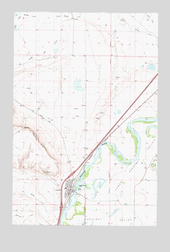
Cascade, MT USGS Topographic Map
Click on map above to begin viewing in our Map Viewer.

This topographic map contains these locations and features:
Feature Name Type Latitude Longitude GNIS ID View Map
17N01E05C___01 WellWellN47.2519°W111.6397°821700View Map
17N01E06A___01 WellWellN47.2591°W111.6503°821750View Map
18N01E05B___01 WellWellN47.3463°W111.6397°822367View Map
18N01E19B___01 WellWellN47.3030°W111.6608°822082View Map
18N01E19B___02 WellWellN47.3030°W111.6608°822083View Map
18N01E20D___01 WellWellN47.2958°W111.6291°822030View Map
18N01E29D___01 WellWellN47.2813°W111.6291°821922View Map
18N01E29D___02 WellWellN47.2813°W111.6291°821923View Map
18N01E29D___03 WellWellN47.2813°W111.6291°821924View Map
18N01E30B___01 WellWellN47.2886°W111.6608°821979View Map
18N01W01C___01 WellWellN47.3388°W111.6822°822300View Map
18N01W11B___01 WellWellN47.3316°W111.7036°822268View Map
18N01W11B___02 WellWellN47.3316°W111.7036°822269View Map
18N01W12B___01 SpringSpringN47.3316°W111.6822°822267View Map
18N01W13____01 WellWellN47.3133°W111.6769°822139View Map
18N01W13____02 WellWellN47.3133°W111.6769°822140View Map
18N01W13B___01 SpringSpringN47.3169°W111.6822°822162View Map
18N01W13C___01 WellWellN47.3097°W111.6822°822110View Map
18N01W13C___02 WellWellN47.3097°W111.6822°822111View Map
18N01W15B___01 WellWellN47.3169°W111.7250°822163View Map
18N01W16D___01 SpringSpringN47.3071°W111.7413°822112View Map
18N01W21B___01 WellWellN47.3024°W111.7464°822073View Map
18N01W23D___01 WellWellN47.2952°W111.6928°822013View Map
18N01W24C___01 WellWellN47.2952°W111.6822°822012View Map
18N01W26____01 WellWellN47.2841°W111.6983°821936View Map
18N01W26B___01 WellWellN47.2877°W111.7036°821970View Map
18N01W27A___01 SpringSpringN47.2877°W111.7141°821971View Map
18N01W27C___01 SpringSpringN47.2805°W111.7250°821904View Map
18N01W27C___02 SpringSpringN47.2805°W111.7250°821905View Map
18N01W27C___03 SpringSpringN47.2805°W111.7250°821906View Map
18N01W27C___04 SpringSpringN47.2805°W111.7250°821907View Map
18N01W27C___05 SpringSpringN47.2805°W111.7250°821908View Map
18N01W35____01 WellWellN47.2694°W111.6983°821836View Map
18N01W35____02 WellWellN47.2694°W111.6983°821837View Map
18N01W35A___01 WellWellN47.2733°W111.6928°821864View Map
18N01W35B___01 WellWellN47.2733°W111.7036°821865View Map
18N01W35C___01 WellWellN47.2658°W111.7036°821807View Map
18N01W35D___01 WellWellN47.2658°W111.6928°821805View Map
18N01W35D___02 WellWellN47.2658°W111.6928°821806View Map
CascadePopulated PlaceN47.2711°W111.7005°769638View Map
CascadeLocaleN47.2705°W111.6986°1762398View Map
Cascade Airport (historical)AirportN47.2705°W111.7222°806380View Map
Cascade FieldAirportN47.2664°W111.7202°2770385View Map
Cascade Hospital (historical)HospitalN47.2711°W111.7005°1761830View Map
Cascade Post OfficePost OfficeN47.2675°W111.7030°1762442View Map
Cascade ReservoirReservoirN47.2763°W111.7131°769642View Map
Cascade SchoolSchoolN47.2722°W111.7053°1761860View Map
Cascade Stock Yards (historical)LocaleN47.3000°W111.6703°1762397View Map
Cascade Trailer ParkLocaleN47.2711°W111.7005°1761754View Map
Cascade Volunteer Fire DepartmentBuildingN47.2715°W111.7009°2546601View Map
Church of Christ (historical)ChurchN47.2711°W111.7005°1761822View Map
Community United Methodist Church of CascadeChurchN47.2755°W111.7016°1761820View Map
Dodge (historical)LocaleN47.2916°W111.6841°1762399View Map
Dry ForkStreamN47.3602°W111.6261°770809View Map
Elizabeth ReservoirReservoirN47.3733°W111.7005°771180View Map
Farmer Rancher Fire Volunteer Fire DepartmentBuildingN47.2712°W111.7012°2546726View Map
Hillside CemeteryCemeteryN47.2871°W111.7022°1761831View Map
Interchange 254CrossingN47.2605°W111.7083°1761776View Map
Interchange 256CrossingN47.2799°W111.6994°1761777View Map
Knapp CreekStreamN47.2580°W111.7064°773103View Map
Lower Chestnut ValleyFlatN47.2866°W111.6375°805908View Map
Missouri River BridgeBridgeN47.2694°W111.6964°1761764View Map
Rocky Gap CreekStreamN47.3716°W111.7035°775887View Map
Rocky ReefRidgeN47.3691°W111.7483°775900View Map
Sacred Heart Catholic ChurchChurchN47.2711°W111.7005°1761821View Map
Saint Clair (historical)Populated PlaceN47.2808°W111.6814°1762374View Map
Saint Clair Methodist Church (historical)ChurchN47.2808°W111.6814°1762373View Map
Saint Clair Post Office (historical)Post OfficeN47.2808°W111.6814°1762375View Map
Saint Clair School (historical)SchoolN47.2624°W111.6939°1761876View Map
The Church of Jesus Christ of Latter Day SaintsChurchN47.2769°W111.7036°1761819View Map
Town of CascadeCivilN47.2712°W111.7029°2413176View Map
Webb Number 1 DamDamN47.3733°W111.7008°795962View Map
Wedsworth Memorial LibraryBuildingN47.2708°W111.6994°1761736View Map
Yucca Golf ClubLocaleN47.2636°W111.7030°1761756View Map

Note: Coordinates in the location and feature list above are referenced to NAD83 datum.


Copyright (C) 2008-2025 Ryan Niemi / Sunset Dynamics ... All Rights Reserved