TopoQuest Logo
Do you find TopoQuest useful?
Help keep TopoQuest running and adding new maps/features by donating!
Bitcoin:  19c7KJd3qBynnjoSw5npx9KScwjBe4ifkT
Litecoin:  LXs6TkuXGGXo1vDsWCkWVdjQX94eUKd6ui
Home View Maps Find Maps Find Places Resources & Links


Catheys Valley, California Topographic Map

USGS Map Title: Catheys Valley, CA
USGS Map MRC: 37120D1
DRG (GeoTIFF) Download: o37120d1.tif


Neighboring USGS Topographic Map Quads:


  Hornitos, CA  
37120E2
 

  Bear Valley, CA  
37120E1
 

  Feliciana Mountain, CA  
37119E8
 

  Indian Gulch, CA  
37120D2
 

  Catheys Valley, CA  
37120D1
 

  Mariposa, CA  
37119D8
 

  Owens Reservoir, CA  
37120C2
 

  Illinois Hill, CA  
37120C1
 

  Ben Hur, CA  
37119C8


Map MRC Location:

N38°
W121°
N38°
W120°
H8 H7 H6 H5 H4 H3 H2 H1
G8 G7 G6 G5 G4 G3 G2 G1
F8 F7 F6 F5 F4 F3 F2 F1
E8 E7 E6 E5 E4 E3 E2 E1
D8 D7 D6 D5 D4 D3 D2 D1
C8 C7 C6 C5 C4 C3 C2 C1
B8 B7 B6 B5 B4 B3 B2 B1
A8 A7 A6 A5 A4 A3 A2 A1
N37°
W121°
N37°
W120°

Catheys Valley, CA USGS 1:24K Topographic Map Preview:
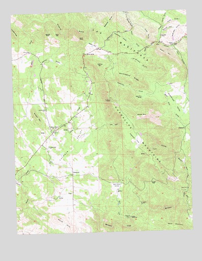
Catheys Valley, CA USGS Topographic Map
Click on map above to begin viewing in our Map Viewer.

This topographic map contains these locations and features:
Feature Name Type Latitude Longitude GNIS ID View Map
Agua FriaPopulated PlaceN37.4849°W120.0202°1655792View Map
Apple Tree SpringSpringN37.4510°W120.0344°218320View Map
Bald HillSummitN37.4872°W120.0955°1655805View Map
Barrel SpringSpringN37.4760°W120.0731°218693View Map
Bellyache CanyonValleyN37.4905°W120.0605°254599View Map
BridgeportPopulated PlaceN37.4333°W120.0043°1655844View Map
Buck PointSummitN37.4852°W120.0788°220006View Map
Bull RunStreamN37.3805°W120.0543°220119View Map
Bull Run ValleyFlatN37.3999°W120.0543°220123View Map
CarsonLocaleN37.4808°W120.0118°220642View Map
Carson CreekStreamN37.4813°W120.0213°254716View Map
Carson FlatFlatN37.4816°W120.0113°220649View Map
Cathey's Valley Elementary SchoolSchoolN37.4241°W120.1012°220732View Map
Catheys MountainSummitN37.4691°W120.0660°254726View Map
Catheys ValleyPopulated PlaceN37.4324°W120.0980°254727View Map
Catheys ValleyValleyN37.4149°W120.1018°254728View Map
Catheys Valley CemeteryCemeteryN37.4450°W120.1031°220731View Map
Catheys Valley Census Designated PlaceCensusN37.4371°W120.0936°2582968View Map
Catheys Valley ParkParkN37.4377°W120.0860°1809306View Map
Catheys Valley Post OfficePost OfficeN37.4326°W120.0981°2769336View Map
Cavallada CreekStreamN37.4813°W120.0393°254729View Map
China GulchValleyN37.4030°W120.0041°221035View Map
Francis MineMineN37.3908°W120.0371°223799View Map
Garnet PointSummitN37.4874°W120.1024°224078View Map
Guadalupe CreekStreamN37.4541°W120.0213°224693View Map
Guadalupe LookoutLocaleN37.4494°W120.0577°224695View Map
Guadalupe MountainsSummitN37.4349°W120.0482°1656053View Map
Guadalupe ValleyBasinN37.4466°W120.0116°224699View Map
Hoffs GulchValleyN37.4908°W120.0182°225388View Map
Horse GulchValleyN37.4844°W120.0218°234033View Map
La Mineta GulchValleyN37.4680°W120.0232°254862View Map
Mariposa County Fire Department Company 23 Catheys ValleyBuildingN37.4385°W120.0856°2623716View Map
McBrides GulchValleyN37.4797°W120.0121°253231View Map
Mockingbird RidgeRidgeN37.4633°W120.0527°228888View Map
Moore Hill MineMineN37.3824°W120.0471°229025View Map
Negro HillSummitN37.4758°W120.0188°254967View Map
Payne FlatFlatN37.4810°W120.0677°253744View Map
Raster GulchValleyN37.4666°W120.1132°231244View Map
Rattlesnake RidgeRidgeN37.4652°W120.0302°1958581View Map
Round HillsSummitN37.3833°W120.0980°231956View Map
Sand CreekStreamN37.4791°W120.0307°253823View Map
Savages Trading PostLocaleN37.3830°W120.0452°232608View Map
Sheep GapGapN37.4030°W120.0299°232898View Map
Smoky MountainSummitN37.4411°W120.0318°234736View Map
Specimen GulchValleyN37.4880°W120.0202°235178View Map
StonehouseLocaleN37.4080°W120.0857°235534View Map
Tailings GulchValleyN37.4888°W120.0407°253959View Map
Texas GulchValleyN37.4791°W120.0302°255129View Map
Trabucco FlatFlatN37.4272°W120.0385°236495View Map
Victoria GulchValleyN37.4952°W120.1030°237070View Map
Ward MountainSummitN37.3766°W120.0085°237230View Map
Wildcat MountainSummitN37.4383°W120.1080°237800View Map
Yaqui CreekStreamN37.4386°W120.0080°1958586View Map
Yaqui GulchValleyN37.4386°W120.0080°238233View Map

Note: Coordinates in the location and feature list above are referenced to NAD83 datum.


Copyright (C) 2008-2024 Ryan Niemi / Sunset Dynamics ... All Rights Reserved