TopoQuest Logo
Do you find TopoQuest useful?
Help keep TopoQuest running and adding new maps/features by donating!
Bitcoin:  19c7KJd3qBynnjoSw5npx9KScwjBe4ifkT
Litecoin:  LXs6TkuXGGXo1vDsWCkWVdjQX94eUKd6ui
Home View Maps Find Maps Find Places Resources & Links


Feliciana Mountain, California Topographic Map

USGS Map Title: Feliciana Mountain, CA
USGS Map MRC: 37119E8
DRG (GeoTIFF) Download: o37119e8.tif


Neighboring USGS Topographic Map Quads:


  Buckhorn Peak, CA  
37120F1
 

  Kinsley, CA  
37119F8
 

  El Portal, CA  
37119F7
 

  Bear Valley, CA  
37120E1
 

  Feliciana Mountain, CA  
37119E8
 

  Buckingham Mountain, CA  
37119E7
 

  Catheys Valley, CA  
37120D1
 

  Mariposa, CA  
37119D8
 

  Stumpfield Mountain, CA  
37119D7


Map MRC Location:

N38°
W120°
N38°
W119°
H8 H7 H6 H5 H4 H3 H2 H1
G8 G7 G6 G5 G4 G3 G2 G1
F8 F7 F6 F5 F4 F3 F2 F1
E8 E7 E6 E5 E4 E3 E2 E1
D8 D7 D6 D5 D4 D3 D2 D1
C8 C7 C6 C5 C4 C3 C2 C1
B8 B7 B6 B5 B4 B3 B2 B1
A8 A7 A6 A5 A4 A3 A2 A1
N37°
W120°
N37°
W119°

Feliciana Mountain, CA USGS 1:24K Topographic Map Preview:
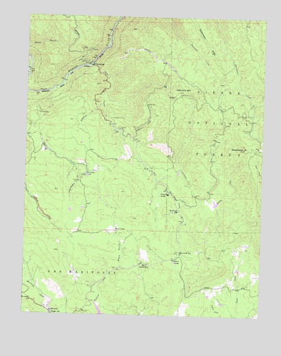
Feliciana Mountain, CA USGS Topographic Map
Click on map above to begin viewing in our Map Viewer.

This topographic map contains these locations and features:
Feature Name Type Latitude Longitude GNIS ID View Map
Acorn LodgeLocaleN37.5235°W119.9216°266361View Map
Bear CreekStreamN37.6052°W119.9671°266422View Map
Bear Creek SchoolSchoolN37.5258°W119.9185°266427View Map
BriceburgPopulated PlaceN37.6049°W119.9668°1656298View Map
Buffalo MineMineN37.5877°W119.9385°266506View Map
California Dept Forestry and Fire Protection Madera - Mariposa - Merced Unit Mariposa Fire StationBuildingN37.5009°W119.9866°2623992View Map
Colorado MineMineN37.5558°W119.9724°266589View Map
Colorado SchoolSchoolN37.5591°W119.9691°266590View Map
Feliciana MineMineN37.5913°W119.9268°266702View Map
Feliciana MountainSummitN37.5941°W119.9199°266703View Map
John C Fremont HospitalHospitalN37.5002°W119.9774°1809313View Map
King Solomon MineMineN37.5824°W119.9568°266883View Map
Long Canyon CreekStreamN37.5627°W119.9757°266939View Map
Mariposa CountyCivilN37.5815°W119.9055°277286View Map
Mariposa County Fire Department Company 21 MidpinesBuildingN37.5459°W119.9200°2623822View Map
Mariposa Ranger StationLocaleN37.5010°W119.9863°266978View Map
MidpinesPopulated PlaceN37.5444°W119.9205°1656313View Map
Midpines Census Designated PlaceCensusN37.5531°W119.9484°2583080View Map
Midpines ParkParkN37.5258°W119.9185°1809327View Map
Midpines Post OfficePost OfficeN37.5609°W119.9362°2789143View Map
Mono CampLocaleN37.5355°W119.9532°267023View Map
Mono GulchValleyN37.5194°W119.9502°267026View Map
Plumbar CreekStreamN37.5391°W119.9157°267136View Map
Rancheria CreekStreamN37.5880°W119.9621°267155View Map
Saxon CreekStreamN37.5935°W119.9888°267215View Map
Schroeder MineMineN37.5849°W119.9932°267218View Map
Sierra Faith CenterChurchN37.5233°W119.9221°1809334View Map
Summit InnLocaleN37.5213°W119.9377°267922View Map
Sweetwater MineMineN37.5777°W119.8832°268028View Map
Sweetwater PointSummitN37.5699°W119.8854°268029View Map
Sweetwater RidgeRidgeN37.5969°W119.8977°268030View Map
Timber LodgeLocaleN37.5508°W119.9257°268287View Map
Trabucco CreekStreamN37.5749°W119.9468°268368View Map

Note: Coordinates in the location and feature list above are referenced to NAD83 datum.


Copyright (C) 2008-2025 Ryan Niemi / Sunset Dynamics ... All Rights Reserved