TopoQuest Logo
Do you find TopoQuest useful?
Help keep TopoQuest running and adding new maps/features by donating!
Bitcoin:  19c7KJd3qBynnjoSw5npx9KScwjBe4ifkT
Litecoin:  LXs6TkuXGGXo1vDsWCkWVdjQX94eUKd6ui
Home View Maps Find Maps Find Places Resources & Links


Mariposa, California Topographic Map

USGS Map Title: Mariposa, CA
USGS Map MRC: 37119D8
DRG (GeoTIFF) Download: o37119d8.tif


Neighboring USGS Topographic Map Quads:


  Bear Valley, CA  
37120E1
 

  Feliciana Mountain, CA  
37119E8
 

  Buckingham Mountain, CA  
37119E7
 

  Catheys Valley, CA  
37120D1
 

  Mariposa, CA  
37119D8
 

  Stumpfield Mountain, CA  
37119D7
 

  Illinois Hill, CA  
37120C1
 

  Ben Hur, CA  
37119C8
 

  Horsecamp Mountain, CA  
37119C7


Map MRC Location:

N38°
W120°
N38°
W119°
H8 H7 H6 H5 H4 H3 H2 H1
G8 G7 G6 G5 G4 G3 G2 G1
F8 F7 F6 F5 F4 F3 F2 F1
E8 E7 E6 E5 E4 E3 E2 E1
D8 D7 D6 D5 D4 D3 D2 D1
C8 C7 C6 C5 C4 C3 C2 C1
B8 B7 B6 B5 B4 B3 B2 B1
A8 A7 A6 A5 A4 A3 A2 A1
N37°
W120°
N37°
W119°

Mariposa, CA USGS 1:24K Topographic Map Preview:
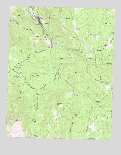
Mariposa, CA USGS Topographic Map
Click on map above to begin viewing in our Map Viewer.

This topographic map contains these locations and features:
Feature Name Type Latitude Longitude GNIS ID View Map
Agua Fria CreekStreamN37.4130°W119.9843°233401View Map
Australia GulchValleyN37.4508°W119.9466°1958572View Map
Big SpringSpringN37.4602°W119.9206°219260View Map
BootjackPopulated PlaceN37.4649°W119.8866°277477View Map
Bootjack Census Designated PlaceCensusN37.4672°W119.8887°2407885View Map
Buckeye CreekStreamN37.4227°W119.9882°220024View Map
California Highway Patrol Central Division - MariposaBuildingN37.4962°W119.9798°2770078View Map
California State Mining and Mineral MuseumBuildingN37.4641°W119.9474°1809305View Map
Church of ChristChurchN37.4955°W119.9802°1809307View Map
Crows NestSummitN37.4710°W119.9593°1958579View Map
East Fork Buckeye CreekStreamN37.4463°W119.9830°1958584View Map
First Baptist ChurchChurchN37.4902°W119.9693°1809309View Map
Granite King MineMineN37.4322°W119.9902°224409View Map
Humbug CreekStreamN37.4263°W119.8771°225751View Map
Indian MountainSummitN37.4899°W119.9332°1658817View Map
John Allen FlatFlatN37.4105°W119.8952°226259View Map
Lookout MountainSummitN37.4074°W119.9421°227637View Map
MariposaPopulated PlaceN37.4849°W119.9663°1659063View Map
Mariposa Assembly of God ChurchChurchN37.4958°W119.9805°1809314View Map
Mariposa Census Designated PlaceCensusN37.4873°W119.9683°2408181View Map
Mariposa County CourthouseBuildingN37.4891°W119.9674°1809315View Map
Mariposa County FairgroundsParkN37.4652°W119.9466°1809337View Map
Mariposa County Fire Department Company 22 Mariposa Public Utility District Fire Station 1BuildingN37.4959°W119.9806°2623786View Map
Mariposa County Fire Department Company 27 Morman BarBuildingN37.4608°W119.9458°2624172View Map
Mariposa County Fire Department Company 37 BootjackBuildingN37.4636°W119.8830°2623741View Map
Mariposa County High SchoolSchoolN37.4894°W119.9638°1809316View Map
Mariposa County Law LibraryBuildingN37.4891°W119.9674°1809317View Map
Mariposa County Sheriff's OfficeBuildingN37.4902°W119.9664°2755762View Map
Mariposa DivisionCivilN37.4733°W119.9940°1935193View Map
Mariposa Elementary SchoolSchoolN37.4871°W119.9641°1809318View Map
Mariposa Foursquare ChurchChurchN37.4888°W119.9707°1809319View Map
Mariposa Junior High SchoolSchoolN37.4783°W119.8982°1809320View Map
Mariposa MineMineN37.4838°W119.9599°228110View Map
Mariposa Museum and History CenterBuildingN37.4891°W119.9710°1809321View Map
Mariposa ParkParkN37.4827°W119.9652°1809322View Map
Mariposa Post OfficePost OfficeN37.4886°W119.9706°1809323View Map
Mariposa Public Utility District Fire Department Station 2 HeadquartersBuildingN37.4861°W119.9658°2623666View Map
Mariposa Town Historic DistrictParkN37.4885°W119.9671°1809324View Map
Mariposa United Methodist ChurchChurchN37.4852°W119.9646°1809325View Map
McBrights GulchValleyN37.4719°W119.9488°1958585View Map
Mercy Medical TransportBuildingN37.4826°W119.9641°2662236View Map
Moore HillSummitN37.3908°W119.9874°229023View Map
Mormon BarPopulated PlaceN37.4622°W119.9479°1659179View Map
Owl CreekStreamN37.4658°W119.8752°230174View Map
Pegleg CreekStreamN37.4508°W119.8896°267116View Map
Saint Joseph CemeteryCemeteryN37.4827°W119.9613°1809331View Map
Saint Josephs Catholic ChurchChurchN37.4824°W119.9618°1809332View Map
Sebastopol SchoolSchoolN37.4608°W119.8963°232771View Map
Seventh Day Adventist ChurchChurchN37.4897°W119.9691°1809333View Map
Spring CreekStreamN37.4505°W119.9482°235235View Map
Spring Hill High SchoolSchoolN37.4633°W119.9471°1809335View Map
Stockton CreekStreamN37.4685°W119.9513°267758View Map
Stockton Creek 672 DamDamN37.4983°W119.9593°1664008View Map
Stockton RidgeRidgeN37.4802°W119.9563°1958582View Map
Streeter MountainSummitN37.4472°W119.8799°267809View Map
Striped RockSummitN37.3977°W119.9193°235599View Map
Yosemite Fire and RescueBuildingN37.4292°W119.8907°2624575View Map

Note: Coordinates in the location and feature list above are referenced to NAD83 datum.


Copyright (C) 2008-2025 Ryan Niemi / Sunset Dynamics ... All Rights Reserved