TopoQuest Logo
Do you find TopoQuest useful?
Help keep TopoQuest running and adding new maps/features by donating!
Bitcoin:  19c7KJd3qBynnjoSw5npx9KScwjBe4ifkT
Litecoin:  LXs6TkuXGGXo1vDsWCkWVdjQX94eUKd6ui
Home View Maps Find Maps Find Places Resources & Links


Cayuse, Oregon Topographic Map

USGS Map Title: Cayuse, OR
USGS Map MRC: 45118F5
DRG (GeoTIFF) Download: o45118f5.tif


Neighboring USGS Topographic Map Quads:


  Helix, OR  
45118G6
 

  Adams, OR  
45118G5
 

  Athena, OR  
45118G4
 

  Mission, OR  
45118F6
 

  Cayuse, OR  
45118F5
 

  Thorn Hollow, OR  
45118F4
 

  Table Rock, OR  
45118E6
 

  Cabbage Hill, OR  
45118E5
 

  Meacham, OR  
45118E4


Map MRC Location:

N46°
W119°
N46°
W118°
H8 H7 H6 H5 H4 H3 H2 H1
G8 G7 G6 G5 G4 G3 G2 G1
F8 F7 F6 F5 F4 F3 F2 F1
E8 E7 E6 E5 E4 E3 E2 E1
D8 D7 D6 D5 D4 D3 D2 D1
C8 C7 C6 C5 C4 C3 C2 C1
B8 B7 B6 B5 B4 B3 B2 B1
A8 A7 A6 A5 A4 A3 A2 A1
N45°
W119°
N45°
W118°

Cayuse, OR USGS 1:24K Topographic Map Preview:
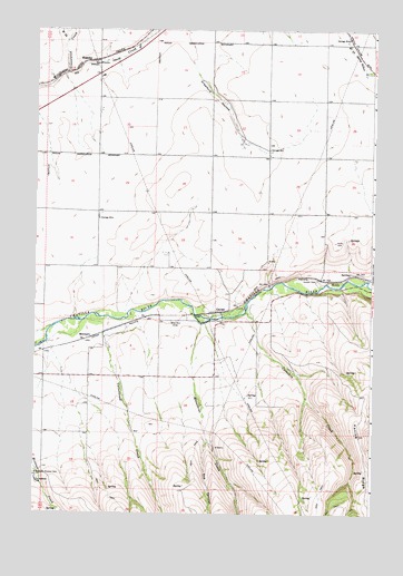
Cayuse, OR USGS Topographic Map
Click on map above to begin viewing in our Map Viewer.

This topographic map contains these locations and features:
Feature Name Type Latitude Longitude GNIS ID View Map
Blakeley (historical)LocaleN45.7415°W118.6041°1136079View Map
CayusePopulated PlaceN45.6768°W118.5566°1136129View Map
Cayuse Census Designated PlaceCensusN45.6765°W118.5735°2407996View Map
Cayuse Post Office (historical)Post OfficeN45.6765°W118.5565°1165025View Map
Coonskin CreekStreamN45.6771°W118.5472°1119245View Map
Cottonwood CreekStreamN45.6751°W118.6061°1119334View Map
Crawford HollowValleyN45.7479°W118.5722°1119521View Map
Doe CanyonValleyN45.6443°W118.5608°1119996View Map
Eastland (historical)LocaleN45.7376°W118.6166°1167764View Map
Greasewood CreekStreamN45.7387°W118.6141°1121363View Map
Homeli CemeteryCemeteryN45.6854°W118.5202°1121942View Map
HomlyLocaleN45.6854°W118.5144°1136387View Map
Kanine RidgeRidgeN45.6454°W118.5050°1122633View Map
MinthornLocaleN45.6704°W118.6039°1136546View Map
Moonshine CreekStreamN45.6740°W118.5636°1124328View Map
Quail FieldAirportN45.6542°W118.5896°2650875View Map
Saint Andrews School (historical)SchoolN45.6331°W118.6236°1126452View Map
Sumpkin (historical)LocaleN45.6696°W118.6094°1167827View Map
Umatilla ReservationCivilN45.6274°W118.5442°1159100View Map
Umatilla Reservation DivisionCivilN45.6465°W118.5459°1938105View Map
West Fork Greasewood CreekStreamN45.7468°W118.6139°1128851View Map

Note: Coordinates in the location and feature list above are referenced to NAD83 datum.


Copyright (C) 2008-2024 Ryan Niemi / Sunset Dynamics ... All Rights Reserved