TopoQuest Logo
Do you find TopoQuest useful?
Help keep TopoQuest running and adding new maps/features by donating!
Bitcoin:  19c7KJd3qBynnjoSw5npx9KScwjBe4ifkT
Litecoin:  LXs6TkuXGGXo1vDsWCkWVdjQX94eUKd6ui
Home View Maps Find Maps Find Places Resources & Links


Adams, Oregon Topographic Map

USGS Map Title: Adams, OR
USGS Map MRC: 45118G5
DRG (GeoTIFF) Download: o45118g5.tif


Neighboring USGS Topographic Map Quads:


  Smeltz, OR  
45118H6
 

  Waterman, OR  
45118H5
 

  Milton-Freewater, OR  
45118H4
 

  Helix, OR  
45118G6
 

  Adams, OR  
45118G5
 

  Athena, OR  
45118G4
 

  Mission, OR  
45118F6
 

  Cayuse, OR  
45118F5
 

  Thorn Hollow, OR  
45118F4


Map MRC Location:

N46°
W119°
N46°
W118°
H8 H7 H6 H5 H4 H3 H2 H1
G8 G7 G6 G5 G4 G3 G2 G1
F8 F7 F6 F5 F4 F3 F2 F1
E8 E7 E6 E5 E4 E3 E2 E1
D8 D7 D6 D5 D4 D3 D2 D1
C8 C7 C6 C5 C4 C3 C2 C1
B8 B7 B6 B5 B4 B3 B2 B1
A8 A7 A6 A5 A4 A3 A2 A1
N45°
W119°
N45°
W118°

Adams, OR USGS 1:24K Topographic Map Preview:
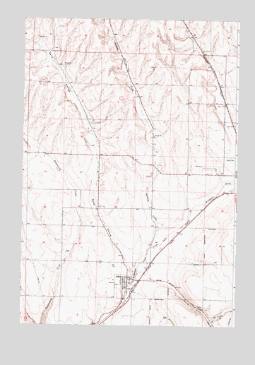
Adams, OR USGS Topographic Map
Click on map above to begin viewing in our Map Viewer.

This topographic map contains these locations and features:
Feature Name Type Latitude Longitude GNIS ID View Map
Adam Public Works DepartmentBuildingN45.7675°W118.5696°2700304View Map
AdamsPopulated PlaceN45.7674°W118.5625°1116762View Map
Adams City HallBuildingN45.7675°W118.5633°2700305View Map
Adams City ParkParkN45.7671°W118.5619°2091170View Map
Adams Post OfficePost OfficeN45.7676°W118.5575°1164805View Map
Adams Public LibraryBuildingN45.7675°W118.5633°2700306View Map
Athena CemeteryCemeteryN45.8187°W118.5041°1117079View Map
City of AdamsCivilN45.7664°W118.5641°2409662View Map
Davis AirstripAirportN45.7743°W118.5594°1131739View Map
East Umatilla County Rural Fire Protection District Station 2BuildingN45.7688°W118.5577°2576992View Map
Gerking CreekStreamN45.7818°W118.5486°1121108View Map
Gerking FlatFlatN45.8557°W118.5644°1121109View Map
Sand HollowValleyN45.7687°W118.5589°1126564View Map
Spring Hollow CreekStreamN45.7710°W118.5569°1127449View Map
Waterman GulchValleyN45.8568°W118.5178°1129684View Map
West Fork Spring Hollow CreekStreamN45.7524°W118.5150°1128869View Map

Note: Coordinates in the location and feature list above are referenced to NAD83 datum.


Copyright (C) 2008-2024 Ryan Niemi / Sunset Dynamics ... All Rights Reserved