TopoQuest Logo
Do you find TopoQuest useful?
Help keep TopoQuest running and adding new maps/features by donating!
Bitcoin:  19c7KJd3qBynnjoSw5npx9KScwjBe4ifkT
Litecoin:  LXs6TkuXGGXo1vDsWCkWVdjQX94eUKd6ui
Home View Maps Find Maps Find Places Resources & Links


Cedartown East, Georgia Topographic Map

USGS Map Title: Cedartown East, GA
USGS Map MRC: 34085A2
DRG (GeoTIFF) Download: o34085a2.tif


Neighboring USGS Topographic Map Quads:


  Livingston, GA  
34085B3
 

  Rome South, GA  
34085B2
 

  Wax, GA  
34085B1
 

  Cedartown West, GA  
34085A3
 

  Cedartown East, GA  
34085A2
 

  Rockmart North, GA  
34085A1
 

  Benedict, GA  
33085H3
 

  Felton, GA  
33085H2
 

  Rockmart South, GA  
33085H1


Map MRC Location:

N35°
W86°
N35°
W85°
H8 H7 H6 H5 H4 H3 H2 H1
G8 G7 G6 G5 G4 G3 G2 G1
F8 F7 F6 F5 F4 F3 F2 F1
E8 E7 E6 E5 E4 E3 E2 E1
D8 D7 D6 D5 D4 D3 D2 D1
C8 C7 C6 C5 C4 C3 C2 C1
B8 B7 B6 B5 B4 B3 B2 B1
A8 A7 A6 A5 A4 A3 A2 A1
N34°
W86°
N34°
W85°

Cedartown East, GA USGS 1:24K Topographic Map Preview:
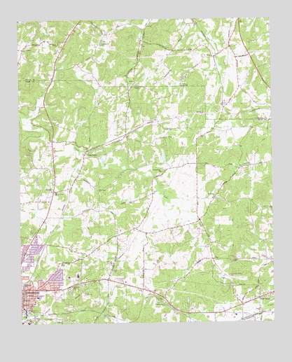
Cedartown East, GA USGS Topographic Map
Click on map above to begin viewing in our Map Viewer.

This topographic map contains these locations and features:
Feature Name Type Latitude Longitude GNIS ID View Map
Bethlehem ChurchChurchN34.0009°W85.2330°311246View Map
BricePopulated PlaceN34.1095°W85.1533°331231View Map
Brice Hill Country ClubLocaleN34.0987°W85.1699°344192View Map
Briscoe (historical)Populated PlaceN34.0893°W85.2397°343528View Map
Casey LakeReservoirN34.0682°W85.1784°339790View Map
Casey Lake DamDamN34.0668°W85.1783°339789View Map
Cedar Hill SchoolSchoolN34.0004°W85.2469°355063View Map
Cedartown High SchoolSchoolN34.0197°W85.2218°343533View Map
Cedartown Middle SchoolSchoolN34.0339°W85.2197°2545601View Map
City of CedartownCivilN34.0215°W85.2494°2404015View Map
Collard Valley ChurchChurchN34.0626°W85.1797°355240View Map
Daniel Merner ChapelChurchN34.0090°W85.2430°343541View Map
Doyal Road ChurchChurchN34.1226°W85.1991°353615View Map
Eastview Baptist ChurchChurchN34.0098°W85.2475°343545View Map
Eastview Baptist ChurchChurchN34.0120°W85.2444°343546View Map
Eastview ChurchChurchN34.0237°W85.2197°343547View Map
Eastview Public School (historical)SchoolN34.0082°W85.2466°343548View Map
Ethel Harpst School for Dependent Children (historical)SchoolN34.0090°W85.2436°343551View Map
Fish CreekPopulated PlaceN34.0101°W85.1316°355801View Map
Fish SpringSpringN34.0023°W85.1324°343557View Map
Georgia State Patrol Troop A Post 29 CedartownBuildingN34.0132°W85.2182°2733955View Map
Gordon Hill ChurchChurchN34.0651°W85.1352°314716View Map
Grady (historical)Populated PlaceN34.0037°W85.1674°343563View Map
GreenPopulated PlaceN34.0884°W85.1486°353701View Map
Greenwood CemeteryCemeteryN34.0159°W85.2494°314881View Map
Harpst AcademySchoolN34.0091°W85.2448°2545667View Map
Hillside MissionChurchN34.0057°W85.2458°315442View Map
Holiness ChurchChurchN34.0109°W85.2433°343570View Map
Jones SpringSpringN34.0029°W85.2402°343573View Map
Lake CreekPopulated PlaceN34.0704°W85.2172°356345View Map
Lake Creek ChurchChurchN34.0682°W85.2183°343575View Map
Lake Creek ChurchChurchN34.0545°W85.2113°316536View Map
Lake Creek SchoolSchoolN34.0534°W85.2322°316537View Map
Locke SpringSpringN34.0773°W85.2355°343576View Map
Lyle SchoolSchoolN34.0109°W85.2422°317497View Map
Murphy - Harpst Children's Center Harpst CampusHospitalN34.0089°W85.2438°2611010View Map
New Bethel ChurchChurchN34.0518°W85.1536°319283View Map
New Home ChurchChurchN34.0759°W85.1774°319343View Map
New Prospect CemeteryCemeteryN34.1120°W85.2472°353794View Map
New Prospect ChurchChurchN34.1126°W85.2477°319504View Map
Northview CemeteryCemeteryN34.0143°W85.2252°319704View Map
Northview CemeteryCemeteryN34.0145°W85.2255°319705View Map
Oak Grove Baptist ChurchChurchN34.0545°W85.2344°356436View Map
Oak Grove Baptist Church CemeteryCemeteryN34.0543°W85.2355°1946024View Map
Open Door ChurchChurchN34.0107°W85.1794°343581View Map
Pleasant Hill CemeteryCemeteryN34.1148°W85.2088°353827View Map
Pleasant Hill ChurchChurchN34.1148°W85.2077°320908View Map
Polk CountyCivilN34.0018°W85.1882°343585View Map
Polk County Airport- Cornelius Moore FieldAirportN34.0180°W85.1496°326801View Map
Polk County Fire Department Fish Creek StationBuildingN34.0036°W85.1465°2603988View Map
Polk County Fire Department Lake Creek StationBuildingN34.0627°W85.2221°2603987View Map
Polk County JailBuildingN34.0154°W85.2174°2734098View Map
Polk County Sheriff's OfficeBuildingN34.0156°W85.2174°2733631View Map
Polk County Volunteer Fire DepartmentBuildingN34.0164°W85.2181°2603992View Map
Polk Medical CenterHospitalN34.0137°W85.1963°343587View Map
Polk Memorial GardensCemeteryN34.0173°W85.2011°320982View Map
RelayPopulated PlaceN34.0990°W85.1916°326488View Map
Sardis ChurchChurchN34.0048°W85.1319°322552View Map
Victory ChurchChurchN34.0037°W85.1530°343606View Map
Vineyard Harvester Christian AcademySchoolN34.0536°W85.2322°2545735View Map
Wesley ChapelChurchN34.0970°W85.1919°325021View Map
Westside Elementary SchoolSchoolN34.0192°W85.2262°2545800View Map
Wimberly Hill Baptist ChurchChurchN34.0073°W85.1791°356644View Map
Wimberly Hill Baptist Church CemeteryCemeteryN34.0068°W85.1794°1946022View Map

Note: Coordinates in the location and feature list above are referenced to NAD83 datum.


Copyright (C) 2008-2025 Ryan Niemi / Sunset Dynamics ... All Rights Reserved