TopoQuest Logo
Do you find TopoQuest useful?
Help keep TopoQuest running and adding new maps/features by donating!
Bitcoin:  19c7KJd3qBynnjoSw5npx9KScwjBe4ifkT
Litecoin:  LXs6TkuXGGXo1vDsWCkWVdjQX94eUKd6ui
Home View Maps Find Maps Find Places Resources & Links


Center Hill, Alabama Topographic Map

USGS Map Title: Center Hill, AL
USGS Map MRC: 34087H4
DRG (GeoTIFF) Download: o34087h4.tif


Neighboring USGS Topographic Map Quads:


  Saint Joseph, TN  
35087A5
 

  Loretto, TN  
35087A4
 

  Bonnertown, TN  
35087A3
 

  Pruitton, AL  
34087H5
 

  Center Hill, AL  
34087H4
 

  Lexington, AL  
34087H3
 

  Killen, AL  
34087G5
 

  Wheeler Dam, AL  
34087G4
 

  Rogersville, AL  
34087G3


Map MRC Location:

N35°
W88°
N35°
W87°
H8 H7 H6 H5 H4 H3 H2 H1
G8 G7 G6 G5 G4 G3 G2 G1
F8 F7 F6 F5 F4 F3 F2 F1
E8 E7 E6 E5 E4 E3 E2 E1
D8 D7 D6 D5 D4 D3 D2 D1
C8 C7 C6 C5 C4 C3 C2 C1
B8 B7 B6 B5 B4 B3 B2 B1
A8 A7 A6 A5 A4 A3 A2 A1
N34°
W88°
N34°
W87°

Center Hill, AL USGS 1:24K Topographic Map Preview:
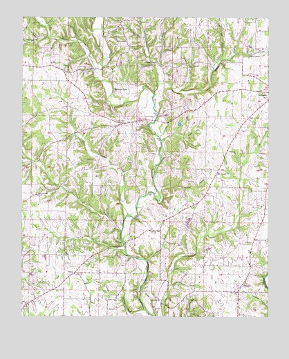
Center Hill, AL USGS Topographic Map
Click on map above to begin viewing in our Map Viewer.

This topographic map contains these locations and features:
Feature Name Type Latitude Longitude GNIS ID View Map
Allen BranchStreamN34.9470°W87.4303°112995View Map
Allen CemeteryCemeteryN34.9587°W87.4303°113003View Map
Allen ParkParkN34.9598°W87.4289°145042View Map
AntiochPopulated PlaceN34.8931°W87.4734°155995View Map
Antioch Church of ChristChurchN34.8929°W87.4731°145044View Map
Antioch School (historical)SchoolN34.8926°W87.4736°145046View Map
ArkdellPopulated PlaceN34.9598°W87.4297°156002View Map
Arkdell Post Office (historical)Post OfficeN34.9562°W87.4264°166168View Map
Arkdell School (historical)SchoolN34.9709°W87.4286°145049View Map
Bailey CemeteryCemeteryN34.8787°W87.4997°113351View Map
Baileys African Methodist Episcopal Chapel (historical)ChurchN34.8787°W87.4992°150947View Map
Belew (historical)Populated PlaceN34.9915°W87.4389°166173View Map
Belew Post Office (historical)Post OfficeN34.9915°W87.4389°169236View Map
Bethel African Methodist Episcopal ChurchChurchN34.8779°W87.4559°150849View Map
Bluewater CemeteryCemeteryN34.8898°W87.4339°141144View Map
Bluewater Primitive Baptist ChurchChurchN34.8898°W87.4345°114602View Map
Camp BranchStreamN34.9029°W87.4478°115441View Map
Center HillPopulated PlaceN34.9556°W87.4484°115845View Map
Center Hill ChurchChurchN34.9556°W87.4481°163819View Map
ComerPopulated PlaceN34.9293°W87.4047°166177View Map
Comer Post OfficePost OfficeN34.9293°W87.4047°169250View Map
Cox CemeteryCemeteryN34.9212°W87.3828°116784View Map
Crow CemeteryCemeteryN34.8759°W87.4422°116916View Map
Crow CemeteryCemeteryN34.9322°W87.4365°116917View Map
Dog BranchStreamN34.8870°W87.4253°117341View Map
Dry BranchStreamN34.9179°W87.3897°117520View Map
Ebenezer Church (historical)ChurchN34.9468°W87.4425°155514View Map
Ebenezer School (historical)SchoolN34.9545°W87.4500°145146View Map
Green CemeteryCemeteryN34.9981°W87.4375°119336View Map
Greens Chapel Methodist ChurchChurchN34.9809°W87.4322°145214View Map
Grissom CemeteryCemeteryN34.9756°W87.4256°119430View Map
Hickory Flat Freewill Baptist ChurchChurchN34.9109°W87.4353°120020View Map
Holden CemeteryCemeteryN34.8956°W87.4720°120218View Map
Hurricane CreekStreamN34.9715°W87.4317°120597View Map
Jordan BranchStreamN34.8776°W87.4367°121041View Map
Keaty BranchStreamN34.9781°W87.4328°121093View Map
KingtownPopulated PlaceN34.9054°W87.3831°121242View Map
Lexington ChurchChurchN34.9687°W87.3784°141143View Map
Lexington DivisionCivilN34.9200°W87.3918°165835View Map
Little Bluewater CreekStreamN34.9772°W87.4608°152085View Map
Little Bluewater CreekStreamN34.9680°W87.4333°121710View Map
Marys Chapel Church of the NazareneChurchN34.9898°W87.4489°152242View Map
McGuire SpringSpringN34.9846°W87.3850°122557View Map
McPeters BranchStreamN34.8759°W87.4439°122597View Map
Michael HollowValleyN34.9268°W87.4311°122680View Map
MitchelltownPopulated PlaceN34.8818°W87.4289°156721View Map
Moore CemeteryCemeteryN34.9873°W87.3833°123006View Map
Mount Pleasant Baptist ChurchChurchN34.9348°W87.4011°152504View Map
Needmore SpringSpringN34.9726°W87.3847°142116View Map
New Hope School (historical)SchoolN34.8895°W87.4217°157364View Map
North Carolina (historical)Populated PlaceN34.9256°W87.4936°142125View Map
North Carolina Church of ChristChurchN34.9259°W87.4922°152701View Map
North Carolina School (historical)SchoolN34.9265°W87.4922°142126View Map
Old Fall BranchStreamN34.9829°W87.3995°124209View Map
Olive Hill School (historical)SchoolN34.9343°W87.4734°155453View Map
Palestine (historical)Populated PlaceN34.9737°W87.4542°142143View Map
Palestine School (historical)SchoolN34.9765°W87.4536°142144View Map
Perry CemeteryCemeteryN34.9348°W87.4011°124622View Map
Pettus CemeteryCemeteryN34.9324°W87.4363°124658View Map
Pettus CemeteryCemeteryN34.9667°W87.4036°124659View Map
Posehill SpringsSpringN34.9357°W87.4486°155440View Map
Posey (historical)Populated PlaceN34.9354°W87.4486°142158View Map
Possum CreekStreamN34.9170°W87.4470°125194View Map
Richardson ChapelChurchN34.9704°W87.4539°125611View Map
Richardson ChapelChurchN34.9845°W87.4439°142163View Map
Richardson Chapel CemeteryCemeteryN34.9690°W87.4531°142164View Map
Richardson CreekStreamN34.9101°W87.4497°153146View Map
Salem School (historical)SchoolN34.9073°W87.3814°142179View Map
Scott CemeteryCemeteryN34.9542°W87.4528°126483View Map
Shakerag BranchStreamN34.9923°W87.4864°153397View Map
Slabtown (historical)Populated PlaceN34.9804°W87.4347°142194View Map
SpringfieldPopulated PlaceN34.8881°W87.3881°157097View Map
Springfield ChurchChurchN34.8881°W87.3875°142202View Map
Springfield School (historical)SchoolN34.8884°W87.3870°142203View Map
Stutts CemeteryCemeteryN34.9451°W87.4400°127486View Map
Sweet GumPopulated PlaceN34.9781°W87.4184°142216View Map
Sweet Gum Flat Primitive Baptist ChurchChurchN34.9804°W87.4167°153620View Map
Sweet Gum SchoolSchoolN34.9906°W87.4139°153621View Map
Taylor BranchStreamN34.8909°W87.4997°127722View Map
Walton BranchStreamN34.8984°W87.4370°128568View Map
Williams School (historical)SchoolN34.9351°W87.4017°142261View Map
Wilson CemeteryCemeteryN34.8840°W87.4134°129075View Map
Worley SpringSpringN34.9040°W87.4531°129238View Map
Wright CemeteryCemeteryN34.9404°W87.4639°129242View Map

Note: Coordinates in the location and feature list above are referenced to NAD83 datum.


Copyright (C) 2008-2024 Ryan Niemi / Sunset Dynamics ... All Rights Reserved