TopoQuest Logo
Do you find TopoQuest useful?
Help keep TopoQuest running and adding new maps/features by donating!
Bitcoin:  19c7KJd3qBynnjoSw5npx9KScwjBe4ifkT
Litecoin:  LXs6TkuXGGXo1vDsWCkWVdjQX94eUKd6ui
Home View Maps Find Maps Find Places Resources & Links


Loretto, Tennessee Topographic Map

USGS Map Title: Loretto, TN
USGS Map MRC: 35087A4
DRG (GeoTIFF) Download: o35087a4.tif


Neighboring USGS Topographic Map Quads:


  Westpoint, TN  
35087B5
 

  Long Branch, TN  
35087B4
 

  Lawrenceburg, TN  
35087B3
 

  Saint Joseph, TN  
35087A5
 

  Loretto, TN  
35087A4
 

  Bonnertown, TN  
35087A3
 

  Pruitton, AL  
34087H5
 

  Center Hill, AL  
34087H4
 

  Lexington, AL  
34087H3


Map MRC Location:

N36°
W88°
N36°
W87°
H8 H7 H6 H5 H4 H3 H2 H1
G8 G7 G6 G5 G4 G3 G2 G1
F8 F7 F6 F5 F4 F3 F2 F1
E8 E7 E6 E5 E4 E3 E2 E1
D8 D7 D6 D5 D4 D3 D2 D1
C8 C7 C6 C5 C4 C3 C2 C1
B8 B7 B6 B5 B4 B3 B2 B1
A8 A7 A6 A5 A4 A3 A2 A1
N35°
W88°
N35°
W87°

Loretto, TN USGS 1:24K Topographic Map Preview:
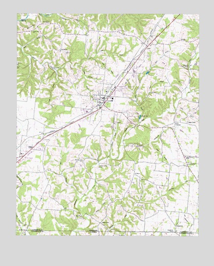
Loretto, TN USGS Topographic Map
Click on map above to begin viewing in our Map Viewer.

This topographic map contains these locations and features:
Feature Name Type Latitude Longitude GNIS ID View Map
Baker BranchStreamN35.1062°W87.4970°1276137View Map
Belew SpringsSpringN35.0394°W87.4427°1305074View Map
Berendsen School (historical)SchoolN35.0148°W87.4828°1302982View Map
Big BranchStreamN35.0206°W87.4572°1277236View Map
Bishop ChapelChurchN35.0642°W87.3825°1277523View Map
Bishop Chapel CemeteryCemeteryN35.0645°W87.3833°1641966View Map
Blue Water CemeteryCemeteryN35.0948°W87.3833°1641967View Map
Bluewater ChurchChurchN35.0951°W87.3825°1305318View Map
Brown CrossroadsPopulated PlaceN35.0642°W87.3914°1314742View Map
Burke ParkParkN35.0834°W87.4417°1308154View Map
BusbyPopulated PlaceN35.1067°W87.4097°1305561View Map
Caney BranchStreamN35.0934°W87.4728°1279547View Map
City of LorettoCivilN35.0800°W87.4404°2404957View Map
Clack BranchPopulated PlaceN35.0954°W87.4742°1314848View Map
Clack Branch CemeteryCemeteryN35.1037°W87.4664°1280577View Map
Commissioner District 1CivilN35.0544°W87.4659°2464255View Map
Commissioner District 2CivilN35.0525°W87.3951°2463943View Map
Daisy ChapelChurchN35.1045°W87.4700°1281964View Map
Dickson Lake DamDamN35.0801°W87.4031°1307184View Map
Dixon BranchStreamN35.0640°W87.4159°1282516View Map
Dry BranchStreamN35.0951°W87.3814°1282874View Map
FairviewPopulated PlaceN35.0423°W87.4553°1283985View Map
Fairview CemeteryCemeteryN35.0423°W87.4556°1641982View Map
Fairview First Congregational Methodist ChurchChurchN35.0417°W87.4561°1641983View Map
Fairview School (historical)SchoolN35.0417°W87.4570°1317725View Map
First Baptist ChurchChurchN35.0801°W87.4381°1308168View Map
Fisher HollowValleyN35.1129°W87.4821°1646869View Map
Gable BranchStreamN35.0506°W87.4292°1303006View Map
Gable HollowValleyN35.0509°W87.4266°1285059View Map
GlendalePopulated PlaceN35.1104°W87.3872°1285505View Map
Glendale Church (historical)ChurchN35.1092°W87.3839°1317729View Map
Glendale School (historical)SchoolN35.1092°W87.3839°1317730View Map
Hall CemeteryCemeteryN35.0384°W87.4436°1286556View Map
Hensley RidgeRidgeN35.1195°W87.4859°1287472View Map
Hensley Ridge (historical)Populated PlaceN35.1167°W87.4875°1303009View Map
Hensley Ridge CemeteryCemeteryN35.1156°W87.4886°1287473View Map
Hensley Ridge School (historical)SchoolN35.1154°W87.4895°1317734View Map
Hill Poultry FarmLocaleN35.0086°W87.4108°2635242View Map
Holland CemeteryCemeteryN35.0059°W87.4942°1288051View Map
Holland Stand (historical)LocaleN35.0034°W87.4931°1641993View Map
Johnson LakeReservoirN35.0670°W87.4154°1289643View Map
Liberty GrovePopulated PlaceN35.0415°W87.3831°1315389View Map
Liberty Grove CemeteryCemeteryN35.0398°W87.3845°1641999View Map
Liberty Grove ChurchChurchN35.0401°W87.3836°1642000View Map
Liberty Grove SchoolSchoolN35.0448°W87.3839°1291151View Map
Licklog BranchStreamN35.0720°W87.3909°1291251View Map
LorettoPopulated PlaceN35.0779°W87.4397°1292062View Map
Loretto BranchStreamN35.0962°W87.4575°1292063View Map
Loretto CemeteryCemeteryN35.0720°W87.4475°1642002View Map
Loretto CemeteryCemeteryN35.0723°W87.4453°1642003View Map
Loretto Church of ChristChurchN35.0806°W87.4375°1308193View Map
Loretto City HallBuildingN35.0784°W87.4397°1308194View Map
Loretto Division (historical)CensusN35.0701°W87.4400°1648824View Map
Loretto Elementary SchoolSchoolN35.0812°W87.4384°1308195View Map
Loretto High SchoolSchoolN35.0698°W87.4517°1303024View Map
Loretto Police DepartmentBuildingN35.0875°W87.4298°2766023View Map
Loretto Post OfficePost OfficeN35.0785°W87.4366°1649118View Map
Loretto United Methodist ChurchChurchN35.0792°W87.4417°1308196View Map
Loretto Volunteer Fire DepartmentBuildingN35.0874°W87.4297°2653840View Map
McDougal CemeteryCemeteryN35.0120°W87.4578°1293267View Map
Odems ChapelChurchN35.0498°W87.4889°1296237View Map
Old State HouseBuildingN35.0034°W87.4934°1296374View Map
Pebble Hill School (historical)SchoolN35.0706°W87.3820°1303042View Map
PeppertownPopulated PlaceN35.0059°W87.3903°1315694View Map
Peppertown CemeteryCemeteryN35.0023°W87.3917°1642018View Map
Peppertown ChurchChurchN35.0029°W87.3925°1297176View Map
Peppertown School (historical)SchoolN35.0140°W87.3881°1303043View Map
Pond BranchStreamN35.0731°W87.4145°1298087View Map
Powell BranchStreamN35.0512°W87.4289°1298393View Map
Rascal TownPopulated PlaceN35.0073°W87.4422°1647741View Map
Restview CemeteryCemeteryN35.0812°W87.4333°1642021View Map
Ricketts BranchStreamN35.0109°W87.4511°1299380View Map
Sacred Heart Catholic ChurchChurchN35.0767°W87.4434°1642023View Map
Sacred Heart Catholic SchoolSchoolN35.0770°W87.4445°1642024View Map
Saint MarysPopulated PlaceN35.0351°W87.4189°1315862View Map
Saint Marys Catholic Church (historical)ChurchN35.0317°W87.4150°1317744View Map
Saint Marys CemeteryCemeteryN35.0315°W87.4150°1317745View Map
Saint Marys School (historical)SchoolN35.0334°W87.4150°1317746View Map
Smith CemeteryCemeteryN35.0962°W87.4992°1270583View Map
South Lawrence Elementary SchoolSchoolN35.0673°W87.4589°1303058View Map
Steen BranchStreamN35.0798°W87.3834°1271309View Map
Stillhouse BranchStreamN35.0909°W87.4536°1271393View Map
Weathers HospitalHospitalN35.0792°W87.4409°1308218View Map
Williams BranchStreamN35.0442°W87.4356°1274625View Map
Yeager BranchStreamN35.1001°W87.4486°1275258View Map

Note: Coordinates in the location and feature list above are referenced to NAD83 datum.


Copyright (C) 2008-2024 Ryan Niemi / Sunset Dynamics ... All Rights Reserved