TopoQuest Logo
Do you find TopoQuest useful?
Help keep TopoQuest running and adding new maps/features by donating!
Bitcoin:  19c7KJd3qBynnjoSw5npx9KScwjBe4ifkT
Litecoin:  LXs6TkuXGGXo1vDsWCkWVdjQX94eUKd6ui
Home View Maps Find Maps Find Places Resources & Links


Center Hill Dam, Tennessee Topographic Map

USGS Map Title: Center Hill Dam, TN
USGS Map MRC: 36085A7
DRG (GeoTIFF) Download: o36085a7.tif


Neighboring USGS Topographic Map Quads:


  Gordonsville, TN  
36085B8
 

  Buffalo Valley, TN  
36085B7
 

  Baxter, TN  
36085B6
 

  Liberty, TN  
36085A8
 

  Center Hill Dam, TN  
36085A7
 

  Silver Point, TN  
36085A6
 

  Gassaway, TN  
35085H8
 

  Smithville, TN  
35085H7
 

  Sligo Bridge, TN  
35085H6


Map MRC Location:

N37°
W86°
N37°
W85°
H8 H7 H6 H5 H4 H3 H2 H1
G8 G7 G6 G5 G4 G3 G2 G1
F8 F7 F6 F5 F4 F3 F2 F1
E8 E7 E6 E5 E4 E3 E2 E1
D8 D7 D6 D5 D4 D3 D2 D1
C8 C7 C6 C5 C4 C3 C2 C1
B8 B7 B6 B5 B4 B3 B2 B1
A8 A7 A6 A5 A4 A3 A2 A1
N36°
W86°
N36°
W85°

Center Hill Dam, TN USGS 1:24K Topographic Map Preview:
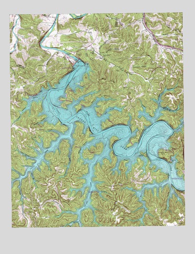
Center Hill Dam, TN USGS Topographic Map
Click on map above to begin viewing in our Map Viewer.

This topographic map contains these locations and features:
Feature Name Type Latitude Longitude GNIS ID View Map
Allen CemeteryCemeteryN36.0171°W85.8378°2711240View Map
Atnip Bluff Cabin ColonyLocaleN36.0431°W85.7805°1313838View Map
Atnip HollowValleyN36.0225°W85.8147°1313839View Map
Big Hurricane CreekStreamN36.0262°W85.7617°1313853View Map
Braswell CemeteryCemeteryN36.1020°W85.8411°1313864View Map
Buckeye HollowValleyN36.0083°W85.8276°1313867View Map
BucknerPopulated PlaceN36.0048°W85.7514°1314760View Map
Buckner ChapelChurchN36.0020°W85.7539°1313868View Map
Buffalo Valley Recreation AreaParkN36.1006°W85.8297°1322518View Map
Burton CemeteryCemeteryN36.0906°W85.7955°1313870View Map
Camp BranchStreamN36.0281°W85.8683°1313871View Map
Carlen CemeteryCemeteryN36.0745°W85.7583°1279675View Map
Carr CemeteryCemeteryN36.1020°W85.8094°1313877View Map
Carr/Jones/Merritt CemeteryCemeteryN36.0872°W85.7758°2711565View Map
Carter ChapelChurchN36.0992°W85.8075°1313878View Map
Center Hill DamDamN36.0965°W85.8274°1313881View Map
Center Hill Recreation AreaParkN36.0931°W85.8300°1322528View Map
Center Hill School (historical)SchoolN36.0784°W85.8228°1322529View Map
Chestnut Grove School (historical)SchoolN36.0167°W85.8569°1322531View Map
Christian HollowValleyN36.1014°W85.8099°1313886View Map
Cobb HollowValleyN36.0402°W85.8575°1313890View Map
Cocoanut School (historical)SchoolN36.0270°W85.7839°1322534View Map
Coggin CemeteryCemeteryN36.1079°W85.8366°2711580View Map
Cove HollowValleyN36.0778°W85.8521°1313900View Map
Cove Hollow DockLocaleN36.0764°W85.8586°1313901View Map
Cove Hollow Recreation AreaParkN36.0795°W85.8539°1322536View Map
Cove Hollow School (historical)SchoolN36.0753°W85.8597°1322537View Map
District 10 (historical)CivilN36.0334°W85.8583°1325908View Map
District 16 (historical)CivilN36.1001°W85.8000°1325914View Map
District 18 (historical)CivilN36.0501°W85.7528°1325916View Map
District 22 (historical)CivilN36.0251°W85.8250°1325920View Map
Edgar Evins State Rustic ParkParkN36.0501°W85.8375°1322550View Map
Elizabeth Chapel (historical)ChurchN36.0245°W85.8189°1322552View Map
Exum CemeteryCemeteryN36.1058°W85.8289°2710714View Map
Fish CemeteryCemeteryN36.0130°W85.8510°2711670View Map
Floating Mill ParkParkN36.0442°W85.7628°1313930View Map
Florida BranchStreamN36.0615°W85.7725°1313931View Map
Fuston HollowValleyN36.0039°W85.8271°1313937View Map
Garner CemeteryCemeteryN36.0996°W85.7753°2711677View Map
Gill CemeteryCemeteryN36.0922°W85.7875°2711680View Map
Greenmoss Ferry (historical)CrossingN36.0606°W85.7694°1314065View Map
Hale BranchStreamN36.0623°W85.8105°1313945View Map
Hames HollowValleyN36.0542°W85.8386°1313948View Map
Hayes School (historical)SchoolN36.0414°W85.8067°1322565View Map
Hellum HollowValleyN36.0898°W85.7901°1647644View Map
Holmes CreekStreamN36.0548°W85.8083°1313958View Map
Holmes Creek Church (historical)ChurchN36.0362°W85.8186°1322567View Map
Holmes Creek DockLocaleN36.0028°W85.8305°1313959View Map
Holmes Creek Recreation AreaParkN36.0209°W85.8211°1322568View Map
Huddleson HollowValleyN36.0901°W85.7867°1313963View Map
Huddleston CemeteryCemeteryN36.0913°W85.7850°2712070View Map
Hullett CemeteryCemeteryN36.0256°W85.7983°1313964View Map
Hurricane Bridge Recreation AreaParkN36.0298°W85.7511°1322569View Map
Hurricane DockLocaleN36.0392°W85.7592°1313967View Map
Indian CreekStreamN36.0623°W85.8333°1313968View Map
Johnson CemeteryCemeteryN36.0872°W85.7755°2712084View Map
Jones ForkStreamN36.0526°W85.8322°1313979View Map
Lafever CemeteryCemeteryN36.0895°W85.7578°1290469View Map
Laurel HillPopulated PlaceN36.1028°W85.8130°1315361View Map
Laurel Hill SchoolSchoolN36.1003°W85.8072°1313985View Map
League CemeteryCemeteryN36.1028°W85.8148°2712096View Map
Lick BranchStreamN36.0687°W85.7661°1313987View Map
Little Hurricane CreekStreamN36.0603°W85.7714°1313769View Map
Long BranchStreamN36.1031°W85.8397°1313989View Map
Long Branch ChurchChurchN36.0945°W85.8497°1313990View Map
Long Branch Recreation AreaParkN36.1001°W85.8333°1322588View Map
Long Branch School (historical)SchoolN36.0945°W85.8486°1322589View Map
Love CemeteryCemeteryN36.1153°W85.8178°1313991View Map
Loves Ferry (historical)CrossingN36.0245°W85.7583°1314071View Map
Maggard RidgeRidgeN36.0631°W85.7558°1647647View Map
Medley CemeteryCemeteryN36.0626°W85.7538°2712169View Map
Merritt CemeteryCemeteryN36.0745°W85.7909°2711038View Map
Merritt HollowValleyN36.0696°W85.8159°1313998View Map
Mill BranchStreamN36.0331°W85.8600°1314000View Map
Mitchell CemeteryCemeteryN36.1046°W85.8186°2712170View Map
Mocassin Bluff CemeteryCemeteryN36.1218°W85.8001°2712176View Map
Mollie League CemeteryCemeteryN36.1151°W85.8246°2712101View Map
Moss CemeteryCemeteryN36.0995°W85.8089°1314004View Map
Moss HollowValleyN36.1041°W85.8198°1314005View Map
Moss RidgeRidgeN36.0851°W85.8050°1314006View Map
Mullican HollowValleyN36.0241°W85.7604°1314013View Map
Pack School (historical)SchoolN36.0115°W85.8236°1322608View Map
Paige CemeteryCemeteryN36.0320°W85.8380°1314025View Map
Poison HollowValleyN36.0091°W85.8380°1314033View Map
Raccoon HollowValleyN36.0508°W85.8114°1314037View Map
Second CreekStreamN36.0553°W85.7578°1314046View Map
Second Creek Methodist Church (historical)ChurchN36.0534°W85.7580°1322619View Map
Second Creek School (historical)SchoolN36.0548°W85.7547°1322620View Map
Sexton CemeteryCemeteryN36.0816°W85.7894°2712249View Map
Smith CemeteryCemeteryN36.1098°W85.8037°2712069View Map
Smith HollowValleyN36.1020°W85.8105°1313777View Map
Starnes CemeteryCemeteryN36.0859°W85.8575°2712340View Map
Stillhouse HollowValleyN36.0203°W85.8109°1313784View Map
Taylor CemeteryCemeteryN36.0153°W85.8555°1313791View Map
Tucker CemeteryCemeteryN36.1162°W85.7589°1272950View Map
Tucker RidgeRidgeN36.1156°W85.7569°1272956View Map
Tucker Ridge ChurchChurchN36.1148°W85.7539°1272957View Map
View Point School (historical)SchoolN36.0742°W85.7883°1322632View Map
Walkers Chapel Missionary Baptist Church (historical)ChurchN36.0053°W85.7503°1322634View Map
Wallace CemeteryCemeteryN36.1081°W85.7544°1273671View Map
Wallace HollowValleyN36.1121°W85.7709°1275412View Map
Wallace RidgeRidgeN36.1084°W85.7569°1311027View Map
Wildcat HollowValleyN36.0646°W85.8468°1313816View Map
Wolf CreekStreamN36.1031°W85.8358°1313819View Map
Wolf Creek Baptist ChurchChurchN36.0898°W85.7875°1313820View Map
Wolf Creek IslandIslandN36.1014°W85.8319°1313821View Map

Note: Coordinates in the location and feature list above are referenced to NAD83 datum.


Copyright (C) 2008-2024 Ryan Niemi / Sunset Dynamics ... All Rights Reserved