TopoQuest Logo
Do you find TopoQuest useful?
Help keep TopoQuest running and adding new maps/features by donating!
Bitcoin:  19c7KJd3qBynnjoSw5npx9KScwjBe4ifkT
Litecoin:  LXs6TkuXGGXo1vDsWCkWVdjQX94eUKd6ui
Home View Maps Find Maps Find Places Resources & Links


Centerville, Illinois Topographic Map

USGS Map Title: Centerville, IL
USGS Map MRC: 38088B2
DRG (GeoTIFF) Download: o38088b2.tif


Neighboring USGS Topographic Map Quads:


  Burnt Prairie, IL  
38088C3
 

  Golden Gate, IL  
38088C2
 

  Albion South, IL  
38088C1
 

  Springerton, IL  
38088B3
 

  Centerville, IL  
38088B2
 

  Crossville, IL  
38088B1
 

  Enfield, IL  
38088A3
 

  Carmi, IL  
38088A2
 

  Maunie, IL  
38088A1


Map MRC Location:

N39°
W89°
N39°
W88°
H8 H7 H6 H5 H4 H3 H2 H1
G8 G7 G6 G5 G4 G3 G2 G1
F8 F7 F6 F5 F4 F3 F2 F1
E8 E7 E6 E5 E4 E3 E2 E1
D8 D7 D6 D5 D4 D3 D2 D1
C8 C7 C6 C5 C4 C3 C2 C1
B8 B7 B6 B5 B4 B3 B2 B1
A8 A7 A6 A5 A4 A3 A2 A1
N38°
W89°
N38°
W88°

Centerville, IL USGS 1:24K Topographic Map Preview:
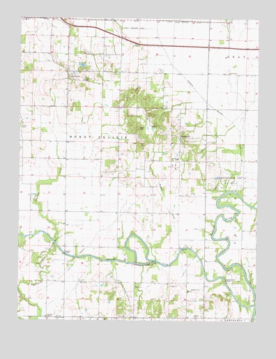
Centerville, IL USGS Topographic Map
Click on map above to begin viewing in our Map Viewer.

This topographic map contains these locations and features:
Feature Name Type Latitude Longitude GNIS ID View Map
Barth CemeteryCemeteryN38.1267°W88.1923°403938View Map
Beck School (historical)SchoolN38.1403°W88.1773°1705664View Map
Blue Mound Church (historical)ChurchN38.1878°W88.1875°1705668View Map
Bootjack School (historical)SchoolN38.1698°W88.1661°1705669View Map
Boyd HillSummitN38.2045°W88.1884°404758View Map
Burnt Prairie ChurchChurchN38.1259°W88.2295°405255View Map
CentervillePopulated PlaceN38.2006°W88.1661°405841View Map
Centerville CemeteryCemeteryN38.1984°W88.1653°1823948View Map
Centerville East Oil FieldOilfieldN38.1867°W88.1381°424733View Map
Centerville SchoolSchoolN38.1917°W88.1673°405843View Map
Concord ChurchChurchN38.2275°W88.1398°406445View Map
Farmerville School (historical)SchoolN38.2453°W88.1409°1705682View Map
Gray School (historical)SchoolN38.1703°W88.2348°1705689View Map
Hadden CemeteryCemeteryN38.1262°W88.1573°409595View Map
Hadden School (historical)SchoolN38.1262°W88.1495°1705690View Map
Illinois No Name Number 2000 DamDamN38.2317°W88.2167°1692132View Map
Interchange 117CrossingN38.2498°W88.2289°1823969View Map
Limekiln CreekStreamN38.1575°W88.2309°412098View Map
Major School (historical)SchoolN38.1889°W88.1984°1705693View Map
Miller CemeteryCemeteryN38.1389°W88.1886°413572View Map
Moccasin School (historical)SchoolN38.1698°W88.1978°1705695View Map
Mount Pleasant CemeteryCemeteryN38.2250°W88.2234°1823973View Map
Mount Pleasant ChurchChurchN38.2256°W88.2239°414054View Map
Mount Pleasant School (historical)SchoolN38.2259°W88.2242°1705696View Map
Old Bethel CemeteryCemeteryN38.2245°W88.2170°414988View Map
Ralls Family CemeteryCemeteryN38.1803°W88.1478°416360View Map
Randolph Drainage DitchCanalN38.2203°W88.1578°416383View Map
Rattlesnake BluffSummitN38.1420°W88.1409°416401View Map
Rebstock CemeteryCemeteryN38.1384°W88.1542°416441View Map
Saint Johns ChurchChurchN38.1267°W88.1906°417395View Map
Salem CemeteryCemeteryN38.2048°W88.2489°417855View Map
Salem Church (historical)ChurchN38.2053°W88.2489°1705701View Map
Schoemann CutoffChannelN38.1484°W88.1837°418098View Map
Sevenmile CreekStreamN38.1573°W88.2309°418231View Map
Shipley CemeteryCemeteryN38.1267°W88.2348°418431View Map
Sigler BridgeBridgeN38.1589°W88.1409°425489View Map
Skillet ForkStreamN38.1314°W88.1256°418570View Map
Sumpter BridgeBridgeN38.1525°W88.2256°425535View Map
Sumpter North Oil FieldOilfieldN38.1570°W88.2328°425537View Map
Sumpter Oil FieldOilfieldN38.1478°W88.1614°425538View Map
Sumpter South Oil FieldOilfieldN38.1367°W88.1923°425539View Map
Sylvan Glen School (historical)SchoolN38.1412°W88.2273°1705707View Map
Township of Burnt PrairieCivilN38.1914°W88.2071°428739View Map
White Lily School (historical)SchoolN38.2345°W88.1975°1705711View Map
Williams School (historical)SchoolN38.2278°W88.1839°1705714View Map
Wilson CreekStreamN38.1500°W88.1781°421288View Map
Winters BridgeBridgeN38.1548°W88.1642°1705715View Map
Woods Drainage DitchCanalN38.2459°W88.1820°421479View Map
Zion ChurchChurchN38.1370°W88.1609°421645View Map

Note: Coordinates in the location and feature list above are referenced to NAD83 datum.


Copyright (C) 2008-2024 Ryan Niemi / Sunset Dynamics ... All Rights Reserved