TopoQuest Logo
Do you find TopoQuest useful?
Help keep TopoQuest running and adding new maps/features by donating!
Bitcoin:  19c7KJd3qBynnjoSw5npx9KScwjBe4ifkT
Litecoin:  LXs6TkuXGGXo1vDsWCkWVdjQX94eUKd6ui
Home View Maps Find Maps Find Places Resources & Links


Chadborn, Montana Topographic Map

USGS Map Title: Chadborn, MT
USGS Map MRC: 45110G5
DRG (GeoTIFF) Download: o45110g5.tif


Neighboring USGS Topographic Map Quads:


  Wilsall, MT  
45110H6
 

  Clyde Park, MT  
45110H5
 

  Ibex Mountain, MT  
45110H4
 

  Gobblers Knob, MT  
45110G6
 

  Chadborn, MT  
45110G5
 

  Grannis, MT  
45110G4
 

  Hoppers, MT  
45110F6
 

  Livingston, MT  
45110F5
 

  Mission, MT  
45110F4


Map MRC Location:

N46°
W111°
N46°
W110°
H8 H7 H6 H5 H4 H3 H2 H1
G8 G7 G6 G5 G4 G3 G2 G1
F8 F7 F6 F5 F4 F3 F2 F1
E8 E7 E6 E5 E4 E3 E2 E1
D8 D7 D6 D5 D4 D3 D2 D1
C8 C7 C6 C5 C4 C3 C2 C1
B8 B7 B6 B5 B4 B3 B2 B1
A8 A7 A6 A5 A4 A3 A2 A1
N45°
W111°
N45°
W110°

Chadborn, MT USGS 1:24K Topographic Map Preview:
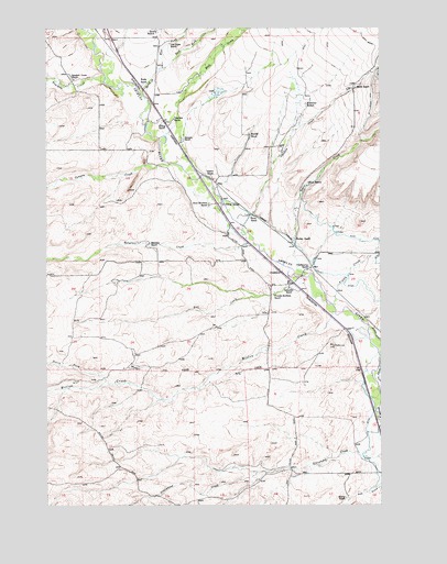
Chadborn, MT USGS Topographic Map
Click on map above to begin viewing in our Map Viewer.

This topographic map contains these locations and features:
Feature Name Type Latitude Longitude GNIS ID View Map
01N09E02A___01 WellWellN45.8691°W110.5683°812909View Map
01N09E11C___01 WellWellN45.8474°W110.5788°812723View Map
01N09E11C___02 WellWellN45.8474°W110.5788°812724View Map
01N09E12D___01 SpringSpringN45.8474°W110.5474°812722View Map
01N09E13C___01 WellWellN45.8330°W110.5580°812570View Map
01N09E14C___01 WellWellN45.8330°W110.5788°812571View Map
01N09E24C___01 WellWellN45.8185°W110.5580°812407View Map
01N09E25D___01 WellWellN45.8041°W110.5474°812203View Map
01N09E36B___01 WellWellN45.7969°W110.5580°812130View Map
01N10E08B___01 WellWellN45.8547°W110.5149°812775View Map
01N10E08B___02 WellWellN45.8547°W110.5149°812776View Map
01N10E19C___01 WellWellN45.8185°W110.5355°812406View Map
01N10E30B___01 WellWellN45.8113°W110.5355°812291View Map
01N10E32D___01 WellWellN45.7897°W110.5046°812058View Map
01S09E01C___01 WellWellN45.7752°W110.5658°811907View Map
01S10E17A___01 WellWellN45.7533°W110.5138°811681View Map
Bangtail CreekStreamN45.8188°W110.5485°779327View Map
Birch RanchLocaleN45.8258°W110.5483°768874View Map
Boding RanchLocaleN45.8505°W110.5819°769071View Map
Bowlds RanchLocaleN45.8472°W110.5488°769142View Map
Brackett CreekStreamN45.8610°W110.6035°780346View Map
Brackett Creek RanchLocaleN45.8619°W110.6149°769179View Map
Bryan Post Office (historical)Post OfficeN45.8388°W110.5688°1743201View Map
Canyon CreekStreamN45.8399°W110.5788°780896View Map
ChadbornPopulated PlaceN45.8116°W110.5385°806917View Map
Chadborn (historical)LocaleN45.8116°W110.5385°1743193View Map
Chadbourn Post Office (historical)Post OfficeN45.8116°W110.5385°1743192View Map
Chadbourne RanchLocaleN45.8124°W110.5274°781138View Map
Chicken CreekStreamN45.8230°W110.5519°781210View Map
Cowan School (historical)SchoolN45.8288°W110.5585°770235View Map
Dunn RanchLocaleN45.8349°W110.5274°770912View Map
East Fork Spring CreekStreamN45.8644°W110.5824°771075View Map
Eyman RanchLocaleN45.8197°W110.5319°771270View Map
Falls CreekStreamN45.7891°W110.5013°783294View Map
Fiddle CreekStreamN45.8027°W110.5183°771332View Map
Foster Ranches Airport (historical)AirportN45.7997°W110.5346°806473View Map
Francis Brothers RanchLocaleN45.8049°W110.5405°771601View Map
Gibson RanchLocaleN45.8366°W110.5633°771765View Map
Kay CreekStreamN45.8033°W110.5210°772945View Map
Keys Brothers RanchLocaleN45.8283°W110.5641°773014View Map
Kirscher RanchLocaleN45.8547°W110.5277°773089View Map
Lower Shields Valley DitchCanalN45.8174°W110.5308°773742View Map
Maroney RanchLocaleN45.8185°W110.5858°773889View Map
Martin RanchLocaleN45.7522°W110.5130°773902View Map
North Fork Willow CreekStreamN45.7827°W110.6027°788282View Map
Queen RanchLocaleN45.8738°W110.5833°775512View Map
Rock CreekStreamN45.8469°W110.5799°789682View Map
Sarazim RanchLocaleN45.8463°W110.5744°776221View Map
Schindler RanchLocaleN45.8063°W110.5341°776261View Map
Smith RanchLocaleN45.8594°W110.5094°776678View Map
Spring CreekStreamN45.8580°W110.5894°777000View Map
Tobin CreekStreamN45.8105°W110.5277°792225View Map
Tregloan (historical)LocaleN45.8494°W110.5819°1743382View Map
Tregloan RanchLocaleN45.8513°W110.5769°777749View Map
Van Gilder RanchLocaleN45.8710°W110.5785°777990View Map
West Fork Spring CreekStreamN45.8647°W110.5824°778280View Map
Willow CreekStreamN45.8010°W110.5174°793348View Map
Wolfe RanchLocaleN45.8608°W110.5880°778658View Map

Note: Coordinates in the location and feature list above are referenced to NAD83 datum.


Copyright (C) 2008-2025 Ryan Niemi / Sunset Dynamics ... All Rights Reserved