TopoQuest Logo
Do you find TopoQuest useful?
Help keep TopoQuest running and adding new maps/features by donating!
Bitcoin:  19c7KJd3qBynnjoSw5npx9KScwjBe4ifkT
Litecoin:  LXs6TkuXGGXo1vDsWCkWVdjQX94eUKd6ui
Home View Maps Find Maps Find Places Resources & Links


Mission, Montana Topographic Map

USGS Map Title: Mission, MT
USGS Map MRC: 45110F4
DRG (GeoTIFF) Download: o45110f4.tif


Neighboring USGS Topographic Map Quads:


  Chadborn, MT  
45110G5
 

  Grannis, MT  
45110G4
 

  Hunters Hot Springs, MT  
45110G3
 

  Livingston, MT  
45110F5
 

  Mission, MT  
45110F4
 

  Elton, MT  
45110F3
 

  Brisbin, MT  
45110E5
 

  Livingston Peak, MT  
45110E4
 

  Mount Rae, MT  
45110E3


Map MRC Location:

N46°
W111°
N46°
W110°
H8 H7 H6 H5 H4 H3 H2 H1
G8 G7 G6 G5 G4 G3 G2 G1
F8 F7 F6 F5 F4 F3 F2 F1
E8 E7 E6 E5 E4 E3 E2 E1
D8 D7 D6 D5 D4 D3 D2 D1
C8 C7 C6 C5 C4 C3 C2 C1
B8 B7 B6 B5 B4 B3 B2 B1
A8 A7 A6 A5 A4 A3 A2 A1
N45°
W111°
N45°
W110°

Mission, MT USGS 1:24K Topographic Map Preview:
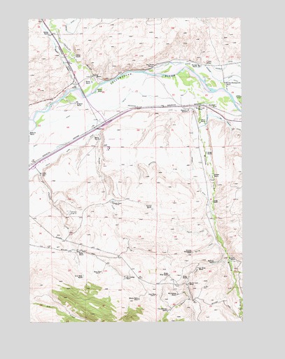
Mission, MT USGS Topographic Map
Click on map above to begin viewing in our Map Viewer.

This topographic map contains these locations and features:
Feature Name Type Latitude Longitude GNIS ID View Map
01S10E22C___01 WellWellN45.7316°W110.4833°811502View Map
01S10E23C___01 WellWellN45.7316°W110.4627°811501View Map
01S10E24A___01 WellWellN45.7388°W110.4319°811562View Map
Africa (historical)LocaleN45.6916°W110.4966°1743091View Map
Balmer DitchCanalN45.7358°W110.4827°768488View Map
Balmer RanchLocaleN45.7435°W110.4888°768489View Map
Beaver CreekStreamN45.6533°W110.3855°779615View Map
Beaver Creek School (historical)SchoolN45.6405°W110.4074°768637View Map
Bill Graham RanchLocaleN45.6360°W110.4141°768851View Map
Bruffey CemeteryCemeteryN45.6444°W110.4174°1743125View Map
Burkland Lumber Company SpurLocaleN45.6916°W110.4980°1743200View Map
CAA Radio Range StationTowerN45.7013°W110.3919°799294View Map
Chicken CreekStreamN45.6908°W110.4960°769813View Map
Crow Agency (historical)LocaleN45.7133°W110.4002°1743311View Map
Dahl PlacePopulated PlaceN45.6358°W110.4266°770425View Map
Dodge RanchLocaleN45.6744°W110.3930°770686View Map
Fisher RanchLocaleN45.6538°W110.4716°771398View Map
Fort Green Clay Smith (historical)MilitaryN45.7222°W110.4611°1743226View Map
Fort Ida Thoroughman (historical)MilitaryN45.7222°W110.4611°1743227View Map
Fort Parker (historical)LocaleN45.7133°W110.4002°1743312View Map
Helger RanchLocaleN45.6947°W110.3966°772322View Map
Highway 89 Bridge Fishing Access SiteLocaleN45.7169°W110.4641°1744489View Map
Hodges DitchCanalN45.6835°W110.4041°772441View Map
Hodges RanchLocaleN45.6858°W110.3927°772442View Map
Hogsted RanchLocaleN45.7152°W110.4716°772458View Map
ICAA Radio Range StationTowerN45.6697°W110.4777°799325View Map
Interchange 340CrossingN45.7069°W110.4549°1743087View Map
Interchange 343CrossingN45.7138°W110.4113°1743086View Map
Irvin Rahn RanchLocaleN45.6444°W110.4694°772734View Map
Jim Graham RanchLocaleN45.6435°W110.4446°772825View Map
Joe Weiss RanchLocaleN45.6472°W110.4019°772837View Map
Larson RanchLocaleN45.7197°W110.4599°773235View Map
Middle Windsor DitchCanalN45.7255°W110.3916°774192View Map
Minnie Rahn PlacePopulated PlaceN45.6338°W110.4369°774274View Map
MissionLocaleN45.7047°W110.4621°774277View Map
Mission CreekStreamN45.7144°W110.3888°787497View Map
Mission Creek School (historical)SchoolN45.7133°W110.4002°774289View Map
Mission FieldAirportN45.6966°W110.4534°806470View Map
Mission Post Office (historical)Post OfficeN45.7083°W110.3966°1743371View Map
Mission RanchLocaleN45.7119°W110.4069°774294View Map
Murry RanchLocaleN45.7005°W110.4591°774519View Map
Myers RanchLocaleN45.7235°W110.4641°774535View Map
Nichols Spur (historical)LocaleN45.7133°W110.4369°1743359View Map
Norman HomesteadLocaleN45.6533°W110.4049°774668View Map
O Bar A RanchLocaleN45.7072°W110.3996°774892View Map
Olin RanchLocaleN45.7219°W110.4719°774950View Map
Palmer RanchLocaleN45.7344°W110.4735°775070View Map
Poison CreekStreamN45.7024°W110.4608°775328View Map
Poor Farm CemeteryCemeteryN45.6860°W110.4924°1743106View Map
Rasheg RanchLocaleN45.6713°W110.4285°775563View Map
Shaw PlacePopulated PlaceN45.6458°W110.4583°776412View Map
Sheep Mountain Fishing Access SiteLocaleN45.7316°W110.4085°1744487View Map
Shields RiverStreamN45.7235°W110.4574°790415View Map
Shields River Post Office (historical)Post OfficeN45.7222°W110.4619°1743340View Map
Skillman RanchLocaleN45.6491°W110.3916°776610View Map
Spring CreekStreamN45.6602°W110.3902°776997View Map
Steeves RanchLocaleN45.7263°W110.4635°777189View Map
Sunset County FarmLocaleN45.6860°W110.4938°777332View Map
Teichert RanchLocaleN45.6502°W110.3830°777447View Map
Tendland RanchLocaleN45.7138°W110.3908°777459View Map
Tom Skillman RanchLocaleN45.6297°W110.4196°777695View Map
Urbach School (historical)SchoolN45.6744°W110.4516°1743326View Map
Urback PlacePopulated PlaceN45.6744°W110.4516°777950View Map
Vallis DitchCanalN45.6966°W110.4763°777983View Map
Van Ornum RanchLocaleN45.7305°W110.4260°777996View Map
Weiss RanchLocaleN45.6427°W110.4077°778175View Map
Weiss West RanchLocaleN45.6435°W110.4191°778176View Map
Windsor Headquarters RanchLocaleN45.7233°W110.3852°778587View Map
Windsor RanchLocaleN45.7305°W110.4008°778589View Map

Note: Coordinates in the location and feature list above are referenced to NAD83 datum.


Copyright (C) 2008-2024 Ryan Niemi / Sunset Dynamics ... All Rights Reserved