TopoQuest Logo
Do you find TopoQuest useful?
Help keep TopoQuest running and adding new maps/features by donating!
Bitcoin:  19c7KJd3qBynnjoSw5npx9KScwjBe4ifkT
Litecoin:  LXs6TkuXGGXo1vDsWCkWVdjQX94eUKd6ui
Home View Maps Find Maps Find Places Resources & Links


Wilsall, Montana Topographic Map

USGS Map Title: Wilsall, MT
USGS Map MRC: 45110H6
DRG (GeoTIFF) Download: o45110h6.tif


Neighboring USGS Topographic Map Quads:


  Wallrock, MT  
46110A7
 

  Cottonwood Reservoir, MT  
46110A6
 

  Lena Creek, MT  
46110A5
 

  Sedan, MT  
45110H7
 

  Wilsall, MT  
45110H6
 

  Clyde Park, MT  
45110H5
 

  Grassy Mountain, MT  
45110G7
 

  Gobblers Knob, MT  
45110G6
 

  Chadborn, MT  
45110G5


Map MRC Location:

N46°
W111°
N46°
W110°
H8 H7 H6 H5 H4 H3 H2 H1
G8 G7 G6 G5 G4 G3 G2 G1
F8 F7 F6 F5 F4 F3 F2 F1
E8 E7 E6 E5 E4 E3 E2 E1
D8 D7 D6 D5 D4 D3 D2 D1
C8 C7 C6 C5 C4 C3 C2 C1
B8 B7 B6 B5 B4 B3 B2 B1
A8 A7 A6 A5 A4 A3 A2 A1
N45°
W111°
N45°
W110°

Wilsall, MT USGS 1:24K Topographic Map Preview:
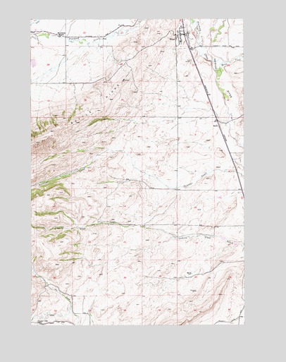
Wilsall, MT USGS Topographic Map
Click on map above to begin viewing in our Map Viewer.

This topographic map contains these locations and features:
Feature Name Type Latitude Longitude GNIS ID View Map
02N08E11A___01 SpringSpringN45.9416°W110.6905°813485View Map
02N08E11B___01 WellWellN45.9416°W110.7008°813486View Map
02N09E05B___01 WellWellN45.9555°W110.6391°813555View Map
02N09E17C___01 WellWellN45.9194°W110.6391°813359View Map
03N08E26A___01 WellWellN45.9858°W110.6908°813690View Map
03N08E28C___01 WellWellN45.9785°W110.7427°813663View Map
03N09E19C___01 WellWellN45.9927°W110.6599°813702View Map
03N09E19C___02 WellWellN45.9927°W110.6599°813703View Map
03N09E19C___03 WellWellN45.9927°W110.6599°813704View Map
03N09E19C___04 WellWellN45.9927°W110.6599°813705View Map
03N09E19C___05 WellWellN45.9927°W110.6599°813706View Map
03N09E30A___01 WellWellN45.9855°W110.6494°813688View Map
Arthun DamDamN45.9266°W110.6408°795324View Map
Brackett Creek School (historical)SchoolN45.8766°W110.7472°769180View Map
D'Ewart DamDamN45.9916°W110.7474°795326View Map
Farmers Exchange Elevator (historical)LocaleN45.9938°W110.6602°1743136View Map
Flathead CreekStreamN45.9824°W110.6433°783512View Map
Horse CreekStreamN45.9777°W110.6416°768062View Map
Meyersburg School (historical)SchoolN45.9935°W110.7327°774124View Map
O'Halloran DamDamN45.9033°W110.6324°796677View Map
O'Halloran Number 1 DamDamN45.9049°W110.6341°796715View Map
Potter (historical)LocaleN45.9985°W110.6619°1743353View Map
ShieldsPopulated PlaceN45.9569°W110.6408°776486View Map
Shields (historical)LocaleN45.9569°W110.6408°1743341View Map
Shields Post Office (historical)Post OfficeN45.9569°W110.6408°1743342View Map
Shields River Lutheran ChurchChurchN45.9938°W110.6602°1743163View Map
Shields River Valley Historical MarkerParkN45.9527°W110.6388°1743212View Map
Shields School (historical)SchoolN45.9569°W110.6408°1743343View Map
Shields Valley ElementarySchoolN45.9899°W110.6628°1743276View Map
Shields Valley Grain Incorporated ElevatorLocaleN45.9938°W110.6602°1743209View Map
WilsallPopulated PlaceN45.9938°W110.6602°778561View Map
Wilsall (historical)LocaleN45.9938°W110.6602°1743377View Map
Wilsall CemeteryCemeteryN45.9820°W110.6555°778562View Map
Wilsall Census Designated PlaceCensusN45.9843°W110.6604°2409602View Map
Wilsall Community ChurchChurchN45.9938°W110.6602°1743162View Map
Wilsall Post OfficePost OfficeN45.9972°W110.6607°1743376View Map
Wilsall United Methodist ChurchChurchN45.9938°W110.6602°1743164View Map
Wilsall Volunteer Fire DepartmentBuildingN45.9953°W110.6612°2546728View Map

Note: Coordinates in the location and feature list above are referenced to NAD83 datum.


Copyright (C) 2008-2025 Ryan Niemi / Sunset Dynamics ... All Rights Reserved