TopoQuest Logo
Do you find TopoQuest useful?
Help keep TopoQuest running and adding new maps/features by donating!
Bitcoin:  19c7KJd3qBynnjoSw5npx9KScwjBe4ifkT
Litecoin:  LXs6TkuXGGXo1vDsWCkWVdjQX94eUKd6ui
Home View Maps Find Maps Find Places Resources & Links


Chambliss Hill, Texas Topographic Map

USGS Map Title: Chambliss Hill, TX
USGS Map MRC: 30094G5
DRG (GeoTIFF) Download: o30094g5.tif


Neighboring USGS Topographic Map Quads:


  Camden, TX  
30094H6
 

  Chester, TX  
30094H5
 

  Colmesneil, TX  
30094H4
 

  Hortense, TX  
30094G6
 

  Chambliss Hill, TX  
30094G5
 

  Woodville, TX  
30094G4
 

  Dallardsville, TX  
30094F6
 

  Jacks Creek North, TX  
30094F5
 

  Hillister, TX  
30094F4


Map MRC Location:

N31°
W95°
N31°
W94°
H8 H7 H6 H5 H4 H3 H2 H1
G8 G7 G6 G5 G4 G3 G2 G1
F8 F7 F6 F5 F4 F3 F2 F1
E8 E7 E6 E5 E4 E3 E2 E1
D8 D7 D6 D5 D4 D3 D2 D1
C8 C7 C6 C5 C4 C3 C2 C1
B8 B7 B6 B5 B4 B3 B2 B1
A8 A7 A6 A5 A4 A3 A2 A1
N30°
W95°
N30°
W94°

Chambliss Hill, TX USGS 1:24K Topographic Map Preview:
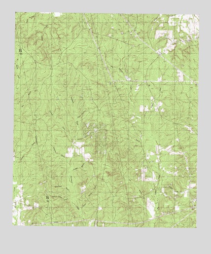
Chambliss Hill, TX USGS Topographic Map
Click on map above to begin viewing in our Map Viewer.

This topographic map contains these locations and features:
Feature Name Type Latitude Longitude GNIS ID View Map
Camp Niwa SpringSpringN30.7638°W94.5038°1998323View Map
Camp NiwanaLocaleN30.7660°W94.5021°1353655View Map
Conner BranchStreamN30.7833°W94.5874°1354880View Map
Coontop CreekStreamN30.7969°W94.5838°1354940View Map
Fall BranchStreamN30.7558°W94.5283°1357204View Map
Flat BranchStreamN30.8008°W94.5294°1357419View Map
George CemeteryCemeteryN30.7855°W94.6091°1357949View Map
Hubert CemeteryCemeteryN30.7699°W94.6016°1359765View Map
Hubert Spring BranchStreamN30.7646°W94.5849°1359766View Map
Jeko LakeReservoirN30.8384°W94.5494°1861671View Map
Jeko Lake DamDamN30.8369°W94.5469°1861670View Map
New Shiloh ChurchChurchN30.7849°W94.5077°1363780View Map
Pigpen BranchStreamN30.8063°W94.5813°1365210View Map
Sawmill BranchStreamN30.8002°W94.5830°1367799View Map
Shady Grove ChurchChurchN30.7802°W94.5691°1368019View Map
Shiloh CemeteryCemeteryN30.8127°W94.5038°1368152View Map
Shiloh ChurchChurchN30.8105°W94.5138°1368161View Map
Swearingen BranchStreamN30.7671°W94.5846°1369457View Map
Treasure BranchStreamN30.7880°W94.5858°1370099View Map
Waters Spring BranchStreamN30.7585°W94.5788°1370927View Map
Wolf Pen CreekStreamN30.8085°W94.5349°1371864View Map

Note: Coordinates in the location and feature list above are referenced to NAD83 datum.


Copyright (C) 2008-2025 Ryan Niemi / Sunset Dynamics ... All Rights Reserved