TopoQuest Logo
Do you find TopoQuest useful?
Help keep TopoQuest running and adding new maps/features by donating!
Bitcoin:  19c7KJd3qBynnjoSw5npx9KScwjBe4ifkT
Litecoin:  LXs6TkuXGGXo1vDsWCkWVdjQX94eUKd6ui
Home View Maps Find Maps Find Places Resources & Links


Camden, Texas Topographic Map

USGS Map Title: Camden, TX
USGS Map MRC: 30094H6
DRG (GeoTIFF) Download: o30094h6.tif


Neighboring USGS Topographic Map Quads:


  Wakefield, TX  
31094A7
 

  Pluck, TX  
31094A6
 

  Wolf Hill, TX  
31094A5
 

  Corrigan, TX  
30094H7
 

  Camden, TX  
30094H6
 

  Chester, TX  
30094H5
 

  Leggett, TX  
30094G7
 

  Hortense, TX  
30094G6
 

  Chambliss Hill, TX  
30094G5


Map MRC Location:

N31°
W95°
N31°
W94°
H8 H7 H6 H5 H4 H3 H2 H1
G8 G7 G6 G5 G4 G3 G2 G1
F8 F7 F6 F5 F4 F3 F2 F1
E8 E7 E6 E5 E4 E3 E2 E1
D8 D7 D6 D5 D4 D3 D2 D1
C8 C7 C6 C5 C4 C3 C2 C1
B8 B7 B6 B5 B4 B3 B2 B1
A8 A7 A6 A5 A4 A3 A2 A1
N30°
W95°
N30°
W94°

Camden, TX USGS 1:24K Topographic Map Preview:
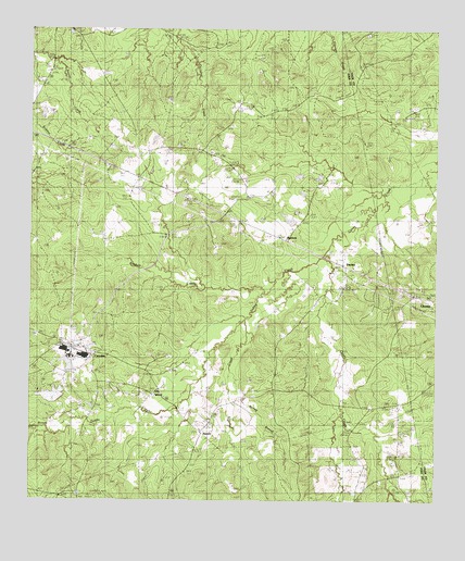
Camden, TX USGS Topographic Map
Click on map above to begin viewing in our Map Viewer.

This topographic map contains these locations and features:
Feature Name Type Latitude Longitude GNIS ID View Map
BarnesPopulated PlaceN30.8933°W94.6969°1379391View Map
BarnumPopulated PlaceN30.9449°W94.6727°1379392View Map
Barnum LakeReservoirN30.9498°W94.6707°1854322View Map
Barnum Lake DamDamN30.9502°W94.6685°1854321View Map
CamdenPopulated PlaceN30.9171°W94.7344°1353595View Map
Camden Post OfficePost OfficeN30.9159°W94.7357°2732332View Map
Caney Creek ChurchChurchN30.8838°W94.6352°1353743View Map
Carter LakeReservoirN30.9027°W94.7431°1864443View Map
Carter Lake DamDamN30.9019°W94.7402°1864442View Map
Dabbs BranchStreamN30.9396°W94.6596°1355533View Map
Dabbs CreekStreamN30.8919°W94.7449°1350791View Map
Darden CemeteryCemeteryN30.9313°W94.6613°1355644View Map
Darden Palestine SchoolSchoolN30.9332°W94.6521°1355645View Map
Davis CemeteryCemeteryN30.8830°W94.6316°1355694View Map
Elm CreekStreamN30.9232°W94.6835°1356950View Map
Lily IslandPopulated PlaceN30.9041°W94.7097°1380086View Map
Lily Island CemeteryCemeteryN30.8969°W94.6944°1361197View Map
Nowlin CemeteryCemeteryN30.8910°W94.6302°1364232View Map
Old BarnumLocaleN30.9585°W94.6596°1364388View Map
Peach Tree Village CemeteryCemeteryN30.9507°W94.6274°1384772View Map
Pine Grove ChurchChurchN30.9494°W94.6955°1365280View Map
Pine PondReservoirN30.9113°W94.7386°1854301View Map
Pine Pond DamDamN30.9135°W94.7385°1854300View Map
Pullen CemeteryCemeteryN30.9005°W94.6455°1365850View Map
Whitehead CemeteryCemeteryN30.8994°W94.6380°1371442View Map

Note: Coordinates in the location and feature list above are referenced to NAD83 datum.


Copyright (C) 2008-2024 Ryan Niemi / Sunset Dynamics ... All Rights Reserved