TopoQuest Logo
Do you find TopoQuest useful?
Help keep TopoQuest running and adding new maps/features by donating!
Bitcoin:  19c7KJd3qBynnjoSw5npx9KScwjBe4ifkT
Litecoin:  LXs6TkuXGGXo1vDsWCkWVdjQX94eUKd6ui
Home View Maps Find Maps Find Places Resources & Links


Woodville, Texas Topographic Map

USGS Map Title: Woodville, TX
USGS Map MRC: 30094G4
DRG (GeoTIFF) Download: o30094g4.tif


Neighboring USGS Topographic Map Quads:


  Chester, TX  
30094H5
 

  Colmesneil, TX  
30094H4
 

  Boggy Lake, TX  
30094H3
 

  Chambliss Hill, TX  
30094G5
 

  Woodville, TX  
30094G4
 

  Birdwell Lake, TX  
30094G3
 

  Jacks Creek North, TX  
30094F5
 

  Hillister, TX  
30094F4
 

  Kirkpatrick Lake, TX  
30094F3


Map MRC Location:

N31°
W95°
N31°
W94°
H8 H7 H6 H5 H4 H3 H2 H1
G8 G7 G6 G5 G4 G3 G2 G1
F8 F7 F6 F5 F4 F3 F2 F1
E8 E7 E6 E5 E4 E3 E2 E1
D8 D7 D6 D5 D4 D3 D2 D1
C8 C7 C6 C5 C4 C3 C2 C1
B8 B7 B6 B5 B4 B3 B2 B1
A8 A7 A6 A5 A4 A3 A2 A1
N30°
W95°
N30°
W94°

Woodville, TX USGS 1:24K Topographic Map Preview:
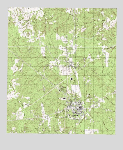
Woodville, TX USGS Topographic Map
Click on map above to begin viewing in our Map Viewer.

This topographic map contains these locations and features:
Feature Name Type Latitude Longitude GNIS ID View Map
Barlow ChapelChurchN30.8371°W94.3871°1351518View Map
Crow CreekStreamN30.8733°W94.4630°1355425View Map
Dies CommunityPopulated PlaceN30.8613°W94.4899°1354342View Map
Dogwood Emergency Medical ServiceBuildingN30.7723°W94.4156°2721016View Map
DoucettePopulated PlaceN30.8183°W94.4288°1356206View Map
Doucette BranchStreamN30.7935°W94.4255°1356207View Map
Doucette Post OfficePost OfficeN30.8195°W94.4287°2731694View Map
Dunrovin HatcheryLocaleN30.7905°W94.3794°1384551View Map
East Branch Turkey CreekStreamN30.8083°W94.4394°1356580View Map
Egypt ChurchChurchN30.8699°W94.3974°1356841View Map
Faith Lutheran ChurchChurchN30.7735°W94.4219°2024384View Map
Forest LakeReservoirN30.7969°W94.4085°1861677View Map
Forest Lake DamDamN30.7969°W94.4085°1861676View Map
Haralson LakesPopulated PlaceN30.8733°W94.3802°2034926View Map
Heritage Village MuseumBuildingN30.7699°W94.4424°2014406View Map
Josiah Wheat LakeReservoirN30.7952°W94.4552°1861673View Map
Josiah Wheat Lake DamDamN30.7952°W94.4552°1861672View Map
Little Turkey CreekStreamN30.7652°W94.4144°1361492View Map
Magnolia HillsPopulated PlaceN30.7783°W94.4769°1380128View Map
Magnolia Hills LakeReservoirN30.7793°W94.4753°1861675View Map
Magnolia Hills Lake DamDamN30.7785°W94.4752°1861674View Map
Our Lady of Pines Catholic ChurchChurchN30.7913°W94.4358°2024383View Map
Texas Department of Criminal Justice Gib Lewis UnitBuildingN30.7956°W94.3978°2738557View Map
Town of WoodvilleCivilN30.7739°W94.4235°2413511View Map
True Gospel Holiness ChurchChurchN30.7713°W94.4127°2024386View Map
Tyler CountyCivilN30.7712°W94.3766°1384014View Map
Tyler County AirportAirportN30.7742°W94.4597°1387769View Map
Tyler County Constable Precinct 1BuildingN30.7749°W94.4156°2751539View Map
Tyler County Constable Precinct 2BuildingN30.7749°W94.4156°2751542View Map
Tyler County Constable Precinct 3BuildingN30.7749°W94.4156°2751541View Map
Tyler County Constable Precinct 4BuildingN30.7749°W94.4156°2751540View Map
Tyler County CourthouseBuildingN30.7755°W94.4152°2030530View Map
Tyler County HospitalHospitalN30.7760°W94.4290°2015690View Map
Tyler County Hospital HeliportAirportN30.7763°W94.4283°1387770View Map
Tyler County JailBuildingN30.7747°W94.4156°2738697View Map
Tyler County Sheriff' OfficeBuildingN30.7818°W94.4146°2751228View Map
Whites Chapel ChurchChurchN30.7713°W94.4127°2024387View Map
WoodvillePopulated PlaceN30.7752°W94.4155°1371934View Map
Woodville City OfficeBuildingN30.7757°W94.4187°2753810View Map
Woodville DivisionCivilN30.7643°W94.4398°1939339View Map
Woodville Elementary SchoolSchoolN30.7796°W94.4180°2009068View Map
Woodville High SchoolSchoolN30.7885°W94.4341°2009069View Map
Woodville Intermediate SchoolSchoolN30.7785°W94.4163°2009070View Map
Woodville Police DepartmentBuildingN30.7762°W94.4163°2751145View Map
Woodville Post OfficePost OfficeN30.7740°W94.4179°2731307View Map
Woodville United Methodist ChurchChurchN30.7752°W94.4194°2024385View Map
Woodville Volunteer Fire DepartmentBuildingN30.7762°W94.4170°2655151View Map

Note: Coordinates in the location and feature list above are referenced to NAD83 datum.


Copyright (C) 2008-2024 Ryan Niemi / Sunset Dynamics ... All Rights Reserved