TopoQuest Logo
Do you find TopoQuest useful?
Help keep TopoQuest running and adding new maps/features by donating!
Bitcoin:  19c7KJd3qBynnjoSw5npx9KScwjBe4ifkT
Litecoin:  LXs6TkuXGGXo1vDsWCkWVdjQX94eUKd6ui
Home View Maps Find Maps Find Places Resources & Links


Chaneysville, Pennsylvania Topographic Map

USGS Map Title: Chaneysville, PA
USGS Map MRC: 39078G4
DRG (GeoTIFF) Download: o39078g4.tif


Neighboring USGS Topographic Map Quads:


  Rainsburg, PA  
39078H5
 

  Clearville, PA  
39078H4
 

  Mench, PA  
39078H3
 

  Beans Cove, PA  
39078G5
 

  Chaneysville, PA  
39078G4
 

  Amaranth, PA  
39078G3
 

  Flintstone, MD  
39078F5
 

  Artemas, PA  
39078F4
 

  Bellegrove, MD  
39078F3


Map MRC Location:

N40°
W79°
N40°
W78°
H8 H7 H6 H5 H4 H3 H2 H1
G8 G7 G6 G5 G4 G3 G2 G1
F8 F7 F6 F5 F4 F3 F2 F1
E8 E7 E6 E5 E4 E3 E2 E1
D8 D7 D6 D5 D4 D3 D2 D1
C8 C7 C6 C5 C4 C3 C2 C1
B8 B7 B6 B5 B4 B3 B2 B1
A8 A7 A6 A5 A4 A3 A2 A1
N39°
W79°
N39°
W78°

Chaneysville, PA USGS 1:24K Topographic Map Preview:
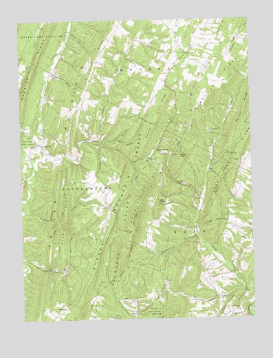
Chaneysville, PA USGS Topographic Map
Click on map above to begin viewing in our Map Viewer.

This topographic map contains these locations and features:
Feature Name Type Latitude Longitude GNIS ID View Map
Ash - Snyder CemeteryCemeteryN39.8387°W78.4409°2776037View Map
Barkman CemeteryCemeteryN39.8504°W78.4617°2776039View Map
Barkman SchoolSchoolN39.8587°W78.4583°1200972View Map
Bethel ChurchChurchN39.8179°W78.4786°1169373View Map
Big MountainSummitN39.7768°W78.4461°1169538View Map
Big Mountain TrailTrailN39.7768°W78.4464°1206730View Map
Blackberry Lick RunStreamN39.7837°W78.4039°1209290View Map
Blues GapGapN39.7715°W78.4864°1169904View Map
Bowman RidgeRidgeN39.8420°W78.4203°1170068View Map
Bowman Ridge TrailTrailN39.8229°W78.4328°1206722View Map
Bowman TrailTrailN39.8301°W78.4336°1206723View Map
Browning TrailTrailN39.7820°W78.4781°1206728View Map
Bushy ForkStreamN39.8248°W78.4633°1192222View Map
Buttermilk HollowValleyN39.8531°W78.4831°1170812View Map
Center School (historical)SchoolN39.7593°W78.3953°1200975View Map
ChaneysvillePopulated PlaceN39.8237°W78.4892°1171560View Map
Chaneysville Methodist / East View CemeteryCemeteryN39.8219°W78.4880°2776059View Map
Chaneysville Volunteer Fire Company - Station 39BuildingN39.8132°W78.4966°2645527View Map
Clear RidgeRidgeN39.8573°W78.4589°1171962View Map
Conrad School (historical)SchoolN39.8012°W78.4056°1200974View Map
Dickens TrailTrailN39.7884°W78.4650°1206729View Map
El - Bethel Assembly of God CemeteryCemeteryN39.8181°W78.4773°2776074View Map
ElbinsvillePopulated PlaceN39.7548°W78.4756°1174071View Map
Elk Lick CreekStreamN39.8170°W78.4861°1174115View Map
Fairview CemeteryCemeteryN39.7541°W78.3824°2776076View Map
Fairview ChurchChurchN39.7540°W78.3836°1174509View Map
Fisher TrailTrailN39.8159°W78.3811°1174824View Map
Five ForksPopulated PlaceN39.8609°W78.4086°1203574View Map
Fletcher Family CemeteryCemeteryN39.8601°W78.4193°2776080View Map
Fletcher SchoolSchoolN39.8570°W78.4153°1200973View Map
Gabriel TrailTrailN39.7534°W78.4217°1206736View Map
Georgetown BranchStreamN39.7943°W78.4986°1175543View Map
Green PointLocaleN39.7695°W78.3836°1207176View Map
Heifer Lick TrailTrailN39.7512°W78.4453°1206731View Map
InglesmithPopulated PlaceN39.7515°W78.3817°1177812View Map
Johnson BranchStreamN39.7615°W78.3795°1178106View Map
Kinser HeightsSummitN39.8168°W78.4139°1178522View Map
Lawhead TrailTrailN39.8098°W78.3939°1179045View Map
Lebanon ChurchChurchN39.7523°W78.4386°1179097View Map
Lester TrailTrailN39.7659°W78.4714°1206761View Map
Millers CornersLocaleN39.8187°W78.4208°1181243View Map
Mount ZionLocaleN39.7968°W78.4522°1200952View Map
Mount Zion Christian CemeteryCemeteryN39.7971°W78.4514°2776123View Map
Mount Zion ChurchChurchN39.7973°W78.4522°1181910View Map
ParcellLocaleN39.8393°W78.4011°1207177View Map
Pennsylvania Conservation and Natural Resources District 2 HeadquartersBuildingN39.8238°W78.4912°2645567View Map
Pine Grove ChurchChurchN39.8179°W78.3861°1183805View Map
Pine RidgeRidgeN39.7754°W78.4778°1183864View Map
Pine Ridge Natural AreaAreaN39.7959°W78.4706°1212058View Map
Pinegrove Christian Church CemeteryCemeteryN39.8185°W78.3864°2776138View Map
Piney CreekLocaleN39.7884°W78.4050°1213443View Map
Piney Lick SchoolSchoolN39.8098°W78.4975°1200971View Map
Polish Mountain TrailTrailN39.7979°W78.4814°1206727View Map
Ragged MountainSummitN39.7604°W78.4675°1184597View Map
Ragged Mountain AirportAirportN39.8170°W78.4790°2717078View Map
Ragged Mountain TrailTrailN39.8051°W78.4431°1206726View Map
Red Pine TrailTrailN39.7979°W78.4108°1206724View Map
Rob SpringSpringN39.7984°W78.4245°1185191View Map
Roscoe TrailTrailN39.7759°W78.4347°1206763View Map
Silas TrailTrailN39.7934°W78.3914°1206725View Map
Smith TrailTrailN39.7676°W78.4517°1206762View Map
Steckman RidgeRidgeN39.8520°W78.3875°1188578View Map
Stoney Lick SchoolSchoolN39.8251°W78.4622°1200764View Map
Sweet Root CreekStreamN39.8168°W78.4886°1193507View Map
Sweet Root Picnic AreaAreaN39.8309°W78.4995°1212059View Map
Sweet Root RunStreamN39.8329°W78.4986°1189173View Map
Tewell RunStreamN39.7778°W78.4239°2100384View Map
Three Lick HollowValleyN39.8699°W78.4715°1189539View Map
Township of MannCivilN39.7659°W78.4045°1215902View Map
Wilson RunStreamN39.8170°W78.4861°1191542View Map
Zion ChurchChurchN39.8526°W78.4197°1191969View Map
Zion Lutheran Church CemeteryCemeteryN39.8532°W78.4207°2776181View Map

Note: Coordinates in the location and feature list above are referenced to NAD83 datum.


Copyright (C) 2008-2025 Ryan Niemi / Sunset Dynamics ... All Rights Reserved