TopoQuest Logo
Do you find TopoQuest useful?
Help keep TopoQuest running and adding new maps/features by donating!
Bitcoin:  19c7KJd3qBynnjoSw5npx9KScwjBe4ifkT
Litecoin:  LXs6TkuXGGXo1vDsWCkWVdjQX94eUKd6ui
Home View Maps Find Maps Find Places Resources & Links


Rainsburg, Pennsylvania Topographic Map

USGS Map Title: Rainsburg, PA
USGS Map MRC: 39078H5
DRG (GeoTIFF) Download: o39078h5.tif


Neighboring USGS Topographic Map Quads:


  Schellsburg, PA  
40078A6
 

  Bedford, PA  
40078A5
 

  Everett West, PA  
40078A4
 

  Buffalo Mills, PA  
39078H6
 

  Rainsburg, PA  
39078H5
 

  Clearville, PA  
39078H4
 

  Hyndman, PA  
39078G6
 

  Beans Cove, PA  
39078G5
 

  Chaneysville, PA  
39078G4


Map MRC Location:

N40°
W79°
N40°
W78°
H8 H7 H6 H5 H4 H3 H2 H1
G8 G7 G6 G5 G4 G3 G2 G1
F8 F7 F6 F5 F4 F3 F2 F1
E8 E7 E6 E5 E4 E3 E2 E1
D8 D7 D6 D5 D4 D3 D2 D1
C8 C7 C6 C5 C4 C3 C2 C1
B8 B7 B6 B5 B4 B3 B2 B1
A8 A7 A6 A5 A4 A3 A2 A1
N39°
W79°
N39°
W78°

Rainsburg, PA USGS 1:24K Topographic Map Preview:
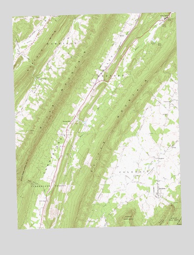
Rainsburg, PA USGS Topographic Map
Click on map above to begin viewing in our Map Viewer.

This topographic map contains these locations and features:
Feature Name Type Latitude Longitude GNIS ID View Map
Bedford County Home - Alms House CemeteryCemeteryN39.9853°W78.5456°2776044View Map
Bedford SpringsPopulated PlaceN39.9973°W78.5097°1169085View Map
Bedford Valley ChurchChurchN39.8912°W78.6025°1169086View Map
BeegletonPopulated PlaceN39.9148°W78.5153°1169121View Map
Black SpringSpringN39.9819°W78.5140°1169737View Map
Borough of RainsburgCivilN39.8957°W78.5173°1214903View Map
Burning BushPopulated PlaceN39.9381°W78.5803°1170729View Map
Burning Bush CemeteryCemeteryN39.9369°W78.5831°2776057View Map
CharlesvillePopulated PlaceN39.9487°W78.5042°1203249View Map
Cove ChurchChurchN39.9012°W78.5336°1172521View Map
Crystal SpringSpringN39.9930°W78.5101°1172805View Map
Cumberland ValleyBasinN39.9473°W78.5734°1172828View Map
James SchoolSchoolN39.9229°W78.5297°1200741View Map
Magnesium SpringSpringN39.9962°W78.5063°1180195View Map
Major John Cessna Burial SiteCemeteryN39.9933°W78.5352°2776106View Map
McFerron SchoolSchoolN39.9434°W78.5764°1200927View Map
Milligan CoveValleyN39.9971°W78.5765°1181265View Map
Pender School (historical)SchoolN39.9631°W78.5492°1200740View Map
RainsburgPopulated PlaceN39.8943°W78.5161°1184608View Map
Red Oaks LakesReservoirN39.9834°W78.5169°1184772View Map
Sand Spring RunStreamN39.8934°W78.6014°1186930View Map
Sulfur Springs StationLocaleN39.9840°W78.6214°1206838View Map
Sulphur SpringsPopulated PlaceN39.9640°W78.6078°1189013View Map
Sulphur Springs CreekStreamN39.9815°W78.6225°1189015View Map
Sulphur Springs Post Office (historical)Post OfficeN39.9640°W78.6078°2027095View Map
Sweet Root CemeteryCemeteryN39.9734°W78.5277°2776169View Map
Teaberry SchoolSchoolN39.9104°W78.5831°1200928View Map
Township of ColerainCivilN39.9248°W78.5066°1215890View Map
Wertz SchoolSchoolN39.9842°W78.5872°1200739View Map
White Sulpher SpringsSpringN39.9640°W78.6077°1202173View Map
Woods Church CemeteryCemeteryN39.9013°W78.5340°2776179View Map
Yeager ChurchChurchN39.9012°W78.5167°1191868View Map
Yeager Memorial Lutheran ChurchCemeteryN39.9014°W78.5173°2776180View Map

Note: Coordinates in the location and feature list above are referenced to NAD83 datum.


Copyright (C) 2008-2024 Ryan Niemi / Sunset Dynamics ... All Rights Reserved