TopoQuest Logo
Do you find TopoQuest useful?
Help keep TopoQuest running and adding new maps/features by donating!
Bitcoin:  19c7KJd3qBynnjoSw5npx9KScwjBe4ifkT
Litecoin:  LXs6TkuXGGXo1vDsWCkWVdjQX94eUKd6ui
Home View Maps Find Maps Find Places Resources & Links


Mench, Pennsylvania Topographic Map

USGS Map Title: Mench, PA
USGS Map MRC: 39078H3
DRG (GeoTIFF) Download: o39078h3.tif


Neighboring USGS Topographic Map Quads:


  Everett West, PA  
40078A4
 

  Everett East, PA  
40078A3
 

  Wells Tannery, PA  
40078A2
 

  Clearville, PA  
39078H4
 

  Mench, PA  
39078H3
 

  Breezewood, PA  
39078H2
 

  Chaneysville, PA  
39078G4
 

  Amaranth, PA  
39078G3
 

  Needmore, PA  
39078G2


Map MRC Location:

N40°
W79°
N40°
W78°
H8 H7 H6 H5 H4 H3 H2 H1
G8 G7 G6 G5 G4 G3 G2 G1
F8 F7 F6 F5 F4 F3 F2 F1
E8 E7 E6 E5 E4 E3 E2 E1
D8 D7 D6 D5 D4 D3 D2 D1
C8 C7 C6 C5 C4 C3 C2 C1
B8 B7 B6 B5 B4 B3 B2 B1
A8 A7 A6 A5 A4 A3 A2 A1
N39°
W79°
N39°
W78°

Mench, PA USGS 1:24K Topographic Map Preview:
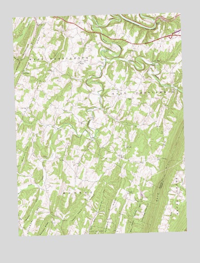
Mench, PA USGS Topographic Map
Click on map above to begin viewing in our Map Viewer.

This topographic map contains these locations and features:
Feature Name Type Latitude Longitude GNIS ID View Map
Baughman ChurchChurchN39.9693°W78.3458°1168818View Map
Baughman Union CemeteryCemeteryN39.9691°W78.3464°2776041View Map
Blackhart Farm CemeteryCemeteryN39.9819°W78.2877°2776052View Map
Brush CreekStreamN39.9034°W78.3572°1170436View Map
Buchanan SchoolSchoolN39.8868°W78.2667°1200968View Map
Calhoun Farm CemeteryCemeteryN39.9700°W78.3583°2776058View Map
Calhoun School (historical)SchoolN39.9620°W78.3567°1200963View Map
Cedar Grove CemeteryCemeteryN39.9789°W78.2850°2776051View Map
Cedar Grove ChurchChurchN39.9790°W78.2847°1171371View Map
Chapman RunStreamN39.9037°W78.3572°1198557View Map
Cherry Lane Brethren CemeteryCemeteryN39.9481°W78.3658°2776060View Map
Cherry Lane ChurchChurchN39.9479°W78.3661°1171647View Map
Clark SchoolSchoolN39.9479°W78.3331°1200964View Map
Clear Creek ChurchChurchN39.9959°W78.3561°1171958View Map
Clear RidgePopulated PlaceN39.9695°W78.3672°1171960View Map
Cooper Farm CemeteryCemeteryN39.9320°W78.3596°2776065View Map
Dibert Farm CemeteryCemeteryN39.9802°W78.3347°2776070View Map
EmersonPopulated PlaceN39.9137°W78.3297°1200965View Map
Felten's Covered BridgeBridgeN39.9729°W78.2886°1954947View Map
Jackson MillsPopulated PlaceN39.9720°W78.2711°1203885View Map
Jackson's Mill Covered BridgeBridgeN39.9709°W78.2706°1954946View Map
James O'Neal CemeteryCemeteryN39.9689°W78.3644°2776096View Map
Juniata CrossingPopulated PlaceN39.9945°W78.2686°1203905View Map
Kagarise - Burger Farm CemeteryCemeteryN39.9357°W78.3502°2776097View Map
MattiePopulated PlaceN39.9195°W78.2981°1180560View Map
MenchPopulated PlaceN39.9734°W78.3245°1180922View Map
Mount Pleasant CemeteryCemeteryN39.9249°W78.2919°2776117View Map
Mount Pleasant ChurchChurchN39.9251°W78.2922°1181811View Map
Mount Union Christian Church CemeteryCemeteryN39.9741°W78.3229°2776121View Map
Mount Union ChurchChurchN39.9737°W78.3220°1181868View Map
Oak Grove SchoolSchoolN39.9312°W78.2647°1200967View Map
Rays HillRidgeN39.9056°W78.2661°1193173View Map
Rock Hill ChurchChurchN39.9179°W78.3397°1185257View Map
Rockhill CemeteryCemeteryN39.9186°W78.3390°2776151View Map
Shaffer CreekStreamN39.9740°W78.3058°1187327View Map
Sparks Family CemeteryCemeteryN39.9934°W78.3528°2776166View Map
Stevens ChapelChurchN39.8984°W78.2920°1188623View Map
Stevens Methodist Chapel Church CemeteryCemeteryN39.8982°W78.2923°2776150View Map
Township of West ProvidenceCivilN39.9954°W78.3502°1215909View Map
Union Memorial CemeteryCemeteryN39.9564°W78.2973°2776174View Map
Union Memorial ChurchChurchN39.9570°W78.2970°1190163View Map
Weimer RunStreamN39.8990°W78.3747°1190781View Map
Wesley ChapelChurchN39.9512°W78.2878°1190853View Map
Wildcat HollowValleyN39.9009°W78.2532°1191414View Map
Woodbush SchoolSchoolN39.9518°W78.2881°1200966View Map

Note: Coordinates in the location and feature list above are referenced to NAD83 datum.


Copyright (C) 2008-2024 Ryan Niemi / Sunset Dynamics ... All Rights Reserved