TopoQuest Logo
Do you find TopoQuest useful?
Help keep TopoQuest running and adding new maps/features by donating!
Bitcoin:  19c7KJd3qBynnjoSw5npx9KScwjBe4ifkT
Litecoin:  LXs6TkuXGGXo1vDsWCkWVdjQX94eUKd6ui
Home View Maps Find Maps Find Places Resources & Links


Chapman, Kansas Topographic Map

USGS Map Title: Chapman, KS
USGS Map MRC: 38097H1
DRG (GeoTIFF) Download: o38097h1.tif


Neighboring USGS Topographic Map Quads:


  Buckeye, KS  
39097A2
 

  Upland, KS  
39097A1
 

  Milford Dam, KS  
39096A8
 

  Abilene, KS  
38097H2
 

  Chapman, KS  
38097H1
 

  Kansas Falls, KS  
38096H8
 

  Abilene SW, KS  
38097G2
 

  Navarre, KS  
38097G1
 

  Woodbine, KS  
38096G8


Map MRC Location:

N39°
W98°
N39°
W97°
H8 H7 H6 H5 H4 H3 H2 H1
G8 G7 G6 G5 G4 G3 G2 G1
F8 F7 F6 F5 F4 F3 F2 F1
E8 E7 E6 E5 E4 E3 E2 E1
D8 D7 D6 D5 D4 D3 D2 D1
C8 C7 C6 C5 C4 C3 C2 C1
B8 B7 B6 B5 B4 B3 B2 B1
A8 A7 A6 A5 A4 A3 A2 A1
N38°
W98°
N38°
W97°

Chapman, KS USGS 1:24K Topographic Map Preview:
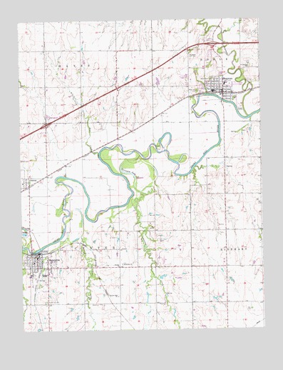
Chapman, KS USGS Topographic Map
Click on map above to begin viewing in our Map Viewer.

This topographic map contains these locations and features:
Feature Name Type Latitude Longitude GNIS ID View Map
Academy Airport (historical)AirportN38.8917°W97.1211°481417View Map
Alida Pearl Co - Operative Association Grain Elevator Number 1LocaleN38.9696°W97.0143°2695323View Map
Bethlehem ChurchChurchN38.9017°W97.0731°476687View Map
ChapmanPopulated PlaceN38.9722°W97.0225°476688View Map
Chapman City HallBuildingN38.9705°W97.0195°2693100View Map
Chapman City LibraryBuildingN38.9705°W97.0195°2692598View Map
Chapman CreekStreamN38.9606°W97.0064°476163View Map
Chapman Elementary SchoolSchoolN38.9809°W97.0250°2497506View Map
Chapman Fire DepartmentBuildingN38.9706°W97.0195°2111173View Map
Chapman High SchoolSchoolN38.9710°W97.0249°480914View Map
Chapman Middle SchoolSchoolN38.9740°W97.0186°480913View Map
Chapman Police DepartmentBuildingN38.9705°W97.0196°2503800View Map
Chapman Post OfficePost OfficeN38.9715°W97.0196°2693662View Map
Chapman United Methodist ChurchChurchN38.9754°W97.0217°2689372View Map
Chapman Wastewater PlantLocaleN38.9642°W97.0117°2692118View Map
City of ChapmanCivilN38.9740°W97.0237°2393800View Map
City of EnterpriseCivilN38.9024°W97.1162°2394695View Map
DetroitPopulated PlaceN38.9350°W97.1209°485450View Map
Detroit Census Designated PlaceCensusN38.9359°W97.1247°2583498View Map
Dickinson County Fire District 1 Station 1BuildingN38.9915°W97.0244°2111257View Map
Dickinson County Fire District 1 Station 2BuildingN38.9054°W97.1164°2111258View Map
EnterprisePopulated PlaceN38.9028°W97.1170°476680View Map
Enterprise City HallBuildingN38.9036°W97.1172°2693135View Map
Enterprise Elementary SchoolSchoolN38.9028°W97.1187°480916View Map
Enterprise Fire DepartmentBuildingN38.9038°W97.1170°2111305View Map
Enterprise First Baptist ChurchChurchN38.9006°W97.0750°476686View Map
Enterprise Police DepartmentBuildingN38.9036°W97.1172°2504014View Map
Enterprise Post OfficePost OfficeN38.9046°W97.1175°2693712View Map
Enterprise Public LibraryBuildingN38.9038°W97.1171°2694638View Map
Enterprise Seventh - day Adventist SchoolSchoolN38.8989°W97.1182°480915View Map
Enterprise Seventh Day Adventist ChurchChurchN38.8989°W97.1204°2689289View Map
Enterprise United Methodist ChurchChurchN38.9025°W97.1198°2688648View Map
Enterprise Wastewater Treatment PlantLocaleN38.9069°W97.1133°2692070View Map
Four Seasons Recreational Vehicle AcresLocaleN38.9615°W97.1104°2694415View Map
Grace Baptist ChurchChurchN38.9695°W97.0189°2690078View Map
Great Plains AcademySchoolN38.8978°W97.1205°2720253View Map
Indian Hill CemeteryCemeteryN38.9710°W97.0334°476689View Map
Indian Hill Golf CourseLocaleN38.9748°W97.0352°485402View Map
John's Mobile Home ParkPopulated PlaceN38.9770°W97.0406°2694104View Map
Kansas Auto Racing MuseumBuildingN38.9809°W97.0214°2694968View Map
Lone Tree CreekStreamN38.9450°W97.0845°476691View Map
Lutheran Cemetery Number 17CemeteryN38.9013°W97.0732°2673239View Map
M and M Mobile Home CourtPopulated PlaceN38.9908°W97.0260°2694120View Map
Mount Hope CemeteryCemeteryN38.8867°W97.1129°476684View Map
Pleasant Hill CemeteryCemeteryN38.8885°W97.0755°2673250View Map
Pleasant Hill ChurchChurchN38.8886°W97.0761°476685View Map
Prairie Cottage AirportAirportN38.9160°W97.0093°2651096View Map
Prichard AirstripAirportN38.8983°W97.1135°481457View Map
Riverside Stock FarmLocaleN38.9525°W97.0914°2726546View Map
Saint Michael's Catholic ChurchChurchN38.9726°W97.0172°2690874View Map
Saint Patricks CemeteryCemeteryN38.9815°W97.0063°2673251View Map
Saint Patricks ChurchChurchN38.9806°W97.0070°476690View Map
Shamrock Mobile Home EstatesPopulated PlaceN38.9735°W97.0130°2694159View Map
Sherer Memorial Luthern ChurchChurchN38.9714°W97.0236°2689720View Map
Terrapin LakeLakeN38.9385°W97.0700°476681View Map
Township of CenterCivilN38.9151°W97.0931°476679View Map
Township of NobleCivilN38.9995°W97.0053°476494View Map

Note: Coordinates in the location and feature list above are referenced to NAD83 datum.


Copyright (C) 2008-2024 Ryan Niemi / Sunset Dynamics ... All Rights Reserved