TopoQuest Logo
Do you find TopoQuest useful?
Help keep TopoQuest running and adding new maps/features by donating!
Bitcoin:  19c7KJd3qBynnjoSw5npx9KScwjBe4ifkT
Litecoin:  LXs6TkuXGGXo1vDsWCkWVdjQX94eUKd6ui
Home View Maps Find Maps Find Places Resources & Links


Chappee Rapids, Michigan Topographic Map

USGS Map Title: Chappee Rapids, MI
USGS Map MRC: 45087B6
DRG (GeoTIFF) Download: o45087b6.tif


Neighboring USGS Topographic Map Quads:


  Bear Point, MI  
45087C7
 

  McAllister, WI  
45087C6
 

  Wallace, MI  
45087C5
 

  Porterfield, WI  
45087B7
 

  Chappee Rapids, MI  
45087B6
 

  Birch Creek, MI  
45087B5
 

  Harmony, WI  
45087A7
 

  Marinette West, WI  
45087A6
 

  Marinette East, WI  
45087A5


Map MRC Location:

N46°
W88°
N46°
W87°
H8 H7 H6 H5 H4 H3 H2 H1
G8 G7 G6 G5 G4 G3 G2 G1
F8 F7 F6 F5 F4 F3 F2 F1
E8 E7 E6 E5 E4 E3 E2 E1
D8 D7 D6 D5 D4 D3 D2 D1
C8 C7 C6 C5 C4 C3 C2 C1
B8 B7 B6 B5 B4 B3 B2 B1
A8 A7 A6 A5 A4 A3 A2 A1
N45°
W88°
N45°
W87°

Chappee Rapids, MI USGS 1:24K Topographic Map Preview:
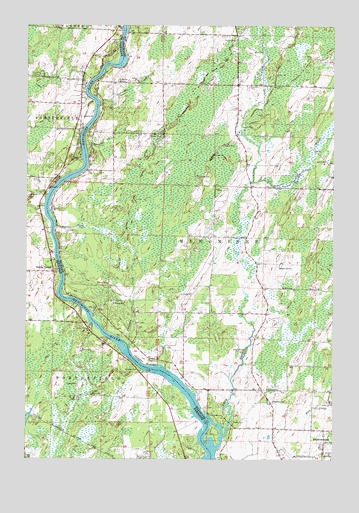
Chappee Rapids, MI USGS Topographic Map
Click on map above to begin viewing in our Map Viewer.

This topographic map contains these locations and features:
Feature Name Type Latitude Longitude GNIS ID View Map
Chappee CreekStreamN45.1575°W87.7082°623101View Map
Chappee RapidsRapidsN45.1519°W87.7012°623102View Map
Chappee Rapids Historical MarkerParkN45.1544°W87.7014°2353270View Map
Hamilton SchoolSchoolN45.1419°W87.6490°627685View Map
Kelley CreekStreamN45.2050°W87.6573°629516View Map
Little RiverStreamN45.1341°W87.6676°630750View Map
Little River Post Office (historical)Post OfficeN45.2036°W87.6583°2353161View Map
Martin CreekStreamN45.1922°W87.7384°631651View Map
Mason ParkParkN45.1355°W87.6654°631710View Map
Menominee-Marinette Twin County AirportAirportN45.1263°W87.6391°1624040View Map
MilesPopulated PlaceN45.2272°W87.7290°1876857View Map
Ostrango CreekStreamN45.2139°W87.7259°634149View Map
Redling School (historical)SchoolN45.1430°W87.6954°1876867View Map
Rubys CornerPopulated PlaceN45.1789°W87.7398°1572708View Map
Saint Mary's Mission CemeteryCemeteryN45.2339°W87.7144°2353256View Map
Saint Marys MissionChurchN45.2336°W87.7134°636912View Map
Sobiesky CreekStreamN45.2266°W87.7204°638228View Map
Township of MenomineeCivilN45.2122°W87.6479°1626724View Map
Twin CreekStreamN45.2000°W87.7423°1575774View Map
Twin Island RapidsFallsN45.2342°W87.7231°2353271View Map
Winesville CemeteryCemeteryN45.2340°W87.7286°1576863View Map
Wineville School (historical)SchoolN45.2275°W87.7293°1876879View Map
Ziemann ParkParkN45.1511°W87.7046°1577126View Map

Note: Coordinates in the location and feature list above are referenced to NAD83 datum.


Copyright (C) 2008-2024 Ryan Niemi / Sunset Dynamics ... All Rights Reserved