TopoQuest Logo
Do you find TopoQuest useful?
Help keep TopoQuest running and adding new maps/features by donating!
Bitcoin:  19c7KJd3qBynnjoSw5npx9KScwjBe4ifkT
Litecoin:  LXs6TkuXGGXo1vDsWCkWVdjQX94eUKd6ui
Home View Maps Find Maps Find Places Resources & Links


Bear Point, Michigan Topographic Map

USGS Map Title: Bear Point, MI
USGS Map MRC: 45087C7
DRG (GeoTIFF) Download: o45087c7.tif


Neighboring USGS Topographic Map Quads:


  Wausaukee North, WI  
45087D8
 

  Resort Lake, MI  
45087D7
 

  Swanson, MI  
45087D6
 

  Wausaukee South, WI  
45087C8
 

  Bear Point, MI  
45087C7
 

  McAllister, WI  
45087C6
 

  Loomis, WI  
45087B8
 

  Porterfield, WI  
45087B7
 

  Chappee Rapids, MI  
45087B6


Map MRC Location:

N46°
W88°
N46°
W87°
H8 H7 H6 H5 H4 H3 H2 H1
G8 G7 G6 G5 G4 G3 G2 G1
F8 F7 F6 F5 F4 F3 F2 F1
E8 E7 E6 E5 E4 E3 E2 E1
D8 D7 D6 D5 D4 D3 D2 D1
C8 C7 C6 C5 C4 C3 C2 C1
B8 B7 B6 B5 B4 B3 B2 B1
A8 A7 A6 A5 A4 A3 A2 A1
N45°
W88°
N45°
W87°

Bear Point, MI USGS 1:24K Topographic Map Preview:
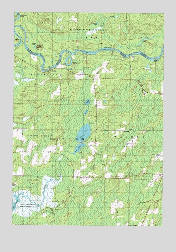
Bear Point, MI USGS Topographic Map
Click on map above to begin viewing in our Map Viewer.

This topographic map contains these locations and features:
Feature Name Type Latitude Longitude GNIS ID View Map
Baker IslandIslandN45.3483°W87.7568°1561102View Map
Bear MountainSummitN45.3541°W87.8540°620872View Map
Bear PointCapeN45.3419°W87.8490°620873View Map
Bear Point County ParkParkN45.3414°W87.8443°1845540View Map
Burke CreekStreamN45.3533°W87.8048°622278View Map
GollPopulated PlaceN45.2803°W87.7509°1565617View Map
Hidden LakeLakeN45.3691°W87.8057°628212View Map
Lake JuliaLakeN45.2952°W87.8204°1567312View Map
Lake MaryLakeN45.3041°W87.8161°1569104View Map
Lake Noquebay State Public Hunting GroundsParkN45.2625°W87.8601°1567746View Map
Lake Noquebay Wildlife Area 2WP1975 DamDamN45.2616°W87.8534°1793621View Map
Little Poche De NocheLakeN45.3418°W87.8281°2784406View Map
Mallard LakeLakeN45.3550°W87.8576°631352View Map
Middle Inlet Lookout TowerTowerN45.3003°W87.8396°1581281View Map
Mud LakeLakeN45.3165°W87.8144°1569947View Map
Oak HillSummitN45.3700°W87.8484°633837View Map
Poche de NocheBendN45.3453°W87.8298°1571712View Map
Snakey LakeLakeN45.3600°W87.7668°638193View Map
Stephenson LakeLakeN45.3224°W87.8133°1574863View Map
Sturgeon LandingLocaleN45.3544°W87.7933°2099836View Map
Upper InletStreamN45.2622°W87.8729°1575970View Map

Note: Coordinates in the location and feature list above are referenced to NAD83 datum.


Copyright (C) 2008-2025 Ryan Niemi / Sunset Dynamics ... All Rights Reserved