TopoQuest Logo
Do you find TopoQuest useful?
Help keep TopoQuest running and adding new maps/features by donating!
Bitcoin:  19c7KJd3qBynnjoSw5npx9KScwjBe4ifkT
Litecoin:  LXs6TkuXGGXo1vDsWCkWVdjQX94eUKd6ui
Home View Maps Find Maps Find Places Resources & Links


McAllister, Wisconsin Topographic Map

USGS Map Title: McAllister, WI
USGS Map MRC: 45087C6
DRG (GeoTIFF) Download: o45087c6.tif


Neighboring USGS Topographic Map Quads:


  Resort Lake, MI  
45087D7
 

  Swanson, MI  
45087D6
 

  Stephenson, MI  
45087D5
 

  Bear Point, MI  
45087C7
 

  McAllister, WI  
45087C6
 

  Wallace, MI  
45087C5
 

  Porterfield, WI  
45087B7
 

  Chappee Rapids, MI  
45087B6
 

  Birch Creek, MI  
45087B5


Map MRC Location:

N46°
W88°
N46°
W87°
H8 H7 H6 H5 H4 H3 H2 H1
G8 G7 G6 G5 G4 G3 G2 G1
F8 F7 F6 F5 F4 F3 F2 F1
E8 E7 E6 E5 E4 E3 E2 E1
D8 D7 D6 D5 D4 D3 D2 D1
C8 C7 C6 C5 C4 C3 C2 C1
B8 B7 B6 B5 B4 B3 B2 B1
A8 A7 A6 A5 A4 A3 A2 A1
N45°
W88°
N45°
W87°

McAllister, WI USGS 1:24K Topographic Map Preview:
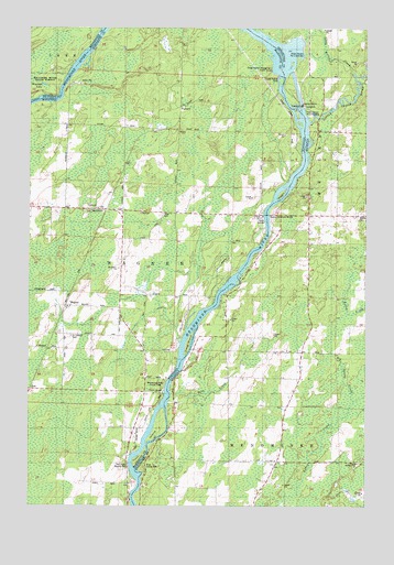
McAllister, WI USGS Topographic Map
Click on map above to begin viewing in our Map Viewer.

This topographic map contains these locations and features:
Feature Name Type Latitude Longitude GNIS ID View Map
Big Spring CreekStreamN45.2775°W87.6298°621356View Map
Community ChurchChurchN45.3278°W87.7246°1845552View Map
DeYoung Family ZooLocaleN45.3069°W87.6467°2353200View Map
Grand Rapids DamDamN45.3622°W87.6565°627107View Map
Grand Rapids DamDamN45.3622°W87.6565°1565716View Map
Grand Rapids FlowageReservoirN45.3622°W87.6564°2784347View Map
Grand Rapids Flowage Number 1 Public AccessParkN45.3639°W87.6607°1845569View Map
Little Cedar RiverStreamN45.3503°W87.6465°1625060View Map
Little Kelley CreekStreamN45.3633°W87.6304°630652View Map
Long IslandIslandN45.2922°W87.6904°1568530View Map
Long ReachAreaN45.3683°W87.7289°2568553View Map
Maggies IslandIslandN45.3316°W87.6562°1568895View Map
McAllisterPopulated PlaceN45.3272°W87.7212°1569158View Map
McAllister SchoolSchoolN45.3122°W87.7165°1569163View Map
Mellen CemeteryCemeteryN45.3266°W87.6271°632082View Map
Menominee River County ParkParkN45.2819°W87.7001°1845594View Map
PackardPopulated PlaceN45.3547°W87.6943°1577764View Map
Pine CreekStreamN45.2786°W87.6971°634907View Map
River ParkFlatN45.2605°W87.7065°635962View Map
River's Edge Adult Care HomeHospitalN45.2925°W87.6875°2353194View Map
Saint Edwards CemeteryCemeteryN45.2944°W87.7340°1572915View Map
Tabor CemeteryCemeteryN45.3264°W87.7009°1575217View Map
Town of WagnerCivilN45.3134°W87.7397°1584338View Map
Twin IslandIslandN45.2675°W87.7046°1575782View Map
Twin Island Wayside ParkParkN45.2608°W87.7126°1845646View Map
WagnerPopulated PlaceN45.3022°W87.7357°1577871View Map
Wagner CreekStreamN45.2925°W87.6939°2440033View Map
Wagner Fire DepartmentBuildingN45.3266°W87.7085°2696862View Map
Wagner TownhallBuildingN45.3266°W87.7087°1845652View Map
Wallace McAllister BridgeBridgeN45.3219°W87.6618°1623688View Map
Wallace McAllister BridgeBridgeN45.3219°W87.6618°1576169View Map
Woesner LakeLakeN45.3600°W87.7451°1616676View Map

Note: Coordinates in the location and feature list above are referenced to NAD83 datum.


Copyright (C) 2008-2024 Ryan Niemi / Sunset Dynamics ... All Rights Reserved