TopoQuest Logo
Do you find TopoQuest useful?
Help keep TopoQuest running and adding new maps/features by donating!
Bitcoin:  19c7KJd3qBynnjoSw5npx9KScwjBe4ifkT
Litecoin:  LXs6TkuXGGXo1vDsWCkWVdjQX94eUKd6ui
Home View Maps Find Maps Find Places Resources & Links


Chase Mills, New York Topographic Map

USGS Map Title: Chase Mills, NY
USGS Map MRC: 44075G1
DRG (GeoTIFF) Download: o44075g1.tif


Neighboring USGS Topographic Map Quads:


  Morrisburg, ON  
44075H2
 

  Louisville, NY  
44075H1
 

  Massena, NY  
44074H8
 

  Waddington, NY  
44075G2
 

  Chase Mills, NY  
44075G1
 

  Norfolk, NY  
44074G8
 

  Morley, NY  
44075F2
 

  West Potsdam, NY  
44075F1
 

  Potsdam, NY  
44074F8


Map MRC Location:

N45°
W76°
N45°
W75°
H8 H7 H6 H5 H4 H3 H2 H1
G8 G7 G6 G5 G4 G3 G2 G1
F8 F7 F6 F5 F4 F3 F2 F1
E8 E7 E6 E5 E4 E3 E2 E1
D8 D7 D6 D5 D4 D3 D2 D1
C8 C7 C6 C5 C4 C3 C2 C1
B8 B7 B6 B5 B4 B3 B2 B1
A8 A7 A6 A5 A4 A3 A2 A1
N44°
W76°
N44°
W75°

Chase Mills, NY USGS 1:24K Topographic Map Preview:
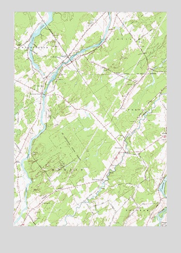
Chase Mills, NY USGS Topographic Map
Click on map above to begin viewing in our Map Viewer.

This topographic map contains these locations and features:
Feature Name Type Latitude Longitude GNIS ID View Map
Allen CornersLocaleN44.7956°W75.0363°975888View Map
Chamberlain CornersLocaleN44.8276°W75.1027°976113View Map
Chamberlain Corners CemeteryCemeteryN44.8316°W75.1009°976114View Map
Chase MillsPopulated PlaceN44.8489°W75.0808°976120View Map
Chase Mills Post OfficePost OfficeN44.8495°W75.0806°2598999View Map
Clark CemeteryCemeteryN44.7607°W75.0229°976141View Map
Dalton CrossingPopulated PlaceN44.8537°W75.1222°976216View Map
DishawPopulated PlaceN44.8387°W75.0402°976246View Map
Dixon CornersLocaleN44.7770°W75.0535°976248View Map
Haskell RidgeRidgeN44.7701°W75.0933°976414View Map
Haskell Ridge CemeteryCemeteryN44.7640°W75.1020°976415View Map
North Winds FarmLocaleN44.7536°W75.0433°2559372View Map
School Number 1 (historical)SchoolN44.7639°W75.1025°2106398View Map
School Number 10 (historical)SchoolN44.8581°W75.1122°2106406View Map
School Number 12 (historical)SchoolN44.8506°W75.0792°2106407View Map
School Number 3 (historical)SchoolN44.7633°W75.0058°2106399View Map
School Number 3 (historical)SchoolN44.7767°W75.0525°2106400View Map
School Number 5 (historical)SchoolN44.8181°W75.0678°2106401View Map
School Number 5 (historical)SchoolN44.8333°W75.0244°2106402View Map
School Number 6 (historical)SchoolN44.7922°W75.1208°2106403View Map
School Number 9 (historical)SchoolN44.7914°W75.0242°2106404View Map
School Number 9 (historical)SchoolN44.8658°W75.0333°2106405View Map
Smith CornersLocaleN44.7873°W75.1233°977011View Map
Visitation CemeteryCemeteryN44.8020°W75.0003°977171View Map
Yaleville Road BridgeBridgeN44.7668°W75.0000°2599042View Map

Note: Coordinates in the location and feature list above are referenced to NAD83 datum.


Copyright (C) 2008-2024 Ryan Niemi / Sunset Dynamics ... All Rights Reserved