TopoQuest Logo
Do you find TopoQuest useful?
Help keep TopoQuest running and adding new maps/features by donating!
Bitcoin:  19c7KJd3qBynnjoSw5npx9KScwjBe4ifkT
Litecoin:  LXs6TkuXGGXo1vDsWCkWVdjQX94eUKd6ui
Home View Maps Find Maps Find Places Resources & Links


Chatham SE, Louisiana Topographic Map

USGS Map Title: Chatham SE, LA
USGS Map MRC: 32092C3
DRG (GeoTIFF) Download: o32092c3.tif


Neighboring USGS Topographic Map Quads:


  Eros, LA  
32092D4
 

  Cadeville, LA  
32092D3
 

  West Monroe South, LA  
32092D2
 

  Chatham, LA  
32092C4
 

  Chatham SE, LA  
32092C3
 

  Luna, LA  
32092C2
 

  Womack, LA  
32092B4
 

  Vixen, LA  
32092B3
 

  Blankston, LA  
32092B2


Map MRC Location:

N33°
W93°
N33°
W92°
H8 H7 H6 H5 H4 H3 H2 H1
G8 G7 G6 G5 G4 G3 G2 G1
F8 F7 F6 F5 F4 F3 F2 F1
E8 E7 E6 E5 E4 E3 E2 E1
D8 D7 D6 D5 D4 D3 D2 D1
C8 C7 C6 C5 C4 C3 C2 C1
B8 B7 B6 B5 B4 B3 B2 B1
A8 A7 A6 A5 A4 A3 A2 A1
N32°
W93°
N32°
W92°

Chatham SE, LA USGS 1:24K Topographic Map Preview:
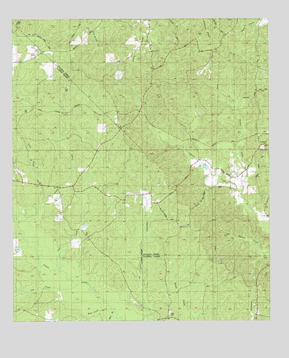
Chatham SE, LA USGS Topographic Map
Click on map above to begin viewing in our Map Viewer.

This topographic map contains these locations and features:
Feature Name Type Latitude Longitude GNIS ID View Map
AnabelPopulated PlaceN32.2932°W92.2510°548279View Map
Bear CreekStreamN32.2552°W92.3279°532836View Map
Biles BranchStreamN32.2532°W92.3263°533114View Map
Cow CreekStreamN32.2710°W92.3574°534207View Map
Cub CreekStreamN32.2715°W92.3543°534300View Map
Cypress Baptist ChurchChurchN32.3207°W92.2513°554163View Map
Frantom Chapel CemeteryCemeteryN32.3687°W92.3656°1766218View Map
Frantom Chapel Methodist ChurchChurchN32.3682°W92.3663°554475View Map
Frantom Chapel School (historical)SchoolN32.3685°W92.3657°548362View Map
Galilee ChurchChurchN32.2985°W92.3065°535153View Map
Glade CreekStreamN32.2921°W92.3735°535243View Map
Head CemeteryCemeteryN32.3424°W92.2593°541279View Map
Little Glade CreekStreamN32.3002°W92.3601°536549View Map
Mount Olive ChurchChurchN32.2882°W92.2932°537364View Map
North Vixen Gas FieldOilfieldN32.2840°W92.2518°548500View Map
Ouachita Parish Fire Protection District 1 Station 14 CypressBuildingN32.3199°W92.2568°2673123View Map
Pine Grove ChurchChurchN32.3021°W92.3460°538176View Map
TamaPopulated PlaceN32.3271°W92.2557°548614View Map
Walnut Grove ChurchChurchN32.3657°W92.3104°540222View Map

Note: Coordinates in the location and feature list above are referenced to NAD83 datum.


Copyright (C) 2008-2024 Ryan Niemi / Sunset Dynamics ... All Rights Reserved