TopoQuest Logo
Do you find TopoQuest useful?
Help keep TopoQuest running and adding new maps/features by donating!
Bitcoin:  19c7KJd3qBynnjoSw5npx9KScwjBe4ifkT
Litecoin:  LXs6TkuXGGXo1vDsWCkWVdjQX94eUKd6ui
Home View Maps Find Maps Find Places Resources & Links


Cadeville, Louisiana Topographic Map

USGS Map Title: Cadeville, LA
USGS Map MRC: 32092D3
DRG (GeoTIFF) Download: o32092d3.tif


Neighboring USGS Topographic Map Quads:


  Downsville South, LA  
32092E4
 

  Calhoun, LA  
32092E3
 

  West Monroe North, LA  
32092E2
 

  Eros, LA  
32092D4
 

  Cadeville, LA  
32092D3
 

  West Monroe South, LA  
32092D2
 

  Chatham, LA  
32092C4
 

  Chatham SE, LA  
32092C3
 

  Luna, LA  
32092C2


Map MRC Location:

N33°
W93°
N33°
W92°
H8 H7 H6 H5 H4 H3 H2 H1
G8 G7 G6 G5 G4 G3 G2 G1
F8 F7 F6 F5 F4 F3 F2 F1
E8 E7 E6 E5 E4 E3 E2 E1
D8 D7 D6 D5 D4 D3 D2 D1
C8 C7 C6 C5 C4 C3 C2 C1
B8 B7 B6 B5 B4 B3 B2 B1
A8 A7 A6 A5 A4 A3 A2 A1
N32°
W93°
N32°
W92°

Cadeville, LA USGS 1:24K Topographic Map Preview:
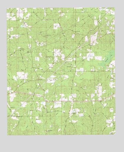
Cadeville, LA USGS Topographic Map
Click on map above to begin viewing in our Map Viewer.

This topographic map contains these locations and features:
Feature Name Type Latitude Longitude GNIS ID View Map
Antioch ChurchChurchN32.4101°W92.3457°532187View Map
Antioch CreekStreamN32.4218°W92.3215°540675View Map
Bacons BranchStreamN32.4888°W92.2621°532268View Map
Beech BranchStreamN32.4574°W92.2537°532878View Map
Bogaloosa CreekStreamN32.4115°W92.3032°553737View Map
Bogaloosa SpringSpringN32.3960°W92.2960°533263View Map
Booker BranchStreamN32.4260°W92.3171°533323View Map
Brushy CreekStreamN32.4215°W92.3043°533475View Map
CadevillePopulated PlaceN32.4290°W92.3390°541060View Map
Centerpoint Baptist ChurchChurchN32.4635°W92.2785°553937View Map
Central Elementary SchoolSchoolN32.4855°W92.3549°553941View Map
Cheniere Gas FieldOilfieldN32.4740°W92.3126°541281View Map
Clark CreekStreamN32.4318°W92.3007°553998View Map
Clark Springs ChurchChurchN32.4374°W92.3332°533969View Map
Clear BranchStreamN32.4493°W92.2849°533980View Map
Guyton CreekStreamN32.4278°W92.3656°2564362View Map
Harris BranchStreamN32.4946°W92.2682°535540View Map
House BranchStreamN32.4565°W92.2604°535831View Map
Humbles BranchStreamN32.4721°W92.2740°535858View Map
LapinePopulated PlaceN32.3896°W92.2526°548435View Map
Lapine ChurchChurchN32.3857°W92.2510°536338View Map
Liberty Grove Church of GodChurchN32.4299°W92.2518°555036View Map
Mallard BranchStreamN32.4921°W92.2604°536866View Map
McDonald CreekStreamN32.4043°W92.3496°540707View Map
Mill CreekStreamN32.4215°W92.3218°540640View Map
Milton CreekStreamN32.4043°W92.3496°537148View Map
Mineral SpringsPopulated PlaceN32.4585°W92.3593°541145View Map
Mount PleasantPopulated PlaceN32.4410°W92.3001°541280View Map
Mount Pleasant Baptist ChurchChurchN32.4401°W92.2996°555409View Map
Oak Grove Baptist ChurchChurchN32.3974°W92.3290°555526View Map
OkaloosaPopulated PlaceN32.3802°W92.3279°541158View Map
Okaloosa School (historical)SchoolN32.3793°W92.3282°548508View Map
Ouachita Parish Fire Protection District 1 Station 12 CadevilleBuildingN32.4279°W92.3269°2673125View Map
Parish Governing Authority District BCivilN32.4230°W92.2673°1930301View Map
Parker CemeteryCemeteryN32.4718°W92.3729°537975View Map
Patrick CreekStreamN32.4982°W92.2757°538014View Map
Pierce CemeteryCemeteryN32.4443°W92.2532°538122View Map
Rogers CreekStreamN32.4268°W92.3065°538687View Map
Sam Brown CreekStreamN32.4076°W92.3438°539115View Map
Sanctified ChurchChurchN32.4988°W92.3468°539126View Map
South Cheniere CreekStreamN32.4446°W92.2682°559717View Map
Tiger BranchStreamN32.4563°W92.2587°539924View Map
Ward SevenCivilN32.4440°W92.3265°545149View Map
West Ouachita High SchoolSchoolN32.4281°W92.3367°2462918View Map
Wilders CreekStreamN32.4449°W92.2665°540407View Map

Note: Coordinates in the location and feature list above are referenced to NAD83 datum.


Copyright (C) 2008-2025 Ryan Niemi / Sunset Dynamics ... All Rights Reserved