TopoQuest Logo
Do you find TopoQuest useful?
Help keep TopoQuest running and adding new maps/features by donating!
Bitcoin:  19c7KJd3qBynnjoSw5npx9KScwjBe4ifkT
Litecoin:  LXs6TkuXGGXo1vDsWCkWVdjQX94eUKd6ui
Home View Maps Find Maps Find Places Resources & Links


Cherokee Valley, New Mexico Topographic Map

USGS Map Title: Cherokee Valley, NM
USGS Map MRC: 35103F3
DRG (GeoTIFF) Download: o35103f3.tif


Neighboring USGS Topographic Map Quads:


  Rosebud, NM  
35103G4
 

  Ione, NM  
35103G3
 

  Centerville Corner, NM  
35103G2
 

  McCloy Ranch, NM  
35103F4
 

  Cherokee Valley, NM  
35103F3
 

  Kerlin Hill, NM  
35103F2
 

  McCarty Ranch, NM  
35103E4
 

  Lockney, NM  
35103E3
 

  Obar, NM  
35103E2


Map MRC Location:

N36°
W104°
N36°
W103°
H8 H7 H6 H5 H4 H3 H2 H1
G8 G7 G6 G5 G4 G3 G2 G1
F8 F7 F6 F5 F4 F3 F2 F1
E8 E7 E6 E5 E4 E3 E2 E1
D8 D7 D6 D5 D4 D3 D2 D1
C8 C7 C6 C5 C4 C3 C2 C1
B8 B7 B6 B5 B4 B3 B2 B1
A8 A7 A6 A5 A4 A3 A2 A1
N35°
W104°
N35°
W103°

Cherokee Valley, NM USGS 1:24K Topographic Map Preview:
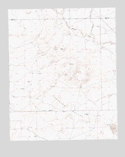
Cherokee Valley, NM USGS Topographic Map
Click on map above to begin viewing in our Map Viewer.

This topographic map contains these locations and features:
Feature Name Type Latitude Longitude GNIS ID View Map
00202 Water WellWellN35.7306°W103.3141°927605View Map
05286 Water WellWellN35.6392°W103.2733°927599View Map
05287 Water WellWellN35.6370°W103.3611°928618View Map
05318 Water WellWellN35.7303°W103.2672°928576View Map
05319 Water WellWellN35.7311°W103.3102°927606View Map
05320 Water WellWellN35.7095°W103.3100°928573View Map
05321 Water WellWellN35.6875°W103.3366°928572View Map
05322 Water WellWellN35.6806°W103.3355°927604View Map
05324 Water WellWellN35.6859°W103.3077°928571View Map
05325 Water WellWellN35.6739°W103.3583°927602View Map
05326 Water WellWellN35.6645°W103.2575°927600View Map
05328 Water WellWellN35.7114°W103.2650°928574View Map
05340 Water WellWellN35.6806°W103.2572°927603View Map
05354 Water WellWellN35.7195°W103.3058°928575View Map
05359 Water WellWellN35.6645°W103.2575°927601View Map
05442 Water WellWellN35.6425°W103.2927°928619View Map
05443 Water WellWellN35.6370°W103.3519°928617View Map
05444 Water WellWellN35.6298°W103.2872°928616View Map
Alford WellWellN35.6864°W103.3100°885676View Map
Arnold WellWellN35.6475°W103.2736°885902View Map
Burks RanchLocaleN35.6751°W103.2933°886929View Map
CammackLocaleN35.7259°W103.2883°924342View Map
Campbell WellWellN35.6759°W103.3222°887115View Map
Cherokee ValleyAreaN35.6567°W103.3058°887480View Map
Cherokee Valley CemeteryCemeteryN35.6529°W103.3297°887481View Map
Dessum WellWellN35.6739°W103.3577°888340View Map
Faus WellWellN35.6887°W103.3402°888983View Map
Garrett WellWellN35.6664°W103.2600°889366View Map
Graveyard WellWellN35.6534°W103.3372°889572View Map
HaufmanLocaleN35.6800°W103.3533°924284View Map
Holcolm WellWellN35.6967°W103.3033°890065View Map
JohnsonLocaleN35.6289°W103.3455°924352View Map
Johnson RanchLocaleN35.6292°W103.3444°890516View Map
Johnson WellWellN35.6375°W103.3533°890525View Map
Kaufman RanchLocaleN35.6809°W103.3502°890631View Map
KuperLocaleN35.6759°W103.2913°924354View Map
North Fork Minneosa CreekStreamN35.7178°W103.2747°892595View Map
Red WindmillLocaleN35.7125°W103.2666°893835View Map
RobertsonLocaleN35.7459°W103.3055°924321View Map
Sand Hill WindmillLocaleN35.7112°W103.3105°894510View Map
Smith-Cox WellWellN35.7320°W103.2691°894959View Map
South WellWellN35.7059°W103.3361°895175View Map
Stoner WellWellN35.6898°W103.2511°895371View Map
Van Wart WellWellN35.6387°W103.2594°896098View Map
Vandergrift TankReservoirN35.6491°W103.2837°896101View Map
Waller WellWellN35.6520°W103.3111°896218View Map

Note: Coordinates in the location and feature list above are referenced to NAD83 datum.


Copyright (C) 2008-2025 Ryan Niemi / Sunset Dynamics ... All Rights Reserved