TopoQuest Logo
Do you find TopoQuest useful?
Help keep TopoQuest running and adding new maps/features by donating!
Bitcoin:  19c7KJd3qBynnjoSw5npx9KScwjBe4ifkT
Litecoin:  LXs6TkuXGGXo1vDsWCkWVdjQX94eUKd6ui
Home View Maps Find Maps Find Places Resources & Links


McCarty Ranch, New Mexico Topographic Map

USGS Map Title: McCarty Ranch, NM
USGS Map MRC: 35103E4
DRG (GeoTIFF) Download: o35103e4.tif


Neighboring USGS Topographic Map Quads:


  Gallegos NE, NM  
35103F5
 

  McCloy Ranch, NM  
35103F4
 

  Cherokee Valley, NM  
35103F3
 

  Fuentes Ranch, NM  
35103E5
 

  McCarty Ranch, NM  
35103E4
 

  Lockney, NM  
35103E3
 

  Montesito Creek, NM  
35103D5
 

  Logan North, NM  
35103D4
 

  Logan NE, NM  
35103D3


Map MRC Location:

N36°
W104°
N36°
W103°
H8 H7 H6 H5 H4 H3 H2 H1
G8 G7 G6 G5 G4 G3 G2 G1
F8 F7 F6 F5 F4 F3 F2 F1
E8 E7 E6 E5 E4 E3 E2 E1
D8 D7 D6 D5 D4 D3 D2 D1
C8 C7 C6 C5 C4 C3 C2 C1
B8 B7 B6 B5 B4 B3 B2 B1
A8 A7 A6 A5 A4 A3 A2 A1
N35°
W104°
N35°
W103°

McCarty Ranch, NM USGS 1:24K Topographic Map Preview:
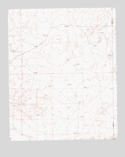
McCarty Ranch, NM USGS Topographic Map
Click on map above to begin viewing in our Map Viewer.

This topographic map contains these locations and features:
Feature Name Type Latitude Longitude GNIS ID View Map
05288 Water WellWellN35.6062°W103.3769°934687View Map
Basin WellWellN35.5892°W103.4663°886097View Map
Bell WellWellN35.5884°W103.4008°886194View Map
Brown North WellWellN35.5523°W103.4308°886768View Map
Brown PlaceLocaleN35.5356°W103.4191°899553View Map
Buck WellWellN35.6045°W103.4080°886834View Map
Casados WellWellN35.5642°W103.4697°887250View Map
Clay WellWellN35.5059°W103.4233°887661View Map
East Sand SpringsSpringN35.5006°W103.3775°888690View Map
East WellWellN35.5034°W103.4766°888735View Map
Eclipse WellWellN35.5217°W103.4163°888768View Map
Homestead WellWellN35.5112°W103.4963°890103View Map
Jones North WellWellN35.5512°W103.4511°890545View Map
Line WellWellN35.5995°W103.4575°891093View Map
McCarty RanchLocaleN35.6075°W103.4308°891721View Map
McCartysLocaleN35.6100°W103.4333°924316View Map
Mexican WellWellN35.5792°W103.3844°891926View Map
Millin Draw WellWellN35.6081°W103.4827°892071View Map
Mullin WellWellN35.5689°W103.3752°892337View Map
New South WellWellN35.5717°W103.4211°892458View Map
New WellWellN35.5398°W103.4766°892500View Map
North WellWellN35.5328°W103.4952°892707View Map
Sandy WellWellN35.5239°W103.4661°894560View Map
South Orphan WellWellN35.5848°W103.4950°895093View Map
South WellWellN35.5753°W103.4325°895173View Map
Tom Young WellWellN35.5495°W103.4122°895740View Map
WebsterLocaleN35.5089°W103.4855°924306View Map
West Key WellWellN35.6012°W103.3927°896383View Map
Widow WellWellN35.5475°W103.3800°896578View Map

Note: Coordinates in the location and feature list above are referenced to NAD83 datum.


Copyright (C) 2008-2025 Ryan Niemi / Sunset Dynamics ... All Rights Reserved